Country:

 City:


The route starts from the church at Saint-Bresson; parking is available on the other side of the road.
Route no. 44, signposted along the route with brown markers
(S/E) From the church, take the D136 towards Rovillers, then turn right onto the bridge over the Raddon.
(1) Stay on the road for 1 km, then at thesecondhairpinbend, take the path on the right up the hillside. At the crossroads, carry on straight ahead; then, at the three-way junction, turn left and continue climbing straight on until you reach the edge of the forest.
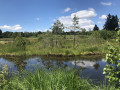
(2) Carry on straight ahead until you reach the road. Turn right, walk past the pond, then take the path leading down to the left and continue to the next fork.
(3) Turn left twice to reach a road.
(4) Take the road on the left, then take the first path on the right which leads across the meadows.
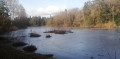
(5) At the three-way junction, take the left-hand path; further on, turn left onto the road, then after the bend, turn right onto the path running alongside the pond.
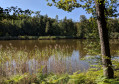
(6) Carry on along this track, skirting the pond on the right, then head into the woodland. At the crossroads, turn left and carry on straight ahead until you reach a tarmac road.
(7) Turn right, then left onto the path leading to the pond. Cross the embankment, then at the wayside cross, turn right.
(8) After passing the small pond, turn left to reach the Corre.
(9) In the hamlet, turn right, then, after the small pond, take the path that climbs up to the right into the woods. Continue uphill until you reach the edge of the forest, then carry on until you reach the road.
(10) Turn right, then right again into Les Mottots. Carry on along the path, turn left, then immediately right, and you’ll reach the Petit Étang.
(11) Carry on along the path and, at the Fork in the road, continue straight on
(12) At the bottom of the descent, turn left and then immediately right. Then carry on straight ahead until you reach the road.
(13) Turn left onto the road, then right. At the Fork in the road, carry straight on until you reach the houses.
(14) Take the path on the right and carry on straight ahead until you reach the pond. Go over the embankment, turn right and then left to reach the houses and then the road.
(15) Turn left and, at the junction with a path leading off to the right, carry on straight ahead along the road. At the pond, turn right. There is a chapel to visit 100 metres below the road.
(16) At the wayside cross, carry on straight ahead, then follow the path that branches off to the left after the houses. At the road, turn right and carry on straight ahead.
(17) Pass the Montdahin Monumental Cross on your left and carry on along the road.
(18) At the right-hand bend, take the path straight ahead and go round the pond on the left to reach Béviau.
(19) After the farm, carry on straight ahead along the track. Pass a track branching off to the left, then another to the right, until you reach the tarmac road.
(20) Take the road on the left and, at the junction with the road leading to Château Grenouille, carry on straight ahead.
(21) At the three-way junction, take the right-hand branch and, at the next junction, keep left. Then carry on along the hillside road until you reach the next junction.
(22) Before Les Gouttes, head up the left-hand side. At the top, carry on straight ahead until you reach the D136, which you’ll follow to the left.
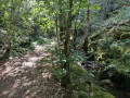
(23) When you reach the houses, turn right onto the path leading into the forest. Turn left at the Fork in the road, then straight on at the next two junctions.
(24) At the four-way junction, turn sharply left onto a path that joins a forest track. Cross the track and head towards the Étang de Ladamont.
(25) Go past the pond’s embankment, then turn left to join the D136. Turn right and stay on the road until the next junction.
(26) Turn right towards Mont du Tronc. Turn left at the Fork in the road, then at the Fork in the road after the left-hand bend, carry on until you reach a path starting on the right.
(27) Leave the road and take the track on the right. Pass between the houses and continue through the forest.
(28) At the crossroads, take the sharp left-hand bend and carry on straight ahead for 1 km.
(29) At the end of the straight stretch, turn left to join the road, which you’ll follow to the right as far as La Corbière.
(30) Turn left onto the dirt track just after the farm shed. Carry on straight ahead until you reach a tarmac road.
(31) Turn right and carry on along the road until you reach the farm. Take the path that climbs to the left. Pass a footpath and then a path leading downhill on the left; at the top, at the crossroads, turn left to reach Les Goutelles.
(32) Turn right and, at the next Fork in the road, carry on straight ahead between the houses. Head downhill until you reach the road leading to Les Bastiens.
(33) Carry on straight ahead along the road, then immediately take the path leading down to the left to join the D136. Turn right, then carry on straight ahead to reach the church at Saint-Bresson (S/E).

 Tourist office
 Moderate

 Easy
 Visorando Member