Country:

 City:


Start in the commune of Saint-Rémy (12200): access via the D1 or the D922, at a place called Farrou, situated north of Villefranche-de-Rouergue. Opposite the Auberge de Farrou, cross the level crossing and ride 1,500 metres up this hill, which is now a dead end. Carry on to the end of the tarmac road and park at the side of the road.
(S/E) Set off along the wide dirt track that follows on from the road. At the top of the climb, turn right onto the road and walk for about 200 m.
(1) At the fork, take the path on the left. Continue straight ahead along this path. Turn left downhill at the first fork. Stay on this path. At the bottom of the descent (elevation 391), continue to the right, heading uphill.
(2) At the top of the climb, continue along the path on the left. After a slight descent, you’ll see a clearing on the left with large rocks. If you proceed carefully, you’ll reach a viewpoint overlooking the Alzou Gorges: avoid this if the rock is wet and slippery! Continue along the path to the Mas de Testes. You’ll come out onto the Route de Veuzac; turn left, then right to cross the stream and then the railway line.
(3) Turn left onto the road (D922) and follow it for about 1 km to Boscau Amont.
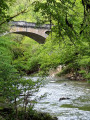
(4) Turn left to cross a small bridge and follow the path which immediately branches off to the left along the stream. Pass under the railway bridge and follow the path opposite as it climbs.
(5) When you reach the road, walk a few metres to the left and then take the Route du BoÏ to the right, just above the road. At the top of the hill, turn right towards the Calvaire. Just before the Church of Saint-Jean-d’Aigremont, turn right to climb up to the Calvaire, where the Chapel of the Holy Sepulchre is situated: a bird’s-eye view of the bastide town of Villefranche-de-Rouergue.
(6) Retrace your steps and walk alongside the wall of the Church of Saint-Jean d’Aigremont. Slip through the passage to the left of the gate, if it is closed, then head down the small path on the left to the Roman-era paved road. Once on the tarmac, leave the Chemin de la Plaine Saint-Jean on your left, follow the hairpin bend to the right and continue on to Villefranche-de-Rouergue. Pass under the railway bridge and then over the bridge spanning the Alzou. Turn left, then right onto the wide avenue lined with plane trees (Allée Aristide Briand) and follow it to the end.
(7) Turn left onto Boulevard Haute Guyenne, walk alongside the high wall, then turn right onto Chemin de Bel Air and then right again onto Chemin de Sainte-Adèle. Walk past the sports hall and, just at the far end of the football pitch, take the pedestrian crossing on the left towards the supermarket. Reach it by turning right onto Rue Henry Mouly, then left onto Rue Antonin Perbosc, and crossing Avenue de Toulouse at the pedestrian crossing.
(8) Go round the supermarket on the right, walking alongside the cemetery wall. Continue straight ahead along the path after the first junction, then turn left onto Chemin de la Borie Haute. Walk past the aerodrome and Graves Castle on your left. Take the dirt track rather than the tarmac road running parallel to it.
(9) Cross the bridge over the ring road. At the next junction, go straight on, then turn left onto Route des Bouyas. At the small cemetery, head towards Durantel for about a hundred metres.
(10) Take the path leading uphill to the right, away from Durantel. After the hamlet of Longagne, turn right down the slope.
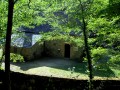
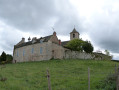
(11) Turn right onto the small path leading to Saint-Rémy. After the wash house, turn left then right to walk alongside the cemetery. Go round the castle on the right, turn left onto the road as it climbs and walk for about fifty metres.
(12) Follow the smallGR®-marked path to the right, which descends towards the stream and then runs alongside it until the next junction. Keep to the left here.
(13) Leave theGR® by taking the track furthest to the left of the three options at this junction. After a short climb, turn right and you’ll find yourself facing the entrance to the Mauriac Quarries.
(14) Although signs indicate that the area is private, it is perfectly possible to pass through the gate on the right. The owner of the quarries, who is my immediate neighbour, has assured me of this. Walk along the edge of the quarries and continue along the path, which takes two bends, narrowing before widening again. Follow it from there for about 2 km.
(15) Pass through the Croisement des Lisses, ignoring another path coming from the left, and arrive in Villeneuve. Walk past the supermarket along the D922, continuing to the junction with the D76, located by the primary school.
(16) Turn right onto Rue Pavée, cross the Place des Conques, walk past the town hall and leave the old town centre via the majestic Porte Soubirane. Turn right, then keep to the left, following theGR® markings once more.
(17) After passing the socio-cultural centre, take theGR® path straight ahead, which is also signposted for Santiago de Compostela. At the next junction (elevation 411), turn right, then continue straight on up the wide incline, ignoring the fork coming from the right.
(18) At the top of the climb, turn right. Continue straight on along thisGR® path, ignoring any side paths, until you reach the tarmac road.
(19) Head straight ahead and, about 100 metres further on, follow theGR® path to the right. Continue straight on along thisGR® path.
(20) Pass the Hubal junction, continuing straight on, then leave theGR® at the Mas de Caville junction, continuing straight on.
(21) At the next junction at Jouas, carry on straight ahead for about 10 metres, then turn immediately left onto a path that descends to a road, after passing under a railway bridge and then over a footbridge to cross the Algouse. Turn right onto the road.
(22) After about 200 metres, turn left towards Nieyreval. Pass through the hamlet and, at the Impasse des Puits on the left, take the path on the right. At the top of the hill, turn right, go under the ring road bridge and, a few metres further on, turn sharply left to return to the car park (S/E).

 Visorando Member
 Moderate

 Easy
 Local authority