The Séquestre ridges

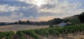
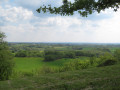
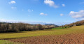
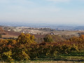
A short walk in the hills above Le Séquestre, with a few gentle climbs and a lovely view of the town of Albi, its cathedral and its route.

Details

3706819
Creation:
Last update:
Last review:
  • Walking
    Activity: Walking
  • ↔
    Distance: 4.42 mi
  • ◔
    Average duration: 2h 35 
  • ▲
    Difficulty: Easy

  • ⚐
    Back to start: Yes
  • ↗
    Ascent: + 617 ft
  • ↘
    Descent: - 604 ft

  • ▲
    Highest point: 823 ft
  • ▼
    Lowest point: 584 ft

Photos

Description of the walk

Start at the car park by the Séquestre Town Hall.
No signposting, except on the section of the Carlus path, which is marked in yellow.

(S/E) With your back to the car park, take Avenue Jean Giono, passing in front of the sports hall. At the T-junction with Route de la Gardié, turn left.

(1) Head up to the right along the dirt track that winds through the broom, bushes and wild countryside, ignoring all the paths branching off to the left, until you reach a crossroads.

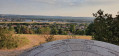
(2) At this junction, take a short detour to the left to admire the view from the orientation point. Retrace your steps, ignore the two paths to the right and left, and continue straight on towards the ‘Parcours du soleil’ sign, passing the solar panels, then head back up to the Chemin de Taillefer.

(3) Follow this small road to the right as far as the Puech de la Gardie.

(4) Turn immediately left, taking part of the Carlus path, and head down a slightly stony track to La Mouline. Turn right onto a short stretch of road that crosses a small bridge and climbs up to the hamlet of La Bourgade.

(5) At La Bourgade, continue along this road to the crossroads where there is a cross on the left, then turn right towards the vineyard.

(6) Head down a farm track through the vineyards. At the bottom of the valley, cross a small stone bridge and follow the path back up to reach La Gardié.

(7) Carry on to the right and then turn left, following the road back to the starting point (S/E).

Waypoints

  1. S/E : mi 0 - alt. 584 ft - Town Hall car park
  2. 1 : mi 0.17 - alt. 604 ft - Path on the right
  3. 2 : mi 0.62 - alt. 797 ft - Viewpoint
  4. 3 : mi 1.03 - alt. 823 ft - Taillefer Track
  5. 4 : mi 1.36 - alt. 791 ft - On the left, the Carlus path
  6. 5 : mi 2.22 - alt. 741 ft - La Bourgade
  7. 6 : mi 2.96 - alt. 764 ft - To the right through the vineyards
  8. 7 : mi 3.65 - alt. 758 ft - La Gardié
  9. S/E : mi 4.42 - alt. 584 ft - Town Hall car park

Reviews and comments

4.2 / 5
Based on 3 reviews

Reliability of the description
4.3 / 5
Ease of following the route
4.3 / 5
Route interest
4 / 5
jean-jacques
jean-jacques

Overall rating : 3.7 / 5

Date of your route : Oct 28, 2023
Reliability of the description : ★★★★☆ Good
Ease of following the route : ★★★★☆ Good
Route interest : ★★★☆☆ Average
Very busy route : Yes

You should start the route from the first junction, as the initial section is of no interest. Sections 1 and 2 are particularly difficult because the path is not maintained; so unless you weave your way through the bushes, leaning forward as you go, or use a ‘coupe-coupe’, it’s a tricky bit…
After that, this path is simply a variation on the Carlus hillside trail, albeit a slightly shorter one.

Machine-translated

Fred00005
Fred00005

Overall rating : 5 / 5

Date of your route : Oct 08, 2023
Reliability of the description : ★★★★★ Very good
Ease of following the route : ★★★★★ Very good
Route interest : ★★★★★ Very good
Very busy route : Yes

We had a brilliant time. We left the town in no time at all. The roads and scenery were magnificent, with some stunning views.
The route was perfect with the app.
We came across a few people, but I think that was down to Pink October, which was organising gatherings.
It only took us 1 hour 45 minutes (instead of the 2 hours 30 minutes we’d been told). And yet we’re not exactly keen walkers.

Machine-translated

marine81
marine81

Overall rating : 4 / 5

Date of your route : Aug 27, 2023
Reliability of the description : ★★★★☆ Good
Ease of following the route : ★★★★☆ Good
Route interest : ★★★★☆ Good
Very busy route : No

A pleasant and easy walk.
There are a few spots at the start where the vegetation has taken over, but it’s still accessible.

Machine-translated

Other walks in the area

For more walks, use our search engine .

The GPS track and description are the property of this route's author. Please do not copy them without permission.