Country:
 City:
City:


Park in the car park on Rue du Lavoir in Crépin.
(S/E) Take Rue des Acacias for 100 m and continue along the path opposite. At the three-way junction, take the left-hand path and head uphill to the D558; cross with care and continue along the path opposite until you reach the four-way junction.
(1) Turn left. At the first junction, carry on straight ahead along this path, ignoring all turn-offs to the right and left. At the waste collection centre, you’ll reach a crossroads with an EDF pylon.
(2) Turn slightly to the right and head for the hamlet of Nantille.
(3) Carry on to the end of the road. Continue straight ahead along the path that follows it. Further on, turn left and pass under a power line. You will reach the junction with Rue de la Mairie, in Les Arloings.
(4) Cross it carefully, head straight on and pass the car park. Turn right, walk past the school and turn right onto Rue de la Chaume-Géant. Continue along the path until you reach the D258. At the Stop sign, turn right towards the church, then left onto Chemin de Tout Blanc. You’ll reach the church at Creuzier-le-Vieux and the cemetery.
(5) Turn left, then, at the next junction, turn right. Carry on, pass the pumping station and take the path on the right until you reach the D174. Turn left with care, then immediately right onto Rue de la Grand Font. At the crossroads, take the left-hand path and head uphill until you reach a cross.
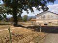
(6) Turn right and continue to the first house. Turn left, pass the riding centre and continue to the T-junction. Turn right to reach, after a right-hand bend, a four-way junction.
(7) Cross the road carefully and continue along the path opposite. At the four-way junction, next to the D67, take the path on the right and head uphill to the cemetery and the church at Creuzier-le-Neuf.
(8) Carry on straight ahead, reaching the Loches district and then the road sign marking the town’s exit. Leave the road and turn left onto the Chemin du Facteur. Continue through the woodland until you reach the ridge path, then follow an easy climb to the highest point.
(9) Take the path on the left, then, at the next junction, turn left again onto Rue des Bussonnets. Cross a road, enter the woods and arrive at the houses in Dionnet.
(10) Turn right onto Chemin des Dionnets. Then take the path on the right into the woods and follow the route you took on the way there. Turn left at a 90° angle to return to the car park on Rue du Lavoir (S/E).

 Visorando Member
 Easy
Easy