The Château du Rozet

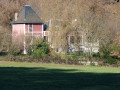
A short route that takes you (depending on the season and vegetation) around the front and back of the Château du Rozet, a chalet built in the aftermath of the 1870 war. It is currently used as a guesthouse.

Details

n°27280524
Creation:
Last update:
Last review:
  • Walking
    Activity: Walking
  • ↔
    Distance: 2.96 mi
  • ◔
    Average duration: 1h 35 
  • ▲
    Difficulty: Easy

  • ⚐
    Back to start: Yes
  • ↗
    Ascent: + 217 ft
  • ↘
    Descent: - 236 ft

  • ▲
    Highest point: 1,109 ft
  • ▼
    Lowest point: 942 ft

Photos

Description of the walk

Park at the War Memorial, opposite Vendat Church.

Red signposts.

(S/E) From the church, take Rue Marx Dormoy opposite the church. Continue to the junction with Rue de la Croix.

(1) Turn left onto a steep, sunken path leading downhill – an old ‘coursière’ (shortcut) leading to Le Rozet. At the bottom, join a tarmac path and follow it as it continues (ignore the Chemin du Bois des Granges, which branches off to the right). Walk past a pumping station, cross a stream, ignore a path on the left and you’ll soon reach a junction at the hamlet of Le Rozet.

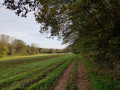
(2) Then turn right onto Rue du Rozet. Walk past the Château du Rozet (guesthouse) and continue straight on along the path for about 500 m. Enter the woods and follow a track for 200 m until you come out onto a path that runs through the fields. Turn left and follow the path to a crossroads.

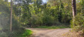
(3) Turn left onto a stony track and continue to a crossroads (hunting lodge). Then turn left. Pass through Lignière and continue along the track.

(4) On leaving Lignière, at a three-way junction, follow the path on the left to Le Rozet (the red-rendered castle).

(2) Carry on to the right and cross the Ruisseau la Guêle again. (A red ‘R’ is painted on the EDF pole with an arrow pointing to the right to indicate the return route to the church after completing a circular route around the château.) After the pumping station, at the bend, continue along the path opposite and join Rue Marx Dormoy.

(1) Turn right to return to the starting point (S/E).

Waypoints

  1. S/E : mi 0 - alt. 1,109 ft - Church of Saint John the Baptist
  2. 1 : mi 0.15 - alt. 1,073 ft - Crossroads
  3. 2 : mi 0.58 - alt. 948 ft - Rue du Rozet
  4. 3 : mi 1.27 - alt. 1,004 ft - Crossroads of tracks
  5. 4 : mi 1.81 - alt. 1,030 ft - Three-way junction
  6. S/E : mi 2.96 - alt. 1,109 ft - Église Saint-Léger (Vendat)

Worth a visit

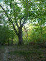
Shortly after the houses that make up Lignière, 50 metres to the right, a fine tree bears the letter B on its trunk. Opposite, on the other side of the path, an uprooted tree has revealed an old ‘rubbish pit’ belonging to a brickmaker and tile-maker who was based here between 1790 and 1810.

Reviews and comments

4.2 / 5
Based on 2 reviews

Reliability of the description
4.5 / 5
Ease of following the route
4.5 / 5
Route interest
3.5 / 5
User 25840004

A WORD OF ADVICE TO WOMEN
A man has no qualms about coming out of his house to watch you walk past on a village path for at least 60 metres, even though you’re on your own and there are no houses for another 100 metres.
Of course, you have to walk past his house both on the way there and on the way back.
A special mention goes to one of his dogs, which chased after me on the way back.

Machine-translated

rtournier
rtournier

Overall rating : 4.7 / 5

Date of your route : Aug 30, 2024
Reliability of the description : ★★★★★ Very good
Ease of following the route : ★★★★★ Very good
Route interest : ★★★★☆ Good
Very busy route : No

A very pleasant walk, with plenty of shade along most of the route – I’d recommend it

Machine-translated

Cédric 71
Cédric 71

Overall rating : 3.7 / 5

Date of your route : Jun 04, 2023
Reliability of the description : ★★★★☆ Good
Ease of following the route : ★★★★☆ Good
Route interest : ★★★☆☆ Average
Very busy route : No

A short, easy walk in peaceful surroundings. The route takes in roads, footpaths and woodland.

Machine-translated

Other walks in the area

For more walks, use our search engine .

The GPS track and description are the property of this route's author. Please do not copy them without permission.