Around Saint-Félix

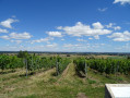
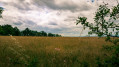
A walk around Saint-Félix, fairly easy and offering some lovely views.

Details

66473393
Creation:
Last update:
Last review:
  • Walking
    Activity: Walking
  • ↔
    Distance: 6.78 mi
  • ◔
    Average duration: 3h 25 
  • ▲
    Difficulty: Moderate

  • ⚐
    Back to start: Yes
  • ↗
    Ascent: + 364 ft
  • ↘
    Descent: - 341 ft

  • ▲
    Highest point: 1,214 ft
  • ▼
    Lowest point: 932 ft

Description of the walk

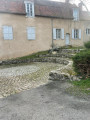
Park in the car park at Saint-Félix church.

(S/E) Head towards the junction and turn right towards the Museum to join the D430.

(1) Turn right onto this road, follow the road to the right at the wayside cross, and head straight down the hill until you reach a cross-country track.

(2) Turn right, stay on the same track at the junction and carry on until you reach the Fork in the road. Continue to the right to join the tarmac road at a place called Place l’Herbet.

(3) Turn right and follow the road to the junction with the D173.

(4) Take a quick first turn left then right with care to join the track almost directly opposite. Leave this track before reaching the buildings at La Côte to continue straight ahead, pass the junction with the Grand Chemin and go straight on until you reach the three-way junction.

(5) Turn right onto the track. Opposite the house (no. 313), turn right and then follow the first track on the left before reaching Les Mouillères.

(6) Turn right at the junction just after the small pond. Continue along the track until you reach the tarmac road to the north of Château de la Roche. Turn right onto it and climb to the top of the hill, staying on the road.

(7) Turn right, rejoin the road and follow it in the same direction.

(8) At the T-junction, turn left to join the D173 at the entrance to Saint-Félix. Turn right and carry on straight ahead to the church car park (S/E).

Waypoints

  1. S/E : mi 0 - alt. 1,165 ft - Church car park
  2. 1 : mi 0.41 - alt. 1,207 ft - D430
  3. 2 : mi 1.42 - alt. 932 ft - Junction, turn right
  4. 3 : mi 2.1 - alt. 988 ft - Place l’Herbet
  5. 4 : mi 3 - alt. 1,089 ft - D173
  6. 5 : mi 3.74 - alt. 1,014 ft - Three-way junction
  7. 6 : mi 4.66 - alt. 1,004 ft - Pond
  8. 7 : mi 5.44 - alt. 1,184 ft - Top of the hill
  9. 8 : mi 6.33 - alt. 1,175 ft - T-junction, turn left
  10. S/E : mi 6.78 - alt. 1,165 ft - Church car park

Reviews and comments

4.5 / 5
Based on 2 reviews

Reliability of the description
4.5 / 5
Ease of following the route
5 / 5
Route interest
4 / 5
Hévin03
Hévin03

Overall rating : 4.3 / 5

Date of your route : Sep 14, 2026
Reliability of the description : ★★★★☆ Good
Ease of following the route : ★★★★★ Very good
Route interest : ★★★★☆ Good
Very busy route : No

A walk with lovely views.
A few sections through large fields that are less interesting.
Overall, a pleasant and easy walk

Machine-translated

Kane
Kane

Overall rating : 4.7 / 5

Date of your route : Dec 02, 2024
Reliability of the description : ★★★★★ Very good
Ease of following the route : ★★★★★ Very good
Route interest : ★★★★☆ Good
Very busy route : No

A lovely little walk, described very well. Best done in the evening to enjoy a beautiful sunset over the Chaîne des Puys.

Machine-translated

Other walks in the area

For more walks, use our search engine .

The GPS track and description are the property of this route's author. Please do not copy them without permission.