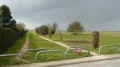
The slopes of the Marne in Dampmart

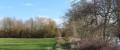
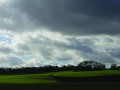
After a long walk along the banks of the Marne, this walk takes you up the hillsides on the right bank to enjoy beautiful views of the valley to the east and the Butte de Montgé to the north.

Details

176365
Creation:
Last update:
Last review:
  • Walking
    Activity: Walking
  • ↔
    Distance: 6.15 mi
  • ◔
    Average duration: 3h 05 
  • ▲
    Difficulty: Easy

  • ⚐
    Back to start: Yes
  • ↗
    Ascent: + 266 ft
  • ↘
    Descent: - 266 ft

  • ▲
    Highest point: 407 ft
  • ▼
    Lowest point: 131 ft
  • ⚐ Country: France
  • ⚐ City: Dampmart (77400)
  • ⚑
    Start/End: N 48.883714° / E 2.732996°
  • ❏
    IGN map(s): Ref. 2414ET
  • Hour-by-hour weather

Photos

Description of the walk

Starting point

The walk starts on Rue du Lavoir in Dampmart.

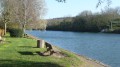
(S) Take the towpath as you head upstream along the Marne. At the bend to the left of the tarmac road, it becomes private property.

(1) It is closed to motor traffic by a barrier, but pedestrians may use it. Continue straight on along this path, which runs alongside private properties for a few hundred metres and then through cultivated fields.

(2) When you reach a tennis court, you can see, on the opposite bank of the Marne, the Jardin de Sculptures de la Dhuys and the abutments of a footbridge that was due to be installed to allow pedestrians to cross the river at this point. (See Practical Information)

Carry on to the two railway bridges (the first is disused) and turn left immediately after crossing them. Follow the railway embankment to the barrier at the junction with a small tarmac road.

PR®® markings (yellow)

(3) You can see the yellow line of thePR®® markings on the barrier. Do not go through the barrier; turn right to follow the track running alongside the wire-mesh fence of an enclosure, which is overgrown with vegetation. Continue until you reach the junction with a track coming from the right and leading up the hillside.

(4) Turn left onto this track and follow it to the next junction, where you turn right to enter the woodland. The path winds its way through the trees and, at the edge of the woodland, crosses a small tarmac road, which you cross.

(5) Continue straight on along the path, which now runs between two fields, until you reach the Promenade de la Dhuis, easily recognisable by its two tracks separated by a grassy verge.

No signposting

(6) You are at Dhuis hectometre point 973 (the marker is next to the metal hoops prohibiting motor vehicles on the promenade). Turn right and follow the Dhuis to hectometre point 981 (the marker is at the bottom of the woodland fence).

(7) Turn left onto the path running between a row of detached houses and the woodland fence. This path leads out onto Rue de la Dhuis.
A little further down the hill, go through the roundabout and continue downhill on the right-hand side of the tree-lined avenue until you reach the next junction, where you turn left into Rue du Maréchal Gallieni, which becomes Rue de Thorigny after the ‘Dampmart’ sign.

Then turn left onto Rue d’Alger, then right onto Rue Denfert-Rochereau. Cross the junction, continue straight ahead along Rue La Fayette, then turn right onto Rue de la République (D105B).
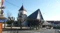
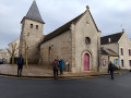
This will bring you to the front of Dampmart Church.

(8) After passing the church, turn left into Rue de l’Abreuvoir. At the end of this street, head down to the left to pass under the railway lines via the underpass, which is closed to motor traffic.
Turn right immediately after exiting the tunnel. You are now on Rue du Lavoir. (E)

The walk is now over.
.

Waypoints

  1. S/E : mi 0 - alt. 141 ft - Rue du Lavoir
  2. 1 : mi 0.13 - alt. 135 ft - Barrier - Marne (la)
  3. 2 : mi 1.24 - alt. 138 ft - Tennis court - Passerelle de la Dhuys
  4. 3 : mi 2.59 - alt. 154 ft - Tarmac road
  5. 4 : mi 3.21 - alt. 161 ft - At the junction, turn left
  6. 5 : mi 4.18 - alt. 407 ft - Tarmac road; continue straight ahead
  7. 6 : mi 4.5 - alt. 377 ft - Hectometre point 973 on the River Dhuis
  8. 7 : mi 5.02 - alt. 381 ft - Hectometre point 981 on the River Dhuis
  9. 8 : mi 5.93 - alt. 184 ft - Dampmart Church
  10. S/E : mi 6.15 - alt. 141 ft - Rue du Lavoir

Notes

Hiking boots and a drink.

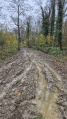
Please note: the paths and tracks can be very muddy in winter along the banks of the Marne and across the fields.

Footbridge project (the project has not been abandoned).
Since this walking guide was created, things have changed: the footbridge was installed in 2018. See POI (2)

Worth a visit

The church at Dampmart:

The Dhuys Sculpture Garden: to get there, you need to cross the Marne at the bridge at Lagny-sur-Marne.

Always be cautious and plan ahead when you're outdoors. Visorando and the author of this route cannot be held responsible for any accidents occurring on this route.

The GR® and PR® markings are the intellectual property of the Fédération Française de Randonnée Pédestre.

Reviews and comments

4.4 / 5
Based on 38 reviews

Reliability of the description
4.5 / 5
Ease of following the route
4.6 / 5
Route interest
4.2 / 5
MISAV
MISAV

Overall rating : 4.3 / 5

Date of your route : Jul 20, 2026
Reliability of the description : ★★★★☆ Good
Ease of following the route : ★★★★☆ Good
Route interest : ★★★★★ Very good
Very busy route : No

A well-shaded route along the Marne.

Machine-translated

heavyz
heavyz

Overall rating : 5 / 5

Date of your route : Aug 31, 2025
Reliability of the description : ★★★★★ Very good
Ease of following the route : ★★★★★ Very good
Route interest : ★★★★★ Very good
Very busy route : No

A very beautiful landscape!

Machine-translated

User 21315517

Overall rating : 5 / 5

Date of your route : Aug 20, 2025
Reliability of the description : ★★★★★ Very good
Ease of following the route : ★★★★★ Very good
Route interest : ★★★★★ Very good
Very busy route : No

A magnificent hiking trail, especially at the start when you walk along the sunny banks of the Marne.

You pass through lots of different landscapes: the banks of the Marne, forest, cabbage and corn fields, before ending up in a small town.

This route was very pleasant, and I highly recommend it if you are used to walking "long" distances

Machine-translated

User 24080723
• Edited:

Overall rating : 5 / 5

Date of your route : Aug 04, 2025
Reliability of the description : ★★★★★ Very good
Ease of following the route : ★★★★★ Very good
Route interest : ★★★★★ Very good
Very busy route : Yes

Nice walk, a few people along the banks of the Marne, which is normal for a sunny Sunday.
A few trees had fallen across the path, but nothing insurmountable.

Machine-translated

BRUDEC
BRUDEC

Overall rating : 4 / 5

Date of your route : Jan 27, 2025
Reliability of the description : ★★★★☆ Good
Ease of following the route : ★★★★☆ Good
Route interest : ★★★★☆ Good
Very busy route : Yes

Avoid this route in winter or after heavy rain, as it can become very muddy

Machine-translated

Jaxaki
Jaxaki

Overall rating : 4.7 / 5

Date of your route : May 20, 2024
Reliability of the description : ★★★★★ Very good
Ease of following the route : ★★★★★ Very good
Route interest : ★★★★☆ Good
Very busy route : No

Nice walks along the Marne with generally very accessible terrain. The climb up to the hills and forest is very gentle. The dogwood hedges along the Marne slightly obscure the view of the water, but it is a beautiful place nonetheless.

Machine-translated

morenojo
morenojo

Overall rating : 4.3 / 5

Date of your route : Jul 19, 2023
Reliability of the description : ★★★★☆ Good
Ease of following the route : ★★★★☆ Good
Route interest : ★★★★★ Very good
Very busy route : No

A very beautiful walk with varied landscapes. Magnificent banks of the Marne and high-quality facilities (footbridge, statue park). There was a slight hiccup at point 4, as we couldn't find the entrance to the forest and went straight to point 6. But that's just a minor detail, it was a lovely walk.

Machine-translated

Eric75
Eric75

Overall rating : 4 / 5

Date of your route : Jan 11, 2021
Reliability of the description : ★★★★☆ Good
Ease of following the route : ★★★★★ Very good
Route interest : ★★★☆☆ Average
Very busy route : Yes

The first part was very pleasant, the banks of the Marne are magnificent and the neighbouring houses are cute.
Everything went downhill when we left the Marne to cross the fields and head into the forest: a Sunday afternoon in January, apparently ideal for motocross bikes and quad bikes ridden by inconsiderate individuals we know all too well. Hearing the motorbikes for several hours and having to move out of the way when they passed completely ruined what had started as such a lovely walk.
I feel sorry for the locals, I can only imagine what it's like in summer.

Machine-translated

akita
akita

Overall rating : 3 / 5

Date of your route : May 03, 2020
Reliability of the description : ★★☆☆☆ Disappointing
Ease of following the route : ★★★☆☆ Average
Route interest : ★★★★☆ Good
Very busy route : No

Lots of people at the start
After the bridge, going uphill, we couldn't find the entrance to the forest..
So the directions weren't very clear, but it was a nice walk

Machine-translated

amostini
amostini

Overall rating : 4.7 / 5

Date of your route : Sep 30, 2020
Reliability of the description : ★★★★☆ Good
Ease of following the route : ★★★★★ Very good
Route interest : ★★★★★ Very good
Very busy route : No

A pleasant and very varied walk. We crossed the Marne on the footbridge to see the interesting sculpture field. At point 3, we couldn't find the path on the right and continued along the road.

Machine-translated

vv91
vv91

Overall rating : 4.7 / 5

Date of your route : Sep 14, 2020
Reliability of the description : ★★★★☆ Good
Ease of following the route : ★★★★★ Very good
Route interest : ★★★★★ Very good
Very busy route : No

A very beautiful hike that allows you to see different landscapes: the banks of the Marne, the forest, fields, hillsides and towns.
Just to note, the footbridge to cross over to see the sculpture garden is open.
At point 881, the fence is no longer made of wood but metal.
Best regards
Hervé

Machine-translated

devoluard
devoluard

Overall rating : 4.3 / 5

Date of your route : May 26, 2020
Reliability of the description : ★★★★☆ Good
Ease of following the route : ★★★★★ Very good
Route interest : ★★★★☆ Good
Very busy route : No

Thank you,
A bucolic and varied route that allows you to enjoy beautiful views of the banks of the Marne.
The description was fairly clear, but we got distracted and missed the turn-off for the forest 🙄

Machine-translated

Harriett
Harriett

Overall rating : 5 / 5

Date of your route : May 12, 2020
Reliability of the description : ★★★★★ Very good
Ease of following the route : ★★★★★ Very good
Route interest : ★★★★★ Very good
Very busy route : No

We just shortened the walk a little when we left because it was our first walk after lockdown.
We had been walking every day, but only 2.5 km. We skipped the detour at 7 and went straight to 8 via the PR. We'll do the whole thing another time. Nice walk.
Thanks to the route planner.
Harriett

Machine-translated

lionel75011
lionel75011

Overall rating : 4.3 / 5

Date of your route : Dec 29, 2019
Reliability of the description : ★★★★☆ Good
Ease of following the route : ★★★★★ Very good
Route interest : ★★★★☆ Good

A pleasant short walk along the banks of the Marne. The new footbridge is very handy for seeing the sculptures. It's true that at this time of year the ground is quite muddy, but that's all part of the fun.

Machine-translated

RENEE D.
RENEE D.

Overall rating : 4.7 / 5

Date of your route : Apr 22, 2019
Reliability of the description : ★★★★★ Very good
Ease of following the route : ★★★★★ Very good
Route interest : ★★★★☆ Good

A beautiful hike near the Marne, varied and easy.

Machine-translated

Other walks in the area

For more walks, use our search engine .

The GPS track and description are the property of this route's author. Please do not copy them without permission.