Country:
 City:
City:


(S/E) Setting off from the Bandstand:
Our walk begins at the foot of the bandstand on Place du Centre. With your back to Notre-Dame Church, set off along Rue du Dépôt.
(1) On the way to Les Couturelles
Turn left onto Rue des Couturelles. You’ll pass the local school.
(2) Heading for Le Hameau
Then take the first junction on your right onto Rue du Hameau.
(3) Transition to Rue de Fontenelle
Continue at a leisurely pace towards Rue de Fontenelle.
(4) Through the fields
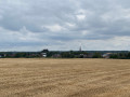
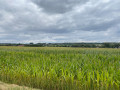
Leave the tarmac behind and head onto a dirt track that winds its way through the fields. Enjoy this lovely, unobstructed view; the path takes you straight to the edge of the woods.
(5) A green interlude in the Bois de Jacques
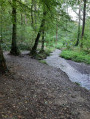
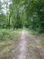
Enter the Bois de Jacques. Let nature be your guide, staying firmly on the main shaded path that winds through the undergrowth.
(6) Between woodland and countryside
As you emerge from the forest, the landscape opens up once more. Continue straight ahead along the open path, which will take you past the local Recypark.
(7) Calvaire de la Rouge Croix
When you reach the small historic chapel of the Calvaire de la Rouge-Croix, leave the road and take the path that opens up immediately to your left.
(8) Rue de la Dîme
Follow this path to the end. At the end, turn left to begin the climb up Rue de la Dîme and, at the end of the street, turn left to rejoin Rue du Dépôt, then take the first right to return to Rue de Marcinelle.
(9) The return to the centre
After a few metres, turn right right next to the pretty Sainte-Philomène Chapel. Take the small path that leads downhill to join Rue des Fossés. A lovely way to finish the walk away from the traffic.
(10) Church of Notre-Dame
After walking round the back of the church, take the steps back up to Place du Centre.
(S/E) Back to the starting point
Follow the street until you reach Place du Centre. You’re now back at the Kiosque.



 Visorando Member
 Moderate
 Difficult