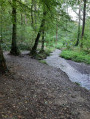
In the heart of the Nalinnois countryside

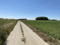
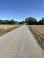
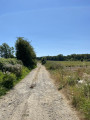
A lovely circular route that takes you through the countryside so you can enjoy our magnificent scenery. The start is at the Place du Centre in Nalinnes, where you can admire the magnificent bandstand and Notre-Dame Church. You’ll follow small country lanes before cutting across the fields to reach Gourdinne, where you can visit the wash house. You’ll then rejoin the path leading to the Baconval woods. Once out of the woods, you’ll pass by a lovely pond and head up to Les Six Chemins, before returning to the starting point.

Details

104554940
Creation:
Last update:
Last review:
  • Walking
    Activity: Walking
  • ↔
    Distance: 8.24 mi
  • ◔
    Average duration: 4h 05 
  • ▲
    Difficulty: Moderate

  • ⚐
    Back to start: Yes
  • ↗
    Ascent: + 322 ft
  • ↘
    Descent: - 312 ft

  • ▲
    Highest point: 781 ft
  • ▼
    Lowest point: 614 ft

Photos

Description of the walk

Start at Place du Centre in Nalinnes (car park).

(S/E) Head downhill and take Rue du Village eastwards. You’ll come out onto Rue à Canadas; turn right three times to join Rue de la Croisette. Join Rue Praile and follow it to the right. When it bends to the right, carry on straight ahead along Rue des Monts. At the T-junction, turn left.

(1) Take the first right. Continue along Chemin de Logette. At the end, join Rue Praile again and follow it to the right. Take the first left, Rue Tingremont. Cross a stream.

(2) At the T-junction, turn left, still on Rue Tingremont. At the Fork in the road, turn right onto Chemin de Chaudeville.

(3) At the end, turn left. Carry straight on, heading due east. You’ll reach Rue Lumsonry; follow it as it continues.

(4) At the junction, turn right onto a country lane. After a few hundred metres, take in the view of the village of Somzée.

(5) At the junction, turn right. Carry on straight ahead, heading south-west.

(6) At the end, first turn right then left to cross Rue de Coumagne and join Rue du Lavoir. At the Fork in the road, veer left.

(7) Take the first right, a narrow dirt track. Cross a small footbridge over a stream. Ignore a turn-off on the left; you’ll come out onto Rue des Mésanges and follow it to the right for a few dozen metres.

(8) Then turn left onto a stony path that climbs through the Gourdinne countryside.

(9) At a three-way junction, turn right. You’ll reach the Bois de Baconval; follow Rue du Vieux Chêne, crossing Allée Sud, Allée Centrale and Allée Nord in turn.

(10) Cross Rue de Nalinnes carefully and continue along the path opposite.

(11) Take the path that runs between two ponds. You’ll come out onto Rue du Moulin; follow it to the right. At the Fork in the road shortly afterwards, veer left onto Rue Fontenelle.

(12) In the hamlet of Fontenelle, turn right then left, still on Rue Fontenelle. At the end, turn left onto Rue du Hameau and you’ll immediately come to another junction (chapel).

(13) Then take a path on the right. Walk north-north-east until you reach the Carrefour des Six Chemins.

(14) Take the first path on the right, heading south-east. Further on, enter Nalinnes via Rue des Noyers.

(15) At the T-junction, turn left onto Rue de la Dîme. Cross Rue du Petit Parc on the right-hand side.

(16) At the end, first turn right then left to cross Rue du Dépôt and take a narrow lane. Join Rue des Fossés at the corner by the cemetery and follow it to the right. At the junction, go straight on and you’ll immediately reach the entrance to the Church of Notre-Dame.

(17) Carry on straight ahead to Place du Centre (S/E).

Waypoints

  1. S/E : mi 0 - alt. 666 ft - Place du Centre
  2. 1 : mi 0.42 - alt. 656 ft - Rue des Monts
  3. 2 : mi 1.01 - alt. 673 ft - T-junction
  4. 3 : mi 1.48 - alt. 728 ft - Chemin de Chaudeville x Chemin de Florennes
  5. 4 : mi 2.16 - alt. 745 ft - Rue Lumsonry x Rue du Bois
  6. 5 : mi 2.83 - alt. 751 ft - Junction
  7. 6 : mi 3.88 - alt. 696 ft - Crossing Rue de Coumagne
  8. 7 : mi 4.09 - alt. 643 ft - Junction
  9. 8 : mi 4.2 - alt. 646 ft - Start of the trail
  10. 9 : mi 4.44 - alt. 696 ft - Three-way junction
  11. 10 : mi 5.58 - alt. 692 ft - Crossing Rue de Nalinnes
  12. 11 : mi 5.92 - alt. 617 ft - Ponds
  13. 12 : mi 6.4 - alt. 643 ft - Junction – Fontenelle
  14. 13 : mi 6.74 - alt. 699 ft - Junction - Chapelle de la Croix Rouge (Nalinnes)
  15. 14 : mi 7.22 - alt. 705 ft - Carrefour des Six Chemins
  16. 15 : mi 7.73 - alt. 653 ft - Rue des Noyers x Rue de la Dîme
  17. 16 : mi 7.99 - alt. 676 ft - Crossing Rue du Dépôt
  18. 17 : mi 8.18 - alt. 682 ft - Église de Notre-Dame (Nalinnes)
  19. S/E : mi 8.24 - alt. 666 ft - Place du Centre

Notes

Equipment:
Make sure you have a good pair of walking shoes (dirt tracks can be slippery in wet weather). Some sections are narrow, particularly after the Gourdinne washhouse. The route passes through many open areas across fields. In summer, bring suitable sun protection (cap, sun cream, sunglasses) and plenty of water, as there is little shade along these sections.

Stops :
. A bench at the Gourdinne wash house.
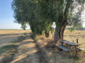
. At 9.8 km, you’ll find a picnic table under the willow trees and a bin for your rubbish.
. At 10.2 km, there is another bench in the village of Fontenelle.

Make sure you have the PDF with its detailed map, or follow the route using the Visorando app.

Worth a visit

  • Notre-Dame de Nalinnes Church: Situated on Place du Centre, this remarkable church has ancient historical roots. Its architecture blends perfectly into the heart of the village.
  • The Bandstand: This magnificent bandstand is a testament to the local cultural and festive life. It is the ideal landmark from which to start your walk.
  • The Gourdinne Wash House: This example of the region’s rural and historical heritage has been preserved and restored. It is a picturesque and refreshing spot, ideal for a half-way stop (there is a bench there).
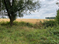
  • The local countryside: The route offers a lovely mix of vast agricultural horizons across the plains and the peaceful shade of the Bois de Baconval.

Other walks in the area

For more walks, use our search engine .

The GPS track and description are the property of this route's author. Please do not copy them without permission.