The woods of Murols

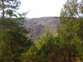
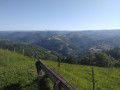
Starting from the village of Murols, with its mountainous character, this is a rather exceptional walk – a little challenging but timeless. There are beautiful views of the Goul Gorges and the Batut stream, as well as stunning panoramas of the Cantal Mountains, with Puy Griou standing out in the distance.

Details

n°23826819
Creation:
Last update:
Last review:
  • Walking
    Activity: Walking
  • ↔
    Distance: 5.84 mi
  • ◔
    Average duration: 3h 55 
  • ▲
    Difficulty: Moderate

  • ⚐
    Back to start: Yes
  • ↗
    Ascent: + 1,460 ft
  • ↘
    Descent: - 1,440 ft

  • ▲
    Highest point: 2,310 ft
  • ▼
    Lowest point: 1,381 ft

Description of the walk

Park in the car park by the church and cemetery in Murols. To get there: from Aurillac, take the D920 southwards. At Jurlhes Haut, turn left onto the D128, then take the D228. At Plainecoste, turn left onto the D505 and follow it to Murols.

(S/E) Leave the car park by taking the road to the left uphill.

(1) In the centre of the village, cross the D505 road with care and head up the road that passes in front of the town hall and the old school. The route then follows theGR®465.
The road soon gives way to a dirt track which enters the woods and overlooks the road.
At the T-junction, take the path on the right heading north, mostly skirting the edge of the woods on your right. The path descends gently.
Further on, cross the small Camurols road with care and continue straight ahead. The track eventually joins the D505 road. Follow it carefully to the left, heading north. The road passes under a high-voltage power line before climbing towards Murols Soubeyre on the right.

(2) At the crossroads, take the road on the left at an acute angle and walk through the hamlet, which stretches out in a long, narrow line. At the end of the road, continue along the path that follows it and enters a wooded area. The path passes to the left of a basalt spur and then descends towards the Goul valley and the village of Lantuéjouls.
Before reaching the first farm in the village, take a right-hand hairpin bend onto a dirt track that is almost level.

(3) At the next crossroads, about five to six hundred metres further on, take the path on the right up the hillside, leaving theGR®465which heads downhill.
The path heads downhill towards the confluence of the Bugaux and Augons streams.

(4) Ford the first stream and follow the second for about one hundred and fifty metres, keeping a close eye on the signposting. Then, on the right, you’ll come to an old ‘forest path’ (a path through the woods). The path winds its way uphill to the east of the Bugaux stream, then past the Négre stream, which is its tributary.
The path opens out onto an open plateau with lovely views of the Monts du Cantal.

(5) Turn right and carefully follow the D505 road for about two hundred metres. The road passes under a high-voltage power line.
Immediately afterwards, turn left onto the Route de Cadillac

(6) After passing straight through the hamlet, just as the road turns sharply left, continue straight ahead along a right-of-way for about four hundred metres. Turn off onto a steep path and descend carefully to the Ruisseau du Batut.
Cross the stream and follow the dirt track back up to Murols through the woods.
The path joins the D505 road less than fifty metres east of the junction you passed on the way there.

(1) Turn left onto the downhill road to return to the car park (S/E).

Waypoints

  1. S/E : mi 0 - alt. 1,936 ft - Car park by the church and cemetery
  2. 1 : mi 0.1 - alt. 1,991 ft - Street x D505 road
  3. 2 : mi 1.36 - alt. 2,241 ft - D505 road x Rue de Murols-Soubeyre
  4. 3 : mi 2.78 - alt. 1,526 ft - GR465 x path on the right
  5. 4 : mi 3.16 - alt. 1,381 ft - Junction of paths
  6. 5 : mi 4.24 - alt. 2,238 ft - Path x D505 road
  7. 6 : mi 4.64 - alt. 2,215 ft - Route de Cadillac x path on the right
  8. S/E : mi 5.84 - alt. 1,936 ft - Car park by the church and cemetery

Notes

This walk across varied terrain requires suitable footwear.
It does not present any real navigation difficulties as it is marked in yellow, features signposting and follows the ‘Les Bois de Murols’ route published by the Carladez Tourist Office. In addition, it is advisable to follow the instructions in the route description and on the map, whilst paying close attention to the landscape. The waypoints (with their GPS coordinates and the distance from the starting point) are helpful for walkers exploring the route for the first time.
The route is quite physically demanding due to the elevation gain.

Worth a visit

Murols
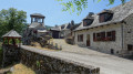
Saint-Laurent Church in Murols.
Church with a gabled bell tower, wayside cross, and the ‘De feu et de vent’ (Of Fire and Wind) Imagination Trail in Murols
It was the seat of a priory under the authority of the Bishop of Rodez.
The church dates from the 15th century. It has a Romanesque chancel and the vault was rebuilt in the 18th century. It features a beautiful four-bay bell gable.
In 1853, the blessing of the great bell (454 kg) was the defining event of the century, witnessed by an assembly of clergy.
This church is not often open to visitors.
In the village, you will also see L’Ostal del Fabre (the blacksmith’s house) and you can take a stroll along one of the ‘paths of the imagination’.
Source

The chapel at Manhaval.
This charming 12th-century pre-Romanesque chapel stands on a ridge, in the heart of a wild, silent landscape. The vicarage closed before the school did in the 1960s, and the undergrowth began to take over.
In 1976, the arrival of two residents helped to improve access to the site and breathe new life into the village. In 1985, a charity began restoring the building.
So far, it has been a success.
Source

Always be cautious and plan ahead when you're outdoors. Visorando and the author of this route cannot be held responsible for any accidents occurring on this route.

The GR® and PR® markings are the intellectual property of the Fédération Française de Randonnée Pédestre.

Reviews and comments

4.2 / 5
Based on 2 reviews

Reliability of the description
4.5 / 5
Ease of following the route
4.5 / 5
Route interest
3.5 / 5
mcvinel
mcvinel

Overall rating : 5 / 5

Date of your route : Feb 06, 2023
Reliability of the description : ★★★★★ Very good
Ease of following the route : ★★★★★ Very good
Route interest : ★★★★★ Very good
Very busy route : No

I went on the hike on a lovely, cold winter’s day; I was the only one on the route.
I took the opportunity to carry on as far as the Manhaval Chapel – it would have been a shame not to see it!
The elevation gain is considerable – it’s worth bearing that in mind – but it’s very clearly indicated in the route description.
I’ll be back to this very charming part of the country.
Thank you

Machine-translated

MNORDIC
MNORDIC

Overall rating : 3.3 / 5

Date of your route : Aug 24, 2022
Reliability of the description : ★★★★☆ Good
Ease of following the route : ★★★★☆ Good
Route interest : ★★☆☆☆ Disappointing
Very busy route : No

Walk on 24 August 2022: Lovely countryside… but nothing exceptional, as advertised
A monotonous route with little of interest apart from being out in the countryside!
A few lovely views, a few beautiful traditional barns along the route
The descent is good… and the climb is more tedious than strenuous!
For a truly exceptional walk, we recommend heading to Bés-Bédène: it’s superb, though a bit of a challenge
(not for young children or casual walkers): the Joan Franc route
We ❤❤❤ the Aveyron

Machine-translated

Other walks in the area

For more walks, use our search engine .

The GPS track and description are the property of this route's author. Please do not copy them without permission.