Country:

 City:
City:


Park in the small car park on Route du Prat.
(S/E) Take the GRP® Lo Camin d’Olt northwards, moving away from the hamlet of Valon (incorrectly spelt on the IGN map).
(1) At the hamlet of Prat, turn right then left, following the GRP® signposts. Continue straight on until you reach a track suitable for vehicles.
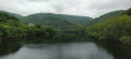
(2) Carry on in the same direction, high above the Truyère.
(3) Cross the footbridge over a small tributary and turn immediately right to join the D621 (Route de Valcayles).
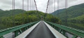
(4) Turn right to cross the Brézou bridge and continue carefully along the road for about 1 km until you reach the Serre ravine.
(5) As you come out of the bend, take the path leading uphill to the left, which has been laid out as steps. Follow the GRP® signposts until you come to a small road at a place called Romegous.
(6) Turn left and continue for about 1 km, passing the turn-off for Panis further on to your right.
(7) At the hairpin bend, take the path leading off to the right of the road. Continue to follow the GRP® signposts.
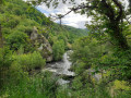
(8) Ignore the path on the left towards Le Prat and carry straight on. Cross the Ruisseau des Vergnes and you’ll soon reach the Saut du Chien waterfall: there are two viewing points where you can take a few minutes to admire it before continuing on your way.
(9) Then continue to follow the GRP® southwards for about 3.5 km. Please note: although the map suggests a shortcut, it is not possible to turn off earlier as the path no longer exists.
(10) In the Bois de la Fage, leave the GRP® Lo Camin d’Olt and turn right onto a path that forms a hairpin bend. You’ll reach a junction with another path.
(11) Turn left at the hairpin bend to continue descending towards the Maurelle ravine. Once at the bottom, head off to the right to come out onto the D97 near the hamlet of Canines.
(12) Turn right and follow the road to the Pont Phalip.
(13) Cross the bridge, then, once you’ve crossed it, take the path on the left. Follow it until you cross the D97 again, then follow the road in the same direction until you reach the first junction.
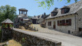
(14) Cross the D97 carefully and head up to the right towards Valon Castle. Leave the castle on your right as you take a sharp left-hand bend, and head to the car park (S/E).
 Visorando Member
 Moderate
 Difficult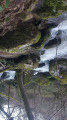
 Easy
Easy