Country:

 City:
City:


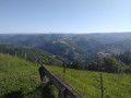
Car park in front of the Rouens viewpoint.
(S/E) With your back to the car park, take the road on the right downhill and head away from the village of Rouens.
(1) At the first junction, turn left towards Gally.
(2) Just before the bend and the houses in Gally, take the hairpin bend onto the path on the right. Head towards the hamlet of La Fargue.
(3) Head down the left-hand side, then follow the GRP® Lo Camin d’Olt, which passes between the barns. Continue until you reach a road just before the hamlet of Sergeant.
(4) Take the hairpin bend to the right as you climb. Pass under a power line, reach the top of the hill and cross a small stream.
(5) Take the path on the left which runs alongside this stream and will lead you back towards the village of Rouens. You’ll emerge at the top onto a wider track.
(6) Turn left and head towards Rouens. You’ll arrive at the large drinking trough situated at the junction of Chemin du Carme and Rue du Belvédère.
(7) Turn right twice. At the three-way junction, turn left to pass in front of Notre-Dame Church and continue straight on to the viewpoint (S/E).
 Visorando Member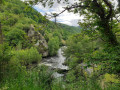
 Very difficult
 Easy
Easy 
 Difficult