The Puy Cervier tour

From the Col du Tourrond, this short walk in the forest offers few views but plenty of peace and quiet. It can be supplemented by one or two routes (see § Practical information).

Details

2968792
Creation:
Last update:
Last review:
  • Walking
    Activity: Walking
  • ↔
    Distance: 2.48 mi
  • ◔
    Average duration: 1h 45 
  • ▲
    Difficulty: Moderate

  • ⚐
    Back to start: Yes
  • ↗
    Ascent: + 705 ft
  • ↘
    Descent: - 679 ft

  • ▲
    Highest point: 4,029 ft
  • ▼
    Lowest point: 3,356 ft

Photos

Description of the walk

Head for the Col du Tourrond, halfway between Jarjayes and Notre-Dame du Laus on the D211.
Park in the dirt car park at the pass.

(S/E) With your back to the road, head left towards Puy de Cervier, along the downhill path. At the next junction, continue straight on (south-east) following the same signs. The path climbs, then joins a track coming from the right to reach a junction.

(1) Continue straight on along the path which climbs more steeply (ignore the one on the left). When it levels out, the path takes a wide bend to the right then turns left again to reach a junction.

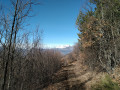
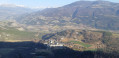
(2) Continue to the left (ignore the path on the right towards Puy Cervier). Soon the view opens up towards the Pic de Bure and Céüze and you reach another junction.

(3) Head down to the left (north-west). Further down, join a path coming from the left and arrive at a path marked ‘Champ Espérant’.

(4) Head right for a few metres, then leave the path and turn right into the forest. Head up towards the Col du Tourrond until you reach a track. Turn left and return to the car park (S/E).


Waypoints

  1. S/E : mi 0 - alt. 3,451 ft - Car park - Col du Tourrond
  2. 1 : mi 0.37 - alt. 3,514 ft - Straight ahead on the path
  3. 2 : mi 1.16 - alt. 4,029 ft - To the left
  4. 3 : mi 1.43 - alt. 3,855 ft - Head down to the left
  5. 4 : mi 2.01 - alt. 3,356 ft - Champ Espérant
  6. S/E : mi 2.48 - alt. 3,451 ft - Car park - Col du Tourrond

Notes

Variation 1: 12 km and 520 m elevation gain.
Starting from the Col du Tourrond, you can do the ‘Around Notre-Dame du Laus’ route via Pas du Lièvre.

With your back to the Col du Tourrond car park, cross the road and take the path opposite to reach the Charamère signpost about 500 m further on.
(4) From this junction, follow the route description in chronological order.

Variation 2: 16 km and 600 m elevation gain.
At Notre-Dame du Laus, you can add the Pindreau route and the Chapel of the Precious Blood at Notre-Dame du Laus.

Worth a visit

Reviews and comments

4.3 / 5
Based on 7 reviews

Reliability of the description
4.9 / 5
Ease of following the route
5 / 5
Route interest
3.1 / 5
diggi
diggi

Overall rating : 3.7 / 5

Date of your route : Jun 27, 2002
Reliability of the description : ★★★★☆ Good
Ease of following the route : ★★★★★ Very good
Route interest : ★★☆☆☆ Disappointing
Very busy route : No

The origin of the name "Puy Cervier" comes from "loup cervier", meaning lynx. Until 1900, when the last lynx was killed in the vicinity of Guillestre, these felines populated the Hautes-Alpes. In the 1970s, the Puy Cervier forest was largely deforested. The ONF then launched a programme to reforest the area with Austrian black pines. However, since 2020, logging and deforestation work has resumed...

Machine-translated

Lili_Rousse
Lili_Rousse

Overall rating : 4.3 / 5

Date of your route : Oct 02, 2024
Reliability of the description : ★★★★★ Very good
Ease of following the route : ★★★★★ Very good
Route interest : ★★★☆☆ Average
Very busy route : Yes

A pleasant, shaded walk with beautiful autumn colours.
But it's really more of a stroll than a hike, as the path (road?) is very easy to follow 😊

Machine-translated

JMB05
JMB05
• Edited:

Overall rating : 3.7 / 5

Date of your route : Mar 08, 2022
Reliability of the description : ★★★★★ Very good
Ease of following the route : ★★★★★ Very good
Route interest : ★☆☆☆☆ Very disappointing
Very busy route : No

A disaster for nature!!! Hike completed on 7 March 2022. This beautiful route (of yesteryear), approximately 12 kilometres long, is now nothing more than a distant memory. Today, the beautiful forest of Puy Cervier has been reduced over several kilometres by intensive tree felling (it's like the storm of 1999 all over again!), The pretty paths have been completely destroyed, replaced by wide tracks left by tracked logging machines, and the trail is littered with branches and tree trunks. Choose your hike: either in the dust when it's dry, or in the mud when it's wet! It's appalling!
This route is not recommended today for any hiker who loves nature.

Machine-translated

mapigap
mapigap
• Edited:

Le Puy Cervier is a place I have had the opportunity to visit several times in recent years. Unfortunately, during my last visit (14/04/21), the trail was unrecognisable. Loggers are exploiting the area. The trails have become muddy tracks. The site has lost its charm. How sad.

Machine-translated

Triton Alpestre
Triton Alpestre
• Edited:

Overall rating : 4 / 5

Date of your route : Nov 29, 2020
Reliability of the description : ★★★★★ Very good
Ease of following the route : Not used / Not applicable
Route interest : ★★★☆☆ Average
Very busy route : No

A nice little hike to comply with lockdown regulations and get back into shape. 1 hour 50 minutes at a leisurely pace. Between pine and birch trees, that's kind of the problem: it's a logging operation! No work on Sundays, but check on weekdays. You can see machines, cut trees, dismantled tracks, well... And then it's on the north-facing slope (in the shade) almost constantly, so it's quite cold at this time of year. It's quite a climb for little legs or people who aren't very fit. Small car park (4-5 cars). Be careful, there is black ice on the roads leading there, even during the day, and in the late afternoon the sun is dazzling. We appreciate the calm, the many possible destinations, the excellent signposting and the absence of tarmac sections.

Thank you for the route suggestion!
Enjoy your hike!

Machine-translated

Azimut71
Azimut71

Overall rating : 5 / 5

Date of your route : Sep 13, 2020
Reliability of the description : ★★★★★ Very good
Ease of following the route : ★★★★★ Very good
Route interest : ★★★★★ Very good
Very busy route : No

The entire route takes place in the forest, so there are no panoramic views.
Nevertheless, it is a very pleasant hike, marked entirely in yellow.

Machine-translated

brayman
brayman

Overall rating : 4.3 / 5

Date of your route : Sep 21, 2020
Reliability of the description : ★★★★★ Very good
Ease of following the route : ★★★★★ Very good
Route interest : ★★★☆☆ Average
Very busy route : No

Chained with N D du Laus
Short elevation gain but all in one go.
Lots of shade and few views!
At point 4, 50 metres further along the path provides access to the only beautiful unobstructed view.

Machine-translated

JC05000
JC05000

Overall rating : 5 / 5

Date of your route : Sep 03, 2020
Reliability of the description : ★★★★★ Very good
Ease of following the route : ★★★★★ Very good
Route interest : ★★★★★ Very good
Very busy route : No

A refreshing short walk through the woods. Ideal for warming up, suitable for children who can walk! A leisurely 1½-hour walk for two!

Machine-translated

Other walks in the area

For more walks, use our search engine .

The GPS track and description are the property of this route's author. Please do not copy them without permission.