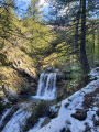
The “Peuple des Oiseaux” panoramic trail in Réallon

A family-friendly discovery trail focusing on mountain birds. From the resort to the hamlet of Vaucluse, this scenic route overlooking the Réallon valley features several play structures made from local larch wood.

Details

60858719
Creation:
Last update:
Last review:
  • Walking
    Activity: Walking
  • ↔
    Distance: 4.45 mi
  • ◔
    Average duration: 2h 40 
  • ▲
    Difficulty: Easy

  • ⚐
    Back to start: Yes
  • ↗
    Ascent: + 669 ft
  • ↘
    Descent: - 669 ft

  • ▲
    Highest point: 5,387 ft
  • ▼
    Lowest point: 4,918 ft

Photos

Description of the walk

Head to the Réallon ski resort via the D609. Park in the large car park at the snow stadium (at the end of the departmental road).

(S/E) From the car park, head up to the snow front, passing the tourist office, heading north then north-east, cutting under the Courtier ski lift towards the houses to go round them.

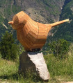
(1) Turn left to follow the Drovers' Road des Oucanes up to the end of the road. Follow the path that continues from there, which marks the start of the “Le Peuple des Oiseaux” trail (wooden bird sculpture).

(2) Take the path on the left, heading north, to join the GR®50 “Tour du Parc National des Écrins” (alsothe GR® de Pays Tour du Lac de Serre-Ponçon). Follow it to the left, heading west. Continue along the “Sentier Panoramique” to the Aigue Noire ski lift.

(3) Once past the base of the ski lift, the path turns north. Pass by a summer chalet, then cross the clearing dotted with larch trees and rabbit hutches on the hillside.
Continue until you descend to the Posette junction and reach the Vaucluse Forest Road.

(4) At the junction, leave the track on the right (Les Mallets) and take the one opposite (Vaucluse, la Pourrachière) for 80 m. Leave this to head down the grassy path, slightly to the right, heading north-west.

(5) You will then rejoin the GR® route, which runs alongside a stone wall, then continues to the Bessuilier ravine, which you must cross to reach the hamlet of Vaucluse. Pass between the first two chalets to reach the forest track above.

(6) Take the dirt track on the left, heading south-west, to cross the Bessuilier ravine again and return to the junction of the paths.

(4) Continue along the forest track opposite, heading east, to the Les Mallets junction.

(7) Take the track climbing to the right, heading south, towards the resort. Cross the Ravin d’Aigue Noire and continue until you reach the junction with the GR®50, shortly after the pylons.

(8) Take the path climbing to the right, heading north-west. A shortcut passes in front of a large information board before joining the panoramic path.

(2) Take the path on the left to reach the resort buildings and the drovers' road.

(1) Cross the resort to reach the car park (S/E).

Waypoints

  1. S/E : mi 0 - alt. 5,089 ft - Car park at Réallon station
  2. 1 : mi 0.16 - alt. 5,151 ft - Southern junction of the first circular loop
  3. 2 : mi 0.33 - alt. 5,197 ft - Pra-d’Ayme junction
  4. 3 : mi 0.82 - alt. 5,276 ft - Base of a ski lift
  5. 4 : mi 1.46 - alt. 5,249 ft - La Posette - Northern junction of the first circular loop
  6. 5 : mi 1.51 - alt. 5,233 ft - Junction of the second circular loop
  7. 6 : mi 2.03 - alt. 5,387 ft - Vaucluse hamlet
  8. 7 : mi 3.37 - alt. 4,918 ft - Les Mallets crossroads
  9. 8 : mi 3.97 - alt. 5,085 ft - Crossroads
  10. S/E : mi 4.45 - alt. 5,089 ft - Car park at Réallon station

Notes

Water point and shops at the resort, during opening periods (summer and winter).

Worth a visit

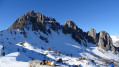
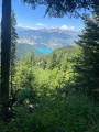
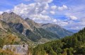
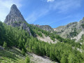
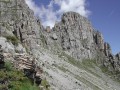
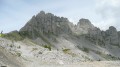
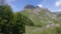
Much of the route runs along a balcony above the Réallon valley, offering some lovely views of the village.
Take your time to walk this circular path in the shade of the trees, to enjoy the views, the wooden play areas and the “nests” (informative panels about birds with QR codes to access a library of bird songs).

Alternative route: you can avoid returning via the forest road at point (6) simply by turning back at point (5).
Although the track beyond point (4) is less pleasant than the out-and-back path, it features information panels on the “Bird People”.

Always be cautious and plan ahead when you're outdoors. Visorando and the author of this route cannot be held responsible for any accidents occurring on this route.

The GR® and PR® markings are the intellectual property of the Fédération Française de Randonnée Pédestre.

Reviews and comments

5 / 5
Based on 3 reviews

Reliability of the description
5 / 5
Ease of following the route
5 / 5
Route interest
5 / 5
quencez
quencez

Overall rating : 5 / 5

Date of your route : Aug 21, 2025
Reliability of the description : ★★★★★ Very good
Ease of following the route : ★★★★★ Very good
Route interest : ★★★★★ Very good
Very busy route : No

nice little family car with a lovely view of Réallon on the way there. The games on the route are fun for children

Machine-translated

Richard1329
Richard1329

Overall rating : 5 / 5

Date of your route : Jul 28, 2025
Reliability of the description : ★★★★★ Very good
Ease of following the route : ★★★★★ Very good
Route interest : ★★★★★ Very good
Very busy route : No

A very beautiful, easy hike for the whole family, with an 18-month-old toddler and an 8-year-old boy who was sometimes difficult to convince to walk. The interesting route made him forget that he didn't like walking!

Machine-translated

Giselain
Giselain

Overall rating : 5 / 5

Date of your route : Oct 10, 2024
Reliability of the description : ★★★★★ Very good
Ease of following the route : ★★★★★ Very good
Route interest : ★★★★★ Very good
Very busy route : Yes

An easy and pleasant walk.

Machine-translated

Other walks in the area

For more walks, use our search engine .

The GPS track and description are the property of this route's author. Please do not copy them without permission.