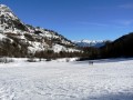
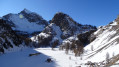
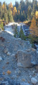
The village of Dormillouse as seen from Les Mensals

Dormillouse in winter is a little paradise, a lovely place to go for a walk. It is easily accessible, whether on snowshoes or with crampons, and offers a particularly welcome break afterwards – either in the fields or in the lodges, which remain open even in winter.

Details

n°45697354
Creation:
Last update:
Last review:
  • Snowshoeing
    Activity: Snowshoeing
  • ↔
    Distance: 5.64 mi
  • ◔
    Duration according to the author: 5 hrs 
  • ▲
    Difficulty: Moderate

  • ⚐
    Back to start: Yes
  • ↗
    Ascent: + 1,496 ft
  • ↘
    Descent: - 1,522 ft

  • ▲
    Highest point: 5,873 ft
  • ▼
    Lowest point: 4,350 ft

Description of the walk

Park in the large car park on the right-hand side of the road, immediately after the hamlet of Les Mensals.

(S/E) Continue along the snow-covered road and you will soon reach asecond, smaller car park. Stay on the road and, a few metres further on, you will come to a path junction.

(1) Turn right onto this path; it is signposted ‘Sentier d’Hiver’. Walk along the left bank of the River Biaisse, cross it via a footbridge, then rejoin the snow-covered road.

(2) Follow the road again and continue along it until you reach the large summer car park at Dormillouse.

(3) Cross to the right via the large footbridge, then begin the steep climb up the winter path. Following a series of tight hairpin bends, you’ll reach the crossroads in thefirst district of Dormillouse, known as Les Enflous.

(4) Turn right and continue the ascent, passing through the Escleyers district and completing the climb to reach the upper district, Les Romans.

(5) Descend via the same route, but in the opposite direction, to return to Les Enflous.

(4) Turn right, cross the footbridge, then keep left at the next junction to join the summer path. You’ll reach the Lac Fangeas junction.

(6) Keep to the right, continue the descent via a few hairpin bends through the larch woodland, and reach the Pont des Oules and the large summer car park.

(3) Retrace your steps along the route you took on the way there to return to the Mensals car park (S/E).

Waypoints

  1. S/E : mi 0 - alt. 4,377 ft - Les Mensals car park
  2. 1 : mi 0.57 - alt. 4,498 ft - Winter trail
  3. 2 : mi 0.97 - alt. 4,567 ft - Route
  4. 3 : mi 1.89 - alt. 4,701 ft - Summer car park
  5. 4 : mi 2.34 - alt. 5,633 ft - Les Enflous
  6. 5 : mi 2.56 - alt. 5,873 ft - Les Romans
  7. 6 : mi 3.33 - alt. 5,177 ft - Fangeas crossroads
  8. S/E : mi 5.64 - alt. 4,350 ft - Les Mensals car park - Biaysse (rivière)

Notes

Note: This hike, undertaken in February 2024, was intended to be a snowshoe outing, but as there was very little snow, the ascent was completed without any equipment; however, the descent required the use of light crampons.
Very important note: It goes without saying that, in the event of significant snowfall, this hike must be undertaken on snowshoes. However, you must check the weather conditions carefully, particularly the risk of avalanches.

Worth a visit

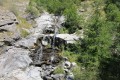
Between (3) and (4), take advantage of a ledge to admire the superb waterfall, which is particularly popular with canyoning enthusiasts.
Between (4) and (5), in the village of Dormillouse, you can stay at:
Lodge de l’École
L’Écrin de Violette
Le Refuge de l’Oncle Émile
(4) There is an old mill on the left-hand side of the path.
(5) Some information about Dormillouse, a remarkable, historic village, perched high up and tucked away.

Reviews and comments

4.7 / 5
Based on 1 review

Reliability of the description
5 / 5
Ease of following the route
4 / 5
Route interest
5 / 5
pel
pel

Overall rating : 4.7 / 5

Date of your route : Jan 21, 2026
Reliability of the description : ★★★★★ Very good
Ease of following the route : ★★★★☆ Good
Route interest : ★★★★★ Very good
Very busy route : Yes

Ascent made with snowshoes on our backs and crampons on our feet. Numerous icy sections on the left bank of the stream: a bit tricky, but we're in the sun!
Descent with snowshoes on the summer path, crossing a few avalanche couloirs.
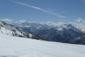
Superb view at the top.

Machine-translated

Other walks in the area

For more walks, use our search engine .

The GPS track and description are the property of this route's author. Please do not copy them without permission.