Country:
 City:


In Nuits-Saint-Georges, park in the cemetery car park on Rue Caumont Bréon.
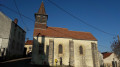
(S/E) Set off along Rue Caumont Bréon, keeping the cemetery on your right. Turn left onto Rue de la Liberté to walk alongside the old cemetery (very romantic), then enter it to visit the Church of Saint-Symphorien, which has a beautiful, colourful interior with murals and pink arches and pillars. On leaving the church, go straight on to join the road on your left. Go straight on at the junction, then veer right and cross the channelled Meuzin (in a sorry state). You are now on the GRP® des Grands Crus trail; follow the red and white markings until otherwise indicated. Continue straight on along Rue Chamois, pass the “Temple métaphysique”, and you’ll reach a junction (Rue Edme Bergeret is to the left).
(1) Turn right. Shortly afterwards, ignore a path on the right and stay on the GRP®. Further on, ignore a path on the left and you’ll reach a Fork in the road.
(2) Take the left-hand path. A little further on, this becomes a track that climbs up to the Statue of Liberty (see ‘Places to see’ section below).
(3) Leave the Statue of Liberty on your right and follow the GRP® to the left; you’ll soon come to the Statue of Liberty signpost at a junction. Keep following the GRP® straight on. You’ll come to a wide path; follow it to the left, ignoring all side trails, until you reach a road at a picnic area with a beautiful tree and a Statue of Liberty orientation board.
(4) Walk along the road to the left, then take the first path on the right, which is a hairpin bend (GRP®). At the junction where three paths meet, turn left.
(5) At the next junction, where four small roads meet, leave the GRP® markings and turn left. You are now on the Félix Tisserand Interpretive Trail. A little further on, you’ll pass a sign for the Pierre de Nuits quarry.
(6) At the next junction, look out for a sign about crème de cassis, and ignore the hairpin bend to the right. You will then pass signs about cooperage, winemaking and Pinot Noir. You will reach a T-junction with the D8.
(7) Follow it to the right to return to the village of Nuits-Saint-Georges, cross the channelled Meuzin again and turn into the first street on the left to find a sign about the (unfortunate) history of this watercourse and the village. Turn immediately right onto Rue Notre-Dame and walk past the church on your right. There are some old murals in this church. Turn right to go round the small square in front of the church and carry on straight ahead along Rue Paul Cabet.
(8) At the junction opposite Place Monge, turn left onto Grande Rue. You’ll arrive at Place de la République, with a fountain on your right, as well as shops and restaurants. Carry on straight ahead. When you reach the town hall – with a bust of Félix Tisserand (a local-born astronomer) in the square – turn sharply left onto Rue Julie Godemet. Ignore the street on your right.
(9) At the Fork in the road at Place Marie Maignot, keep to the right, then ignore the street on the left and turn right onto Rue Félix Tisserand, passing the astronomer’s birthplace on your left. You’ll reach the junction you passed on the way there, with the bridge over the Meuzin on your left. Keep to the right, then turn right onto Rue de l’Égalité to rejoin Rue Caumont Bréon and the car park (S/E).
 Visorando Member
 Moderate

 Difficult