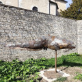
The Fontaine aux Soldats and the Chanois viewpoint

From the secluded Fontaine aux Soldats, you’ll climb towards a wild viewpoint overlooking the rocks of the Dame Blanche, passing the ruins of an old mountain hut along the way, following in the footsteps of that eerie woman who haunts these places after dark. You’ll then descend towards a powder magazine and the Fort de Châtillon via peaceful forest paths.

Details

20523033
Creation:
Last update:
Last review:
  • Walking
    Activity: Walking
  • ↔
    Distance: 5.40 mi
  • ◔
    Average duration: 3h 15 
  • ▲
    Difficulty: Easy

  • ⚐
    Back to start: Yes
  • ↗
    Ascent: + 906 ft
  • ↘
    Descent: - 899 ft

  • ▲
    Highest point: 1,791 ft
  • ▼
    Lowest point: 1,053 ft

Photos

Description of the walk

Car park at Châtillon-le-Duc, at the end of Chemin des Vignes Blanches, on the right. Discreet yellow-and-blue signposting. A large section has no signposting.

(S/E) Head towards the end of the street and take the grassy path (signposted ‘Sentier découverte’, ‘La Fontaine aux Soldats’). You’ll certainly enjoy this path along the valley slope, though it’s a pity to see all these trees felled by the drought. You’ll arrive at the beautiful Fontaine aux Soldats, tucked away in the woods.

(1) Continue the climb up to the village, passing below the walls of the old fort until you reach the first houses of Châtillon, coming to an old stone gateway and a fork in the path.

(2) Head down to the left along the lovely stony path. A little further down, at the fork marked by a signpost reading ‘Grand Besançon’, turn right, crossing a beautiful, light-filled forest and continuing straight on to the lovely Ermitage house, dating from 1627.

(3) Carry on and, after a view over the Ognon valley, turn right, quickly rejoining a wide stony path, which continues to climb to the right. At the next fork, turn right again to reach a large clearing and join a forest track at right angles, where you’ll find a signpost.

(4) Head down to the left for about sixty metres and, after two large stones, climb up the lovely path on the right, ignoring the Yellow Cross and Blue Cross, for a good little climb up to a plateau.

Head carefully to the left towards the unsecured viewpoint overlooking the Dame Blanche and the valley.

(5) Set off again along the path on the left. Carefully follow the ledges to reach an old dry-stone wall and a circular area at the edge of the cliff, which resembles the foundations of an old ‘caborde’ (a dry-stone hut commonly found on the heights of the Besançon mountains).

You will soon reach a crossroads and a stony track at a hairpin bend (mountain bike route 124). For the more adventurous, there is the option to continue on to the Fort de la Dame Blanche (see § Practical Information).

(6) Head back down the hill along the path to the left of the large sign (facing it). You’ll soon come to a fork. Take the left-hand path. Continue straight on along this stony path, ignoring the paths branching off to the right and left, until you reach a small clearing. This leads onto a lovely stony path, then onto a small tarmac road.

Follow it down for about fifty metres to the left, then turn right onto the lovely stony path that passes in front of a water tower. About fifty metres further on, don’t miss the path leading into the woods on the right (forest signs 15 and 16).

(7) Turn right onto this path, then immediately left at the nearby fork, taking the wider path. Stay on this path as it widens. When a wider, stony forest track joins you from the left, continue for about a hundred metres until you reach a fork.

Head down to the left, passing a beautiful wooded sinkhole. You’ll arrive right at the entrance to the village. Turn right until you reach a car park on either side of Rue Bellevue.

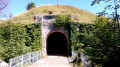
(8) Turn right into Impasse du Chemin de la Poudrière, then into the small grassy lane between the branches of the nearby fork. Be discreet; access is probably permitted – the powder magazine belongs to the local council but is, strangely, situated on private land.

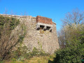
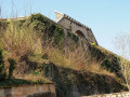
Turn back and turn right, then right again into Rue du Moulin à Vent, passing the modern War Memorial. Then, at the electricity substation, turn right into Rue des Communaux, passing some characterful houses. At the bottom of the street, turn right again into Chemin du Fort, with views of the fortifications overlooking the church

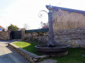
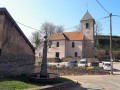
You’ll pass an unusual metal fountain as you head towards the church forecourt. Climb the steps that wind round the church to reach the first viewpoint and a picnic table. Continue uphill to the statue of the Virgin Mary and the end of the ramparts: a viewpoint overlooking the Jura mountain range, Mont Poupet, the Monts de Pirey and the villages of the Ognon Valley.

(9) Return to the church forecourt and head down the steps running alongside the façade. Follow the road to the last house and turn right onto the path that winds down the hill. It turns into a beautiful old stone staircase and leads to a housing estate.

Continue along the short, straight path between two hedges to reach Rue des Grapillottes. In our Franche-Comté dialect, a ‘grapillotte’ is a small incline. The prefix ‘gr’ indicated an upward movement in our ancient Gallic language.

Turn right until you reach the end of the first bend and, between numbers 5 and 6, turn right again into a lane lined with hedges, leading to the cul-de-sac of Rue des Remoussards, which you follow downhill to rejoin the Chemin des Vignes Blanches and the car park on the right (S/E).

Waypoints

  1. S/E : mi 0 - alt. 1,089 ft - Le Claon
  2. 1 : mi 0.37 - alt. 1,135 ft - The Soldiers’ Fountain
  3. 2 : mi 0.62 - alt. 1,325 ft - Stone gate – Fork in the path
  4. 3 : mi 1.19 - alt. 1,145 ft - L’Ermitage
  5. 4 : mi 1.97 - alt. 1,421 ft - Bois du Chanois
  6. 5 : mi 2.34 - alt. 1,683 ft - Chanois Viewpoint
  7. 6 : mi 2.64 - alt. 1,772 ft - Towards the Dame Blanche
  8. 7 : mi 3.48 - alt. 1,532 ft - The Reservoirs
  9. 8 : mi 4.33 - alt. 1,424 ft - The powder magazine
  10. 9 : mi 4.77 - alt. 1,388 ft - The Virgin’s Viewpoint and ramparts
  11. S/E : mi 5.4 - alt. 1,089 ft - Le Claon

Notes

The route includes cliff-edge paths and unsecured viewpoints. The paths are rocky and slippery in places. Sturdy footwear is essential and the use of walking poles is recommended.

At the point (6), for the more adventurous, there is the option to extend the walk to the Fort de la Dame Blanche. Following a beautiful cliff-top path overlooking the Ognon valley, you’ll reach the viewpoint over the Vosges, following in the footsteps of that eerie woman who haunts these places after dark. This adds a further 5 kilometres to the walk and an extra 100 metres of elevation gain. When you reach the gravel road at a hairpin bend, head slightly uphill along it. The signposting continues along this forest track, but I strongly recommend taking the lovely cliff-top path that climbs to the left. It is an old hiking trail with yellow-and-blue markings still clearly visible (in places, Red Cross signs). A full description can be found in *From Fort de Châtillon to the White Lady*.

Worth a visit

(1) The Soldiers’ Fountain: it was not until 1964 that running water reached the sinks of the residents of Châtillon. In days gone by, water was drawn from wells. However, on the Chemin de Claon, just outside the village, there was a fountain whose origin is unknown, but which undoubtedly predates 1774. It is known as the ‘Soldiers’ Fountain’ because, on 22 and 23 October 1870, French soldiers lying in ambush opened fire on the Prussians. Trapped, the Prussians retreated. Fortunately, however, this charming spot has since been the setting for the more peaceful chatter of the washerwomen and the lowing of the cattle that came there to drink.

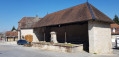
(3) La Grange de l’Ermitage, built in the early 17th century, once belonged to Châtillon-le-Duc. Overlooking the Ognon valley, it was occupied by novice monks before being converted into a farm during the Revolution. The famous Dr Grenier of Pontarlier, a Member of Parliament in 1896 who had converted to Islam, made his entrance into the Palais Bourbon wearing a burnous and turban, to everyone’s astonishment, thus becoming the first Muslim MP in French history. He used his Arabian horse, Saïd, for his visits and, when his trusty old nag reached retirement age, could not bring himself to put him down. It was in 1917 that he acquired the barns at l’Ermitage and Valleroy. The good Dr Grenier then offered him a rural retreat, along with other horses past their prime, which he bought to spare them suffering and death. Out of curiosity, before setting off on your walk, do take a look at this barn before its renovation!

(8) The powder magazine: its upper entrance is situated on the property of a villager. Access to the rooms is via a spiral staircase (81 steps) leading 14.40 m down. The local council restored the interior in 2012 and fitted it with permanent lighting. It is closed to the public, but guided tours are organised from time to time.

(9) Châtillon Fort, built between 1875 and 1879 on the ruins of the castle, forms part of the fortified camp of Besançon. Its purpose was to control the road and railway line to Vesoul. It is not possible to visit the interior of this fort, which is occupied by a private owner. You will have to make do with viewing the ramparts.

Reviews and comments

4.1 / 5
Based on 4 reviews

Reliability of the description
4.3 / 5
Ease of following the route
4 / 5
Route interest
4 / 5
User 27090188

Overall rating : 4.3 / 5

Date of your route : Apr 06, 2026
Reliability of the description : ★★★★★ Very good
Ease of following the route : ★★★★☆ Good
Route interest : ★★★★☆ Good
Very busy route : No

A pleasant walk at the start of spring. All the trees blocking the path have been cut down. The route between points 4 and 5 has become a wide open space ‘thanks’ to the work of the heavy machinery clearing the area.
The little church in the village of Chatillon was open!

Machine-translated

randonneur 70
randonneur 70

Overall rating : 4 / 5

Date of your route : Oct 21, 2024
Reliability of the description : ★★★★☆ Good
Ease of following the route : ★★★★☆ Good
Route interest : ★★★★☆ Good
Very busy route : Yes

A lovely walk, with a few trees blocking the paths following Storm Kirk on 8 October.
Some of the climbs may seem challenging to those who aren’t very fit, but they’re not insurmountable.
I’ll be back to do this walk in another season.
Thanks to the person who created this lovely walk.

Machine-translated

narca25
narca25

Overall rating : 4 / 5

Date of your route : Jun 17, 2024
Reliability of the description : ★★★★☆ Good
Ease of following the route : ★★★★☆ Good
Route interest : ★★★★☆ Good
Very busy route : No

It’s really enjoyable; the start is a bit more physically demanding but perfectly manageable.
Three hours and 15 minutes seems a bit of an exaggeration to me, though I did find the end a bit of a let-down as you walk through part of the village, which wasn’t very practical with my dog.
But otherwise, for those who enjoy walks in the woods, I’d recommend it.

Machine-translated

JUSSREANDOT
JUSSREANDOT

Overall rating : 4 / 5

Date of your route : Apr 16, 2022
Reliability of the description : ★★★★☆ Good
Ease of following the route : ★★★★☆ Good
Route interest : ★★★★☆ Good
Very busy route : No

A lovely walk during which we came across five chamois.
However, what is described as a ‘short climb’ in note no. 4 is in fact a long and difficult ascent.

Machine-translated

Other walks in the area

For more walks, use our search engine .

The GPS track and description are the property of this route's author. Please do not copy them without permission.