Country:
 City:
City:



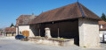
Tallenay Town Hall car park. Yellow-blue markings, mountain bike route and large sections without markings.
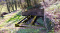
(S/E) Leave the car park and, at the Stop sign, head down to the left towards the wash house, taking a moment to have a look at the old cider press on display (on the lawn, on your left). At the wash house, turn left onto Rue du Château and follow it to the village boundary, leaving Rue du Clos Pommey on your left.
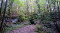
(1) Continue along this quiet, tarmac-surfaced track as it enters the woods. As you emerge from the woods, stay on this small road, passing a lovely forest lane on your left leading to Châtillon, then shortly afterwards a stony track on your right.
(2) You’ll come to a fork; take the path on the right, which soon turns to gravel, leading to another fork marked by a signpost for Les Hauts de Divicius. Carry on straight ahead (the right-hand path) for about sixty metres.
(3) Climb up the lovely path that appears on the right (despite the Yellow Cross and Blue Cross). After a steep climb, you’ll reach a first, barely visible junction of paths (which you might pass without noticing), followed by a second, clearly marked one.
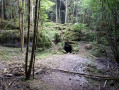
(4) Head carefully to the left towards the unsecured viewpoint overlooking the Dame Blanche and the valley. Continue along the path on the left. Walk carefully along the ledges. You’ll come to an old dry-stone wall, and a circular section at the edge of the ledge resembles the base of an old ‘caborde’ (a common type of stone hut found on the heights of the Besançon mountains). You’ll reach a gravel track at a hairpin bend, which you’ll follow uphill for a short distance. The signposting continues along this forest track.
(5) Take the lovely cliff-top path that climbs to the left. Caution: do not confuse it with the wider path to the left a little earlier on, which descends into the valley. This is an old hiking trail with yellow-and-blue markings that are still clearly visible. Continue to walk carefully along the ridge, enjoying lovely views over the Ognon valley. Stay as close as possible to the cliff edge, following the ridge at a distance with lovely views over the Oignon Valley. When it comes out onto the road, carry on along the path.
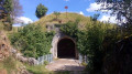
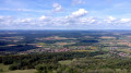
(6) You’ll reach the forest road, which you follow uphill for about fifty metres; after signs no. 40 and 18, take the cliff-top path on the left until you reach the viewpoint (619 m) overlooking the Ognon Valley, with the Vosges peaks (the Hohneck, the Ballon de Servance, the Ballon d’Alsace and the Grand Ballon).
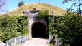
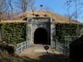
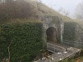
(7) With your back to the valley, descend about 20 metres and head left, passing some ruins, then go down a small flight of steps in front of the fort’s entrance. Pass beneath the viewpoint again and continue along the stony path. At the fork, quickly ignore the path leading down to the left and stay on this stony path until you reach the junction with the forest road you passed earlier.
(5) Stay on the stony path, which curves slightly to the left and reaches a signpost (C18) some thirty metres further on. Descend the wooded slope via the path on the right (towards Le Vieux Tilleul, Petites Baraques, marked with red mountain-bike signs). Continue along this lovely forest path, which overlooks a picturesque forest slope, even when you see, on your left (forest signs 56, 57), a stony path and a signpost. Join this stony path a little further down at a fork.
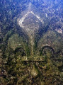
(8) Head down to the right (towards Tallenay), passing beneath some beautiful rocks. A little further down, at a signpost marked ‘Grand Besançon’, take the path on the right down the track so charmingly known as the ‘Sentier du Facteur’. When you reach the first houses, carry on straight ahead, stopping (on your right) at a boundary marker demarcating the royal forest from the time of Louis XV.
(9) Carry on to the little church and, at the wash house, head up to the left to the car park (S/E).
 The route includes ledge paths and unsecured viewing points. The paths are rocky and slippery in places. Sturdy footwear is essential and the use of walking poles is recommended.

 Visorando Member
 Moderate