The Vallon de Terron in Nice

Fancy a bit of exercise or some fresh air between noon and two? This one-hour walk will let you enjoy the fresh air in a wild wooded area below the Larchet Hospital.
A complete change of scenery is guaranteed in this wooded valley with its poudingue rock faces – a mixture of pebbles, sand and clay dating from the Pliocene epoch.

Details

4849952
Creation:
Last update:
Last review:
  • Walking
    Activity: Walking
  • ↔
    Distance: 2.33 mi
  • ◔
    Average duration: 1h 25 
  • ▲
    Difficulty: Easy

  • ⚐
    Back to start: Yes
  • ↗
    Ascent: + 387 ft
  • ↘
    Descent: - 387 ft

  • ▲
    Highest point: 525 ft
  • ▼
    Lowest point: 135 ft
  • ⚐ Country: France
  • ⚐
    Area: Alps
  • ⚐ City: Nice (06100|06300|06200|06)
  • ⚑
    Start/End: N 43.690111° / E 7.227248°
  • ❏
    IGN map(s): Ref. 3742OT
  • Hour-by-hour weather

Photos

Description of the walk

Free car parking along Chemin de la Madonette de Terron.

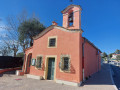
(S/E) Walk northwards along the Chemin de la Madonette de Terron to reach the war memorial and its oratory.

(1) Turn left onto the Chemin du Vallon de Terron. Continue straight on until you reach the hairpin bends.

(2) Leave the tarmac road and continue straight ahead into the valley with its high puddingstone cliffs.
Follow the path and turn left at the wall blocking the path. The path ends with concrete steps at the junction with a tarmac road.

(3) Watch out for traffic. Turn left onto Chemin de Terron, a tarmac road that winds its way up the hill to the car park on Chemin de la Madonette de Terron (S/E).


Waypoints

  1. S/E : mi 0 - alt. 138 ft - Chemin de la Madonette de Terron.
  2. 1 : mi 0.27 - alt. 174 ft - Crossroads – War memorial
  3. 2 : mi 0.52 - alt. 335 ft - Hairpin bend – junction between road and footpath.
  4. 3 : mi 0.72 - alt. 525 ft - Junction between footpath and tarmac road.
  5. S/E : mi 2.33 - alt. 138 ft - Chemin de la Madonette de Terron.

Notes

(2) Poudingue is a mixture of pebbles, sand and clay, dating from the Pliocene epoch.

No water source.

Worth a visit

Promenade des Anglais – Beaches.

Reviews and comments

4.2 / 5
Based on 3 reviews

Reliability of the description
4.7 / 5
Ease of following the route
5 / 5
Route interest
3 / 5
bernard bb
bernard bb

Hello Lucky06, thank you for your review

For your information, here are the previous reviews......
Need something to do or a breath of fresh air between noon and two
or......
A short and easy walk, perfect for people living in the neighbourhood or those short on time.
The first part is pleasant in the valley; the second part is on a tarmac road, which is less enjoyable, even though it’s not very busy

Have a good week, best wishes, Rando B.

Machine-translated

Lucky06
Lucky06
• Edited:

Overall rating : 3.3 / 5

Date of your route : Mar 20, 2022
Reliability of the description : ★★★★☆ Good
Ease of following the route : ★★★★★ Very good
Route interest : ★☆☆☆☆ Very disappointing
Very busy route : No

Unless you live in the neighbourhood, I wouldn’t recommend this walk: it’s mostly along roads, with just a very short stretch through countryside; the rest is walking on tarmac with nothing much to look at.

Machine-translated

bernard bb
bernard bb

Hello, and thank you, Sergio from Nice, for your review.
You’ve summed up the route very well
Friendship Hike B.

Machine-translated

sergio de Nice
sergio de Nice

Overall rating : 4.7 / 5

Date of your route : Jan 23, 2022
Reliability of the description : ★★★★★ Very good
Ease of following the route : ★★★★★ Very good
Route interest : ★★★★☆ Good
Very busy route : No

This route offers a chance to explore the Terron valley and, in particular, the top of the hill of the same name, where, over the years, numerous beautiful villas have replaced the flower fields. The valley is quite cold in January, but once you’re on the path to the summit, a gentle warmth will comfort and encourage you. This route has allowed us to get to know the hill opposite our home; it’s short, with no chance of getting lost, presents no difficulties and is very pleasant for a short walk (1 hour 40 minutes).

Machine-translated

bernard bb
bernard bb

Thank you, Michèle7, for your review.
You’ve summed it up perfectly
Happy hiking!

Machine-translated

Michele7
Michele7

Overall rating : 4.7 / 5

Date of your route : Apr 19, 2021
Reliability of the description : ★★★★★ Very good
Ease of following the route : ★★★★★ Very good
Route interest : ★★★★☆ Good
Very busy route : No

A short and easy walk, perfect for people living in the neighbourhood or those who are short on time.
The first part is a pleasant walk through the valley, whilst the second part is along a tarmac road, which is less enjoyable, even though it’s not very busy.

Machine-translated

Other walks in the area

For more walks, use our search engine .

The GPS track and description are the property of this route's author. Please do not copy them without permission.