Country:

 City:
City:


(S/E) Park in the Les Avenières car park. The walk starts behind the restaurant of the same name.
(1) Take the path leading uphill to the left (north-west) behind the restaurant. The path is well marked. The slope is steep, with steps in places. Continue to Le Treu (1,835 m).
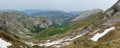
(2) At the summit, enjoy the 360° view, then continue along the path heading north.
(3) Turn left (to follow ‘les Stallets’). The path isn’t very well marked, but you can find your way by looking around. Your destination consists of two barns standing side by side.
If you’d like to take a shortcut, turn right to rejoin the route at the point (12) and return quickly to the start.
(4) Turn right onto the track.
(5) This point is signposted, but there is nothing else to do but continue along the road until you reach a Fork in the road.
(6) When you reach the Fork in the road, carry on straight ahead towards the east until you reach a shaded picnic table.
(7) Take a path that climbs south-east to the Croix de Stata.
(8) After taking in the view, head back the way you came.
(7) Turn left and carry on. The road winds down in a series of rather monotonous bends.
(9) At the entrance to the hamlet of Chaucisse, leave the road to the right onto a path that descends to the Ruisseau du Nant de Chaucisse.
(10) After the ford, the path climbs steeply southwards and reaches a Fork in the road.
(11) Continue to the right, heading due south, until you reach the next Fork in the road.
(12) Turn left. The path becomes a farm track, levels out and leads to the Avenières mountain pasture.
(1) Carry on straight ahead to the car park (S/E).



 Visorando Member

 Difficult
  Easy
Easy 
 Association / Club / Walk leader