The Mont Panard circuit

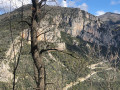
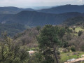
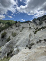
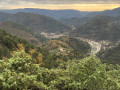
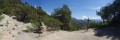
Although the start of this walk is rather uninspiring, as it begins on a track suitable for vehicles, the rest is a magnificent series of wooded paths, offering views of the Rocher Saint-Sauveur, then of the Baudon, Monts Ours and Mont Agel massifs, as well as distant views of the Mediterranean coastline. 

Due to trail closures, the Visorando GPS app may prove useful. 

Details

n°71592668
Creation:
Last update:
Last review:
  • Walking
    Activity: Walking
  • ↔
    Distance: 8.11 mi
  • ◔
    Average duration: 5h 40 
  • ▲
    Difficulty: Moderate

  • ⚐
    Back to start: Yes
  • ↗
    Ascent: + 2,211 ft
  • ↘
    Descent: - 2,228 ft

  • ▲
    Highest point: 3,248 ft
  • ▼
    Lowest point: 1,076 ft

Photos

Description of the walk

Park in the municipal car park, situated behind the village church.  

(S/E) Take the passageway under the church, which leads to the old streets. Turn left onto Rue du Pont Vieux and cross the Paillon bridge. Continue along Rue Saint-Sébastien. 

From point (1) to point (4), take care as there may be traffic 

(1) At the D2204, turn right and follow the road with care for 120 m.

(2) Turn right towards Sospel (D2204), then turn right onto a small road.

(3) Cross the bridge over the Redebraus stream and follow the track of the same name towards Albera. After 200 m, head up to the left along the winding minor road until you reach a fork in a tight bend.

(4) Leave the tarmac road and take the track opposite, following it until you reach a footpath in the bend to the left.

(5) Turn left, heading uphill. Very soon, the path is blocked by a barrier. Take the path on the left and cross about ten terraces through an old olive grove. Use the Visorando app if necessary.

(6) At the open-air water reservoir, continue along the barely visible footpath. When you reach the track – which is a picnic area – take a break, then follow the track straight on until you reach a junction where three tracks meet.

From point ( 7) to point ( 10), take care – there may be traffic 

(7) Carry on to the left; the track overlooks the village of Touët-de-l'Escarène.

(8) Walk past marker 146. At the next junction at the Col de Cavalier, turn left and follow the track due north. 

(9) Turn right onto the start of a path, which soon disappears. Follow the stream to join and follow the Albéra track, suitable for vehicles, until you reach a multi-way junction. 

(10) At the junction (marked by a cairn), continue straight ahead (east) along this wide path heading uphill through woodland. The path soon turns south, then veers left towards the north-east. Much further on, you’ll reach an altitude of 980, known as Bouche de Panard.

(11) Turn slightly left, and at the next junction – where a track meets the path – turn sharply right.
Signpost 154, marked ‘Chapelle de Saint-Pancrace’, is situated about thirty metres further on.
You’ll reach a crossroads of tracks, marked by signpost 153.

(12) Stay on the track on the right, which climbs slightly.

(13) Turn left at the bend in the track. Use the app for the first few metres. The start of the path is not immediately obvious, but it then leads through a very pleasant woodland.

(14) In the clearing, turn left and follow the tarmac track.

(15) At marker 152, turn immediately right towards L’Escarène, onto the descending wooded path.

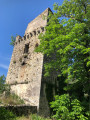
(16) At marker 151, turn right. Walk round the 17th-century Saint-Pancrace Chapel; there is another marker there, pointing towards l’Escarène. The descending path is a concrete track, which ends in a woodland path. 

(17) At marker 150, follow the signs for l’Escarène. Please take care: the Route des Trues is a busy road. Takethe shortcuts, then follow the road.

 (18) At marker 149, at a place called La Russa, follow the Route de la Grave (D21) towards l’Escarène. Take care whilst travelling along the Route de la Grave.

(19) Take the path on the left at the entrance to the village; after the bridge over the Paillon, turn right onto the Chemin des Anciens Combattants.

(20) Enter the village via the old streets, head towards the church, then make your way to the car park (S/E).


Waypoints

  1. S/E : mi 0 - alt. 1,145 ft - Car park at the - Église Saint-Pierre-ès-Liens de l'Escarène. L'édifice est classé au titre des monuments historiques le 28 décembre 1978
  2. 1 : mi 0.23 - alt. 1,171 ft - Road junction
  3. 2 : mi 0.3 - alt. 1,188 ft - Road junction
  4. 3 : mi 0.45 - alt. 1,198 ft - Bridge over the River Redebraus
  5. 4 : mi 1.09 - alt. 1,552 ft - Bend in the road
  6. 5 : mi 1.36 - alt. 1,650 ft - Crossroads of footpaths and tracks
  7. 6 : mi 1.48 - alt. 1,844 ft - Open-air water reservoir
  8. 7 : mi 1.83 - alt. 2,044 ft - Junction of tracks suitable for vehicles
  9. 8 : mi 2.49 - alt. 2,310 ft - Marker 146
  10. 9 : mi 2.97 - alt. 2,493 ft - Watercourse
  11. 10 : mi 3.24 - alt. 2,615 ft - Crossroads of footpaths and tracks
  12. 11 : mi 4.19 - alt. 3,212 ft - Crossroads of footpaths. Bouche de Panard
  13. 12 : mi 4.93 - alt. 2,635 ft - Marker 153. Trail junction
  14. 13 : mi 5.23 - alt. 2,674 ft - Crossroads of footpaths and tracks
  15. 14 : mi 5.68 - alt. 2,303 ft - Clearing
  16. 15 : mi 5.88 - alt. 2,303 ft - Marker 152. Crossroads
  17. 16 : mi 6.47 - alt. 1,801 ft - Marker 151 - chapelle du XVIIe siècle, typique de l’architecture locale des Alpes-Maritimes.
  18. 17 : mi 6.86 - alt. 1,404 ft - Marker 150
  19. 18 : mi 7.54 - alt. 1,115 ft - Marker 149
  20. 19 : mi 7.74 - alt. 1,125 ft - Entrance to the built-up area - Paillon (fleuve)
  21. 20 : mi 7.97 - alt. 1,109 ft - Village entrance
  22. S/E : mi 8.11 - alt. 1,145 ft - Car park at the - Église Saint-Pierre-ès-Liens de l'Escarène. L'édifice est classé au titre des monuments historiques le 28 décembre 1978

Notes

Walking poles and hiking boots are recommended.

No water at point (18) 

Worth a visit

Reviews and comments

3.3 / 5
Based on 4 reviews

Reliability of the description
3.7 / 5
Ease of following the route
2.3 / 5
Route interest
3.8 / 5
jacques06380
jacques06380

Overall rating : 3.7 / 5

Date of your route : Nov 22, 2025
Reliability of the description : ★★★★☆ Good
Ease of following the route : ★★★☆☆ Average
Route interest : ★★★★☆ Good
Very busy route : No

I went via Touët de l'Escarène because it had rained the day before, so I preferred to play it safe and not get lost or slip, given the directions.
I didn't go around Mont Panard; I took the shortcut for a better view of the valley.

Machine-translated

bernard bb
bernard bb

Thank you, Julia H1, for this review
A little-frequented area.
Kind regards, B.

Machine-translated

Julia H1.
Julia H1.

Overall rating : 2.7 / 5

Date of your route : Sep 28, 2025
Reliability of the description : ★★★☆☆ Average
Ease of following the route : ★★☆☆☆ Disappointing
Route interest : ★★★☆☆ Average
Very busy route : No

Impossible without GPS, which is also less accurate under trees.

(5) A few metres after the barrier, look for a path on the right (which we didn't really find at first) and climb straight up the slope to cross a dozen terraces.

(13) We spotted a path that climbs up to the right, crosses the track and continues down a steep slope. It's more of a trail among many trails. We followed the GPX track but walked for about 200 metres on trails before finding the path.

Machine-translated

bernard bb
bernard bb

Thanks, Jean-Louis. Have a good weekend
Hiking friends, B.

Machine-translated

Grillo jean-Louis
Grillo jean-Louis
• Edited:

Hello

The start is at the Col de Castillon; there are a few houses there and the car park is next to a ruined church. Don’t head into the village of Castillon. Carry on; the road to the pass is just after a tunnel on the left. As for the Visorando route, you can add Mont Razet, which has some wartime ruins. At point 3, take a round trip to Mont Razet and then rejoin the Visorando trail; between points 3 and 4, there’s a blockhouse with tunnels worth seeing

Enjoy the walk

Machine-translated

bernard bb
bernard bb

Hello Jean-Louis

Right then, this weekend we’re heading for the Baisse de Scuvion, setting off from Castillon – thanks a lot.

Getting back to Touët de l’Escarène. There’s just a small patch of vegetation to cross, about twenty metres wide at most; if you look carefully, you’ll find a way through. The secateurs are just in case a few brambles get in your way.

Once you’ve got through (and if you have a look on Google Earth, the summit is a series of terraces from a long-forgotten era), the rest of the off-trail section to the summit is very easy to navigate.
Thanks again and have a great weekend, B.

Machine-translated

Grillo jean-Louis
Grillo jean-Louis

Good evening
Thank you, I’ve already saved this walk to Touet de l’Escarene, but I saw that you need to take a pair of secateurs – that worries me a bit if it’s a bit of a jungle in there? However, I’d recommend the Baisse de Scuvion, combining it with a walk up Mont Razet starting from the Col de Castillon – it’s a lovely walk. Have a good weekend

Machine-translated

bernard bb
bernard bb

Thank you, Jean-Louis Grillo, for your review
If you like this area, in Touet de l’Escarène, La Scaletta is well worth a visit
Best wishes for your walks, B.

Machine-translated

Grillo jean-Louis
Grillo jean-Louis

Overall rating : 3 / 5

Date of your route : Apr 24, 2025
Reliability of the description : ★★★★☆ Good
Ease of following the route : ★★☆☆☆ Disappointing
Route interest : ★★★☆☆ Average
Very busy route : No

A route to avoid without the Visorando app. Without the Visorando app, at point 5 I’d advise carrying on straight along the track to reach point 7 – it’s a longer route, but as it’s a right faff navigating the terraces with your mobile in hand, I don’t think you’ll lose much time by sticking to the track. Then, at point 12, it’s better to carry on along the track to get to point 15, as it’s also a bit of a faff trying to find the path at point 13.
There are plenty of tracks on this walk; however, I did the Mont Panard route through the lovely woodland instead.

Thanks all the same to the author for describing this walk.

Machine-translated

bernard bb
bernard bb

Hello aubrynice

Your conclusion is brilliant!!
You made me smile
That’s exactly it
Best wishes, Rando, B.

Machine-translated

aubrynice
aubrynice
• Edited:

Overall rating : 5 / 5

Date of your route : Apr 04, 2025
Reliability of the description : Not used / Not applicable
Ease of following the route : Not used / Not applicable
Route interest : ★★★★★ Very good
Very busy route : No

Thank you for sharing this walk.
It’s a lovely walk, just on the outskirts of Nice; the scenery is varied and offers a real change of scenery...
However, without a GPS track, it’s impossible to follow on certain sections (the start and almost the end)...
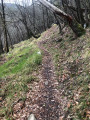
This walk takes you along paths that look like they might have been trodden by wild boars, where the vegetation is quite dense and the path is unmarked and untraced.
If you prefer well-marked trails, this walk isn’t for you: choose another one!
If you enjoy gentle walks and nature trails: go ahead without a second thought – you’ll have a lovely time!

Machine-translated

Other walks in the area

For more walks, use our search engine .

The GPS track and description are the property of this route's author. Please do not copy them without permission.