Country:

 City:
City:


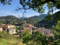
Park in one of the two free car parks located in front of and behind the church of L’Escarène, except on Saturdays (market day), when only the car park behind the church is permitted.
(S/E) Cross the D21 at the pedestrian crossing next to the church and continue straight ahead along Rue de Nice.
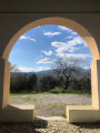
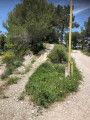
(1) At number 4 on the street, turn left into the car park. Take the concrete steps at the far left-hand end of the car park. Pass through the two metal arches and turn right onto thefirst unmarked path about ten metres further on (cairn). Continue along this path, keeping as close as possible to the property fences.
(2) At the junction of the footpath and the track, turn left. Go through the gate and continue along the track known as the D.F.C.I. de Montagnac.
(3) Continue south-east. Look out for the start of the footpath on the left, which will take you back to the starting point at the end of the walk.
(4) At a slight bend, leave the track and take the footpath opposite, which winds through the pine trees and is much more pleasant than the track.
(5) At the junction of the tracks, go to the right of the water reservoir set aside for firefighting and carry on straight ahead along this track, known as D.F.C.I. la carrière.
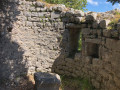
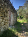
(6) At the junction of the tracks, turn left and, after a hundred metres, turn left onto the footpath. Do not turn before the hundred metres; some signs of deforestation may be misleading. Follow this path to reach the Castel de Sainte-Brigitte: a small grassy plateau known as Sainte-Brigitte or ‘La Condamine’ on some maps. A very beautiful 17th-century stone tower, flanked by contemporary ruins. For safety reasons, do not enter the ruins.
(7) From the tower, head towards the roofless stone-walled ruin, situated about fifty metres to the north, and continue into the small north-north-eastern clearing. On the right, at the far end of the meadow, an opening between the trees reveals a path. Go down the slope and pass a few trees. Cairns mark the start of the path on the right. Landmark not to be passed: the overhead power line running directly overhead.
(8) A cairn marks the start of this magnificent, forgotten, winding woodland path, which has not been used for years. Continue down the gentle, winding descent until you reach the bridge over the River Paillon.
(9) Cross the 3-metre-wide bridge, keeping to the centre as there is no parapet. At the end of the bridge, continue past the wreck of a semi-trailer to reach a section of abandoned road blocked by a gate to prevent littering. Go round the left-hand side of the gate to reach the tarmac D21 road, also known as the Route de la Grave. Beware of regular road traffic. Turn left and continue for 550 m along the D21 towards L’Escarène until you reach the raised metal sign marked D21 / 11.
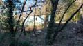
(10) Turn left into the copse below, follow the path and cross the bridge over the River Paillon. Pass under the metal barrier on this bridge, which is fitted with a parapet. Just after the bridge, the start of the path is in poor condition for about fifty metres. Continue along this pleasant path, which leads to the Castel de Sainte-Brigitte area. Pass under the power line. This area is the Castel de Sainte-Brigitte plateau.
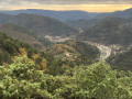
(11) Stay on the path on the right and continue for about thirty metres; the start of our steeply ascending path is on the right. There are a few cairns and tracks along the climb through the woods to the summit of the Cime de Castel at an elevation of 675. It’s worth taking a break to admire the south-westerly view over the Cap d’Antibes.
(12) From the summit, turn onto the descending path on the right. At the junction between the footpath and the track known as “D.F.C.I le castel”, continue to the right towards the electricity pylon. Pass underneath this pylon and continue along the descending track. At the first track, turn right. Pass the D.F.C.I. water reservoir and carry on straight ahead.
(5) At the junction, carry straight on along the ‘Sentier des Pins’ to the left of the ‘D.F.C.I de Montagnac’ track.
(4) Continue along this track, heading due north for 100 m.
(3) At the junction where the track meets the path (marked by a cairn and red mountain-bike signage), turn right onto this gently sloping path. Landmark: on the left, a property entrance without a gate. During the descent, look out for a stone cistern housing a spring.
(1) Return to the small car park at 4 Rue de Nice, then turn right to reach the church of L’Escarène (S/E).


 Visorando Member