Country:

 City:
City:


Park in the car park on Route du Linge (D5 bis).
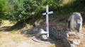
(S/E) From the orientation table, go through the turnstile and carefully make your way down the path, as it can be slippery. The path then turns left into the forest. Join a footpath and continue to the right on the path marked with a Red Triangle. You will soon reach the memorial.
(1) Continue along the path until you soon reach a large crossroads with a forest shelter provided for passing walkers.
(2) Behind this shelter, take the path that runs parallel to the wider one (marked with a Yellow Cross).
On this path, which circles the Hoernleskopf, you’ll pass a path on your right that climbs to the summit; then, about 600 metres further on, another path on your left that leads back down.
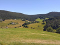
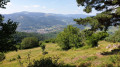
A few hundred metres further on, after passing through a turnstile, the view over the Münster Valley and Hohrodberg opens up.
Return to the forest shelter just after passing through a final turnstile.
(2) Turn right to climb to the summit of the Hoernleskopf.
(3) Return to the previous junction via the same route.
(2) Take the path opposite the shelter, to the right of the one you took on the way there.
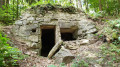
You’ll pass several shelters dating from the First World War (on your left).
Return to the junction by the footpath you passed on the way there. Take the steep path on the right, which has large steps, to reach the car park directly (S/E).

 Visorando Member
 Moderate

 Difficult
 Tourism professional