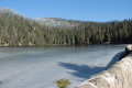
The Croix de Wihr via a route suitable for pushchairs

A lovely walk in the shade with a few points of interest. As the path is very easy to walk on, I suggest an alternative route that allows you to push an all-terrain pushchair (not tested with a pushchair!).
The advantage of this route is that it’s a return walk, so you can turn back whenever you like.

Details

3773749
Creation:
Last update:
Last review:
  • Walking
    Activity: Walking
  • ↔
    Distance: 9.04 mi
  • ◔
    Average duration: 4h 50 
  • ▲
    Difficulty: Moderate

  • ⚐
    Back to start: Yes
  • ↗
    Ascent: + 781 ft
  • ↘
    Descent: - 755 ft

  • ▲
    Highest point: 2,940 ft
  • ▼
    Lowest point: 2,605 ft

Photos

Description of the walk

Coming up from Munster, drive past the village of Hohrodberg until you reach a large car park on the right, where you can park.

(S/E) Walk past the car parks and picnic areas as you head uphill. At the end of the car park, take the path on the right leading downhill, marked with a Red Triangle.
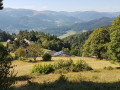
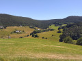
The path winds its way up the mountainside, offering a beautiful view over the Munster valley.
Continue to the first junction.
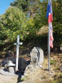
(1) Turn right and follow the Red Triangle markings to reach the memorial.

(2) Walk past the memorial and the wreckage of a plane that crashed during the Second World War until you reach the chalet, which is well worth a visit.

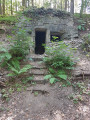
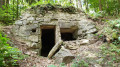
(3) Take a moment to read the information board about the crashed aeroplane and explore the shelter, which holds a few surprises.
Then take the path signposted ‘Croix de Wihr’ (Yellow Cross) and follow it all the way.
The rest of the route presents no difficulty; the points of interest are mainly mentioned to enhance the route. It’s up to you to spot the points of interest (photos with captions).
“Along the way, take a look at the forest – there are plenty of signs of human activity (such as logging).
Some people leave messages there.”

(4) Look for a sign lovingly carved into a tree stump. Continue along the path which passes through the Ban district of the commune of Gunsbach.

(5) Continue along the ‘Chemin des Trois Épis’ (‘Dreihàhrawag’) to a four-way crossroads.

(6) Take the path opposite the ‘Montagne des Vaches’ sign, ‘Kuhberg’. Do not head down to the right onto the wide ‘Montagne du Haut’ path, ‘Owerbreitabariwaj’. Look out for the remains of a well.

(7) Continue along the path that passes in front of the little Antoni Well, ‘Antoni Brennala’.
Take a moment to rest on the bench and set off refreshed!
Continue to follow the Yellow Cross markings towards the Croix de Wihr. From here, the path becomes rockier. It’s another two kilometres to the Croix de Wihr.
It might be time to turn back for anyone who’s ventured out with a pushchair!

(8) Look out for the natural features photographed in 2020. Depending on when you visit, they may no longer be there!
Carry on a little further to finally reach the Croix de Wihr.

(9) There are two benches where you can rest before heading back along the same route. Make sure to follow the ‘Yellow Cross’ signposted Hohrodberg (S/E).

Waypoints

  1. S/E : mi 0 - alt. 2,677 ft - Car park
  2. 1 : mi 0.53 - alt. 2,700 ft - At the fork, turn right
  3. 2 : mi 0.6 - alt. 2,680 ft - Aircraft memorial
  4. 3 : mi 0.7 - alt. 2,625 ft - Chalet
  5. 4 : mi 1.42 - alt. 2,694 ft - Good luck!
  6. 5 : mi 1.97 - alt. 2,785 ft - Gunsbach
  7. 6 : mi 2.25 - alt. 2,858 ft - Kuhberg
  8. 7 : mi 2.57 - alt. 2,874 ft - Antoni Brennala
  9. 8 : mi 4.3 - alt. 2,867 ft - Natural land art
  10. 9 : mi 4.51 - alt. 2,923 ft - Croix de Wihr (Le Grand Hohnack)
  11. S/E : mi 9.04 - alt. 2,674 ft - Car park

Notes

Alternative route suitable for pushchairs – not tested
As for pushchair access, I haven’t tried it myself.
There is no car park at the start; only one car can park on the hard shoulder at the start of the path, or you can drop off some of the walkers, drive back to park, and then walk back up.

(S/E) Pushchair alternative: continue by car along the road and enter the forest.
After about one kilometre (elevation 889), a small path branches off to the right, heading back the way you came. Park at the side without obstructing the road, or drop off passengers and drive back to park in the car parks.
From there, take the gently sloping path down into the forest. The first remains of the First World War bunkers are already visible on the right.
Resume the route from the chalet (3).

There is no water along the route.
As always, wear suitable footwear and bring protection against the rain, sun and cold.
The Club Vosgien’s markings may have changed over time; they are described as seen on the day of the walk.

As this is a return walk, the path can be accessed from the Croix de Wihr, above the village of Labaroche. In this case, follow the signs for ‘Yellow Cross Hohrodberg’.

Reviews and comments

4.7 / 5
Based on 1 review

Reliability of the description
5 / 5
Ease of following the route
5 / 5
Route interest
4 / 5
Denis_68
Denis_68

Thank you, I’m delighted you enjoyed the walk.
Kind regards
Denis

Machine-translated

User 27344297

Overall rating : 4.7 / 5

Date of your route : Aug 19, 2026
Reliability of the description : ★★★★★ Very good
Ease of following the route : ★★★★★ Very good
Route interest : ★★★★☆ Good
Very busy route : No

A peaceful (round-trip) and very pleasant walk

Machine-translated

Other walks in the area

For more walks, use our search engine .

The GPS track and description are the property of this route's author. Please do not copy them without permission.