The Combal Circuit (Mont Caune)

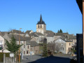
A short route around the Puech overlooking the pretty village of Vezins de Lévézou: Mont Caume. Not particularly difficult, with varied scenery.

Details

4367971
Creation:
Last update:
Last review:
  • Walking
    Activity: Walking
  • ↔
    Distance: 5.63 mi
  • ◔
    Average duration: 3h 10 
  • ▲
    Difficulty: Moderate

  • ⚐
    Back to start: Yes
  • ↗
    Ascent: + 699 ft
  • ↘
    Descent: - 699 ft

  • ▲
    Highest point: 3,258 ft
  • ▼
    Lowest point: 2,776 ft

Photos

Description of the walk

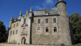
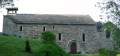
Parking available near the cemetery, to the north of the castle

(S/E) Follow the castle’s surrounding walls towards the church. Head down to the lower part of the village via Rue de l’Église and reach Rue Marlet. Then turn left until you reach the small bridge.

(1) Cross the small bridge and turn immediately right. At the T-junction, head up to the left towards the chemist’s. Pass a street on your left and continue to the sign marking the village exit.

(2) Take the small, shaded path on the right. Climb up to reach the highest point of the route at an altitude of 1,000 metres, at the crossroads (to the south, the summit of Mont Caune (Combal); to the east, the Puech du Pal, 1,155 metres, the highest point in the Lévezou region).

(3) Turn left at a 90° angle and follow the path down towards some farm buildings.

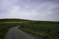
(4) Turn right and follow the path as it continues down the eastern slope of the Combal for about 1.5 km until you reach the C5 road. From there, you can see the village of La Clau (‘La Ville Close’) and its Templar tower.

(5) Follow the road to the right, crossing two small bridges over the Caze and Viaur streams. At the next junction, turn right towards Gleysenove (“Église Neuve”) and follow the Viaur, which rises at the foot of the Puech du Pal. Just after the junction with a path coming from the left, you’ll reach a crossroads.

(6) Turn right and cross the Viaur to reach the small fortified farmstead of Frontin (named after an important family from the Gallo-Roman period). Continue straight on along the path which leads to Gleysenove via the southern slope of the Combal. Leave “Prat Long” on your left and carry on along the small road. At the entrance to the village, leave the Route du Moulin on your left and cross the village of Gleysenove from east to west.

(7) At the crossroads, turn right into the centre of the village, heading towards thefirst cross, then straight on to thesecond cross, and turn right again at this point to join the D654 departmental road via Rue du Four.

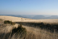
(8) Walk 50 metres uphill to the right and carefully cross the D654 to join the road towards Lésserac. Leave the hamlet on your right and continue straight on towards the north, taking an open path (GRP®) that runs alongside farmland. Le Combal is now visible from the west, and behind you rises Puech Monseigne, reaching a height of 1,128 m.

(9) The path branches off to the right towards the hamlet known as “Boussac”. Cross through it to reach the D654 at “L’Oustal del Coucut” (the Cuckoo’s House). Follow the D654 towards Vezins on your left, enter the village and reach the junction at a bend just past the post office.

(10) Turn left up Rue du Cordonnier, then left again onto Rue du Château until you reach the car park (S/E).

Waypoints

  1. S/E : mi 0 - alt. 3,110 ft - Car park – Cemetery - Château de Vézins-de-Lévézou
  2. 1 : mi 0.14 - alt. 3,045 ft - Small bridge
  3. 2 : mi 0.26 - alt. 3,097 ft - Path on the right
  4. 3 : mi 0.67 - alt. 3,245 ft - Crossroads at the foot of the - Mont Caune
  5. 4 : mi 0.87 - alt. 3,192 ft - Farm buildings
  6. 5 : mi 1.92 - alt. 2,881 ft - Route C5
  7. 6 : mi 2.5 - alt. 2,861 ft - Frontin - Viaur (rivière)
  8. 7 : mi 3.65 - alt. 2,825 ft - Junction with the Route du Moulin
  9. 8 : mi 3.81 - alt. 2,795 ft - D654 junction
  10. 9 : mi 4.63 - alt. 2,992 ft - Junction
  11. 10 : mi 5.49 - alt. 3,038 ft - Crossroads after the post office
  12. S/E : mi 5.63 - alt. 3,110 ft - Car park – Cemetery - Château de Vézins-de-Lévézou

Reviews and comments

4.2 / 5
Based on 3 reviews

Reliability of the description
4.3 / 5
Ease of following the route
4.3 / 5
Route interest
4 / 5
User 11164255

Overall rating : 4.3 / 5

Date of your route : Apr 27, 2026
Reliability of the description : ★★★★☆ Good
Ease of following the route : ★★★★☆ Good
Route interest : ★★★★★ Very good
Very busy route : No

Thanks to the clear route description, our walk went smoothly. There are indeed a few missing signposts, particularly on the second half of the route.

Machine-translated

Cathy Fonfon
Cathy Fonfon

Overall rating : 4 / 5

Date of your route : Mar 11, 2024
Reliability of the description : ★★★★☆ Good
Ease of following the route : ★★★★☆ Good
Route interest : ★★★★☆ Good
Very busy route : No

There’s no labelling on the PR section – thank goodness the description is clear!

Machine-translated

jo1703
jo1703

Overall rating : 4.3 / 5

Date of your route : May 29, 2023
Reliability of the description : ★★★★★ Very good
Ease of following the route : ★★★★★ Very good
Route interest : ★★★☆☆ Average
Very busy route : No

We were unlucky, as a sudden thunderstorm caught us out during the final third of the route.
However, in our opinion, this route is only of moderate interest; what’s more, the paths are not maintained at all.
We therefore had to clear a path through grass about 1 metre high, which was very unpleasant as well as a bit unnerving, given the possibility of snakes…
Perhaps with better weather, our opinion would be more nuanced, except where the condition of the paths is concerned.
The meadows at the start are a real feast for the eyes, with such dense and colourful blooms; we’ll therefore hold on to this image of the route so that we can retain a positive impression of this walk, which certainly has its merits.
Thanks to the route’s creator.

Machine-translated

Other walks in the area

For more walks, use our search engine .

The GPS track and description are the property of this route's author. Please do not copy them without permission.