A walk around the Jaussauds nature reserve via the Reviole woods

A short circular walk around the Jaussauds reservoir, beneath the Col de Manse and overlooking the town of Gap. This ‘Balcons du Gapençais’ route starts in the hamlet of Les Jaussauds and follows a short stretch of the Gap Canal as well as a section of the old Champsaur railway line, which was never put into service.

Details

n°92029262
Creation:
Last update:
Last review:
–
  • Walking
    Activity: Walking
  • ↔
    Distance: 2.36 mi
  • ◔
    Average duration: 1h 20 
  • ▲
    Difficulty: Easy

  • ⚐
    Back to start: Yes
  • ↗
    Ascent: + 318 ft
  • ↘
    Descent: - 325 ft

  • ▲
    Highest point: 4,062 ft
  • ▼
    Lowest point: 3,707 ft

Photos

Description of the walk

Take the N85 road on leaving Gap, heading towards the Col Bayard and Grenoble. At a place called Puymonbeau, turn right onto the D944, heading towards Ancelle – Saint-Léger (Col de Manse). After about 3 km and a second hairpin bend, turn right onto the Route des Jaussauds (small white sign and bus shelter) and follow it for about 500 m to reach the hamlet.
Park at the small picnic area, near the chapel, or at the entrance to the water reservoir (a few spaces available).

(S/E) Leave the main road and take the dirt track heading north-north-east. Join the Canal de Gap and follow it eastwards until you reach the water reservoir.

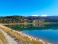
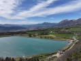
(1) Turn left to head uphill, northwards, then left again and pass under the remains of the Champsaur railway line. The path then veers eastwards and climbs through the woods, without joining the tarmac cycle route. Lovely view of the reservoir. Continue northwards until you reach a junction near the cycle route.

(2) Turn right to join the cycle path and head left through a beech forest, heading east then north-east, until you reach a house at a place called Le Chaumeau.

(3) Go round the back of the house and continue straight ahead along the path which turns eastwards then south-eastwards. After 400 m, you’ll reach a junction by a large pine tree.

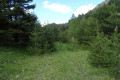
(4) Take the path on the right which leaves the main track. This unmarked path (apart from a few orange mountain-bike markings) descends gently through the beech forest until it reaches the eastern side of the Jaussauds reservoir.

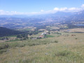
(5) Turn left to go round the reservoir from the south. Enjoy the beautiful panoramic views of the mountain ranges to the south of Gap.
Reach the hamlet via the small Les Jaussauds road and return to the car park where you started (S/E).

Waypoints

  1. S/E : mi 0 - alt. 3,743 ft - Les Jaussauds picnic area - Canal du Drac
  2. 1 : mi 0.25 - alt. 3,753 ft - Réserve Georges Serres
  3. 2 : mi 0.68 - alt. 3,891 ft - Footpath x Cycle route (former railway line)
  4. 3 : mi 0.95 - alt. 3,980 ft - Le Chaumeau
  5. 4 : mi 1.2 - alt. 4,062 ft - Path junction
  6. 5 : mi 1.69 - alt. 3,750 ft - Dike path - Réserve Georges Serres
  7. S/E : mi 2.36 - alt. 3,740 ft - Les Jaussauds picnic area - Canal du Drac

Notes

There is a picnic area in the hamlet of Les Jaussauds, next to the chapel: a drinking fountain, a table and an information board.

The route is mostly shaded and presents no particular difficulties. It follows easy paths and tracks, suitable for most walkers, including children.

Longer alternative route: this circular route can be extended south-westwards from the start. Take the dirt track heading south-west along the cycle route to reach the Buzon Viaduct, then the Peyre Ossel boulder. Then head up to the Manes nature reserve and follow the Gap Canal as far as Les Jaussauds (elevation gain 250 m – total time: 3 hours 15 minutes).

Worth a visit

The Gap Canal (or Drac Canal) draws water from the River Drac in the Haut-Champsaur and carries it to the Gap catchment area, where it is mainly used to supply the town of Gap with drinking water. Each year, around 2,200,000 m³ of water is supplied for human consumption.
Water transfers from the Drac catchment to that of the Durance have a long history and address the water shortage in the Gap catchment. As early as the 15th century, the royal authorities authorised the diversion of certain mountain streams; yet the water needs of the Gap catchment remained critical. It was not until 1863 that Mr Garnier, the department’s MP, stepped in as concessionaire and launched the works, into which he poured his entire fortune. As contractors went bankrupt one after the other, the State (Ministry of Public Works) took over the project in 1873. According to the authorities, the total cost is said to have reached 10,000,000 francs, equivalent to around 2 billion euros. Today, this canal supplies drinking water to more than 40,000 residents and also enables the generation of approximately 8,000,000 kW of electricity per year.

The Georges Serre reservoir, known as ‘des Jaussauds’, is situated in the hamlet of the same name. It is fed by the waters of the Drac (Champsaur) at the exit of the Col de Manse tunnel, at an altitude of around 1,140 metres, on a level stretch of land. The original topography consists of a former marshy basin in morainic terrain, resting on a substratum of black Jurassic marl. It was constructed following four years of studies and a procedure declaring it to be in the public interest ‘on 15 June 1961’. It was first filled with water in 1963.
The structure consists of a compacted earth embankment approximately 450 metres long. Its height at the highest point is around 12 metres. The embankment is of a homogeneous type, with a downstream abutment made of draining materials in the area of greatest height.
This reservoir supplies drinking water to Gap (3,700,000 m³/year) with a reserve capacity of 20 to 30 days, provides irrigation (1,100,000 m³/year) and generates electricity once priority uses have been met (turbine operation at Pont Sarrazin).

The Émile Didier reservoir, known as ‘des Manes’, is familiar to all residents of Gap as it is clearly visible from the N85 on the bends of the Col Bayard. Fed by the Charance Canal, this 150,000 m³ reservoir is intended for the irrigation of an area of 2,246 ha. However, its current operation is deemed inadequate by users, who are often faced with interruptions to the water supply. This is due to the fact that the original project, which envisaged a ‘Les Manes / La Garde’ water link, remains unfinished. Every ten years, the reservoir is drained and inspected by authorised experts.

Notre-Dame des Jaussaud is a small rural chapel situated in the heart of the hamlet, right next to the picnic area.

Other walks in the area

For more walks, use our search engine .

The GPS track and description are the property of this route's author. Please do not copy them without permission.