The tour of the Kerners peninsula

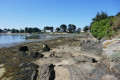
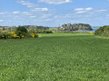
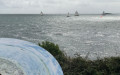
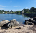
The Gulf of Morbihan is said to have around sixty islands, but let’s not forget it also boasts a multitude of peninsulas. We walked around the Kerners peninsula one morning in June at low tide, and for us it was a chance to immerse ourselves in the very special atmosphere of this inland sea-archipelago, a true distillation of Brittany.

Details

10846702
Creation:
Last update:
Last review:
  • Walking
    Activity: Walking
  • ↔
    Distance: 2.16 mi
  • ◔
    Average duration: 1h 05 
  • ▲
    Difficulty: Easy

  • ⚐
    Back to start: Yes
  • ↗
    Ascent: + 66 ft
  • ↘
    Descent: - 66 ft

  • ▲
    Highest point: 46 ft
  • ▼
    Lowest point: 3 ft

Photos

Description of the walk

Whether you’re in the village of Arzon or Le Crouesty, head towards “Kerners”, then “Port de Kerners” or “Camping de Bilouris”.

Park in the large public car park next to the entrance to the Bilouris campsite. If you’re travelling in a motorhome – as motorhomes aren’t permitted in this car park – you can park about a hundred metres away, at the side of the road just before the car park: during the summer season, make sure you arrive early in the morning.

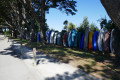
(S/E) Set off along the road leading down to Cale de Bilouris, passing between the campsite on your right and the jumble of small dinghies on your left.
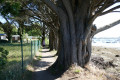
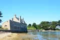
At the beach, take the path that branches off to the left and runs along the shore, mostly a few metres above it, often shaded by very old cypress trees. Watch out for their roots, though.

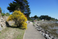
The path crosses Pointe de Kerners, then faces the small island of Hent Tenn, on the opposite bank of a channel about 300 metres wide, and ends at a headland facing west, on a promenade lined with pine and cypress trees.

(1) Beyond this open area, it is possible to walk along the beach, following one branch of the path; the other (not taken) runs through a narrow passage behind some bushes a few metres away, running parallel to the beach.

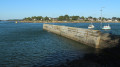
(2) At the far end of the bay, marked by a small breakwater, turn left onto a track suitable for vehicles. It runs alongside the Tindio campsite on the right and joins the road taken to reach the starting car park.

(3) Cross the road and, opposite, turn right onto the Chemin du Ster, which leads into the village of Kerners. Then take the Rue du Racker Ac, then turn right onto the Rue du Pressoir, then left onto the Rue Saint-Nicolas, and finally right onto the Rue des Vierges.

Note: That said, the village of Kerners is very pretty and well worth a stroll through its narrow streets – and, in particular, a visit to its chapel. You are therefore free to choose your own route as you wish. The key to ensuring the route makes sense is to end up at the shore of Anse de Kerners.

(4) Rue des Vierges leads out to the shore. Turn left onto the coastal path, which begins with a stone-paved section, continues along sheet piling and ends at Bilouris via a lovely dirt track
You’ll finally arrive at the Bilouris jetty, after passing the campsite’s sea-view bungalows.
Walk up the lane lined with dinghies and other small boats to reach the car park (S/E).

Waypoints

  1. S/E : mi 0 - alt. 39 ft - Bilouris slipway car park
  2. 1 : mi 0.77 - alt. 13 ft - Promenade beneath the pine trees
  3. 2 : mi 1.14 - alt. 10 ft - A track suitable for vehicles at the far end of the bay
  4. 3 : mi 1.23 - alt. 13 ft - Chemin du Ster
  5. 4 : mi 1.57 - alt. 10 ft - Kerners Cove
  6. S/E : mi 2.16 - alt. 39 ft - Bilouris slipway car park

Notes

We went on this walk in early June 2021.
It’s not at all difficult, and no special equipment is required for this walk, which is really more of a family stroll.

Worth a visit

In my opinion, it’s more interesting to do this walk at low tide; it’s under these conditions that you can best enjoy the atmosphere and the poetry of the place. What’s more, you can then walk along the foreshore and go shellfish gathering.

I have no doubt that every peninsula in the gulf has its own unique characteristics and charm, but I think that once you’ve walked the length of this one, you’ll have a good idea of what the others are like.

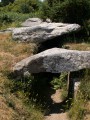
This walk can be done in the morning and combined with another in the afternoon, for example a visit to Tascon Island. You can reach it whilst stopping off to visit the Pen Castel tidal mill, Port Brillac and its dolmen, and many other landscapes of which the Gulf of Morbihan has such an abundance.

Reviews and comments

4.4 / 5
Based on 3 reviews

Reliability of the description
4.7 / 5
Ease of following the route
4.3 / 5
Route interest
4.3 / 5
Ryves68
Ryves68

Overall rating : 5 / 5

Date of your route : Jul 03, 2023
Reliability of the description : ★★★★★ Very good
Ease of following the route : ★★★★★ Very good
Route interest : ★★★★★ Very good
Very busy route : Yes

A lovely walk in the sunshine on 26 June 2023, along a well-maintained path

Machine-translated

brucar
brucar

Overall rating : 4 / 5

Date of your route : Dec 22, 2021
Reliability of the description : ★★★★☆ Good
Ease of following the route : ★★★★☆ Good
Route interest : ★★★★☆ Good
Very busy route : No

A lovely walk, just as planned. Thank you.

Machine-translated

brucar
brucar

Overall rating : 4.3 / 5

Date of your route : Jan 25, 2022
Reliability of the description : ★★★★★ Very good
Ease of following the route : ★★★★☆ Good
Route interest : ★★★★☆ Good
Very busy route : No

Machine-translated

Other walks in the area

For more walks, use our search engine .

The GPS track and description are the property of this route's author. Please do not copy them without permission.