Country:

 City:
City:


Head to URBES (68) between Bussang and Thann. Park in the car park located after the ‘Benelux/Bâle’ campsite along Rue de la Scierie, which begins on the RD 4066 (formerly the RN 66) at the foot of the climb up to the Col de Bussang.
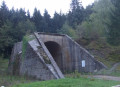
(S/E) Continue along the road (Rue de la Scierie) towards the west and, after the right-hand bend, you’ll reach the viaduct.
(1) Pass under the central arch of the viaduct, which was originally intended to carry a railway line. See “During the walk” §(A).
Before the last house, turn right onto a grassy path, then right again. Low stone walls serve as retaining walls and fences. Note the signposting for the Tunnel Discovery Trail in the opposite direction. Here, too, is an information panel dedicated to this viaduct, with a striking iron sculpture beside it. Walk past the village’s water reservoir.
The path leads onto a small tarmac road that heads towards the hamlet of Brisgau.
(2) Continue straight on, following the Yellow Triangle signposting for about 300 m. Do not go down into the hamlet but turn left onto a dirt track which is actually the old railway line and is not signposted. In a cutting in the rock, pass under a footbridge and turn left immediately to cross over it.
(3) At the end of this, turn left towards “Gustiberg/Drumont”, following the Red Disc markings. The climb consists of a series of tight hairpin bends. The path crosses several forest tracks. At the fourth one, turn left. The welcoming “Paradis Hissel” chalet is signposted 400 m ahead, still following the Red Disc markings. Continue to a Fork in the road, just before the chalet.
(4) Turn right, following the Blue Triangle markings, towards Le Drumont. After about 50 m, do not follow the track but head left up the path that starts on the embankment, right at the start of the area that has been clear-cut, offering a first view of the Markstein and the Grand Ballon. The path, which is often straight, climbs gently.
(5) When you reach a forest track (marked with a Blue Cross), continue straight up a path which widens slightly and veers to the left, leading to the edge of the woods at the boundary of the pastures belonging to the Ferme Auberge de Gustiberg.
(6) Carry on straight ahead, following the Blue Triangle markings, towards the summit of Drumont, leaving the return path on your right. The climb becomes quite steep. Cross a small copse to emerge at the foot of the pastures belonging to the Drumont Farm Inn. One last little effort and you’ll pass beneath the paragliding launch area, where the paragliders skim past the hikers’ ears.
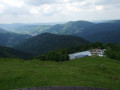
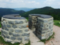
(7) Cross the fence and follow the path uphill towards the orientation table visible at the summit of the Drumont. It offers a 360° view. The signs on the table make it easy to get your bearings. Look out for the Grand Ballon and its ‘ball’, the Thann valley, the Ballon de Servance with its mast, and many other peaks.
(8) After taking in the spectacular views, head down towards the north-east (Blue Rectangle markings) to join theGR®531. On the left, you’ll see the traditional boundary markers of the old border (here, marker 3149), erected after the defeat of 1870. Continue to the Hasenkopf crossroads.
.
(9) At the crossroads, leave theGR®531and turn right to follow thefirst path, marked with a Yellow Disc, which descends through the scree. You’ll soon reach the Lochberg meadow. Pass to the left of the livestock buildings, then turn right to go underneath them. The path widens and you’ll come to the access road to the farm. Continue to the hairpin bend at the far end of the pasture.
(10) Do not follow the signposting which heads left, but take the forest track straight ahead – unmarked and slightly uphill towards the south-east. After a good kilometre, you’ll reach the Gustiberg pasture once more.
(6) Carry on straight ahead along the fence (marked with a Yellow Triangle) and follow the gravelled track to the Gustiberg inn. Walk past the buildings and follow the tarmac road for a few hundred metres until you reach, a little further down, thefirst junction which serves as a car park.
(11) Turn right and follow the road. After a second junction, turn left to follow a path marked with a Yellow Triangle towards Urbes. After a few zigzags, the path joins another road. Turn right, then a little further on turn left to reach the Maison du Haut Mahrel. Don’t count on finding shelter in bad weather – everything is closed.
(12) Before reaching the building, go down the few steps of the stone staircase on the right and head towards the fountain. After a short descent, you’ll come to a lovely road. Turn left. The road becomes tarmacked.
(13) On the left, you’ll see traces of an ancient Roman road. See “During the walk” §(B).
Ignore the first path on the right but carry on until you reach the junction of two lovely roads.
(14) Turn right, passing the site of a former sawmill. See §(C) information board. Some remains of the buildings, including the waterwheel pit, are visible. You will soon come to a bridge which was also intended to carry the railway line.
(15) Climb the embankment on the right to visit the site of the tunnel entrance and the memorial. See §(D). Head back down, pass under the bridge and, at the junction before the left-hand bend, veer slightly to the right then turn left, climbing the steps of the porch of a former camp administrative building.
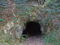
(16) Follow the Red Disc markings, passing in front of the two entrances to the Saint-Antoine mine. See §(E). Continue along the path, which is equipped with wooden footbridges. The path winds its way along the bottom of the main road and leads to the site of a former ore washing plant and then a spinning mill. Cross the stream via a metal footbridge.
(17) Turn left to rejoin the Red Disc-marked path, which, at the edge of the woodland, leads to the access road to the campsite. Simply turn sharply left to reach the car park (S/E).


 Visorando Member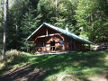
 Average
 Tourist office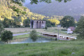
 Easy
Easy