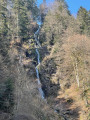
Around the Sée peat bog

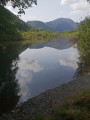
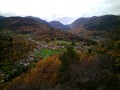
Listen, smell and observe the local flora and fauna. This natural site has played an important role in the lives of the local people and in the local economy.

Details

3031474
Creation:
Last update:
Last review:
  • Walking
    Activity: Walking
  • ↔
    Distance: 1.69 mi
  • ◔
    Average duration: 0h 50 
  • ▲
    Difficulty: Easy

  • ⚐
    Back to start: Yes
  • ↗
    Ascent: + 23 ft
  • ↘
    Descent: - 23 ft

  • ▲
    Highest point: 1,486 ft
  • ▼
    Lowest point: 1,450 ft

Photos

Description of the walk

Start from the See d’Urbès car park.

(S/E) Facing the See d’Urbès welcome sign, head back towards the bridge and the RN66 on your right. Instead of crossing the bridge, take the path leading down to the right. Go through the farm gate and follow the path round the lake (on your left). After a few dozen metres, the path climbs to the right.

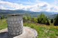
(1) Go through a farm gate and join the road. Follow the road to the left for about a hundred metres. After the viewpoint overlooking the See, continue along the road until you reach a signpost.

(2) Following the signpost, turn left and cross some hay meadows. Turn left after a stream and walk alongside it. Continue along the path to the next junction. Then turn left, keeping the stream on your right. Join the N66 road.

(3) Turn left onto a path running parallel to and below the N66. Continue to a roadside car park and a second welcome sign. After this, the path descends below the road and reaches the Sée. Then turn left to cross the bridge.

From the car park, turn left to reach a bench overlooking the Sée. Retrace your steps and cross the car park again to take the path leading down on the opposite side. Walk to the beautiful structure built over the stream. Retrace your steps to return to the car park (S/E).


Waypoints

  1. S/E : mi 0 - alt. 1,463 ft - See d’Urbès car park
  2. 1 : mi 0.38 - alt. 1,453 ft - Agricultural barrier
  3. 2 : mi 0.81 - alt. 1,467 ft - The trail starts on the left
  4. 3 : mi 1.13 - alt. 1,453 ft - N66 road
  5. S/E : mi 1.69 - alt. 1,463 ft - See d’Urbès car park

Notes

More information and walks on the Hautes Vosges Alsace website
Don’t forget to download the “Balade Hautes Vosges d’Alsace” mobile app from Google Play and the App Store.

Worth a visit

Just a few kilometres away, don’t miss a visit to the 18th-century oil mill in the village of Storckensohn. You can visit the farm labourer’s cottage and watch a demonstration of walnut oil or apple juice production, depending on the season.
Check with the Storckensohn Oil Mill for opening times and admission prices .

Reviews and comments

4.2 / 5
Based on 5 reviews

Reliability of the description
4.2 / 5
Ease of following the route
4.2 / 5
Route interest
4.2 / 5
Magali_J88
Magali_J88

Overall rating : 5 / 5

Date of your route : Jul 05, 2026
Reliability of the description : ★★★★★ Very good
Ease of following the route : ★★★★★ Very good
Route interest : ★★★★★ Very good
Very busy route : No

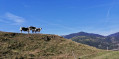
A short, easy walk offering a change of scenery. Watch out for cows roaming freely – they may ‘block’ the path.

Machine-translated

Gby68
Gby68

Overall rating : 4.7 / 5

Date of your route : Feb 01, 2026
Reliability of the description : ★★★★★ Very good
Ease of following the route : ★★★★★ Very good
Route interest : ★★★★☆ Good
Very busy route : No

A place to discover, surrounded by snow-capped mountains in February. It's a bog, so there's a lot of mud at this time of year, but it's a nice little walk. Best to come back in late spring or autumn.

Machine-translated

User 13806771
• Edited:

No interest, except for the very beginning of the hike.
Difficult to find your way, with grass taller than 150 cm and lots of ticks on your clothes.

Machine-translated

rouli68
rouli68

Overall rating : 4.7 / 5

Date of your route : Oct 28, 2024
Reliability of the description : ★★★★★ Very good
Ease of following the route : ★★★★☆ Good
Route interest : ★★★★★ Very good
Very busy route : No

All clear 😉👍👏

Machine-translated

LPOI
LPOI

Overall rating : 4 / 5

Date of your route : Oct 09, 2020
Reliability of the description : ★★★★☆ Good
Ease of following the route : ★★★★☆ Good
Route interest : ★★★★☆ Good
Very busy route : No

It was a bit tricky to find the starting point, which isn’t signposted on the road between Husseren and Urbès.
There is also some confusion at the end of point No. 3, ‘turn left to cross the bridge’; you have to cross private property, even though a sign prohibits it.
A short, informative route, but be careful if it has been raining continuously for several days (which was the case in early October), as part of the route involves walking through a few centimetres of water; make sure you wear waterproof shoes!

Machine-translated

mantello
mantello
• Edited:

Overall rating : 2.7 / 5

Date of your route : May 22, 2020
Reliability of the description : ★★☆☆☆ Disappointing
Ease of following the route : ★★★☆☆ Average
Route interest : ★★★☆☆ Average
Very busy route : No

The route is very poorly signposted. In some places, the path is non-existent; you have to work out where it goes. Not to mention the number of ‘electric fences for cows’ you have to cross. Disappointing – best avoided. The route to the tunnel at Urbès is much more pleasant and no more difficult.

Machine-translated

Other walks in the area

For more walks, use our search engine .

The GPS track and description are the property of this route's author. Please do not copy them without permission.