The Pebble Trail in Tavel

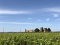
A walk through the landscape of rounded pebbles in the Tavel vineyards.

Details

n°8398478
Creation:
Last update:
Last review:
  • Walking
    Activity: Walking
  • ↔
    Distance: 1.43 mi
  • ◔
    Average duration: 0h 45 
  • ▲
    Difficulty: Easy

  • ⚐
    Back to start: Yes
  • ↗
    Ascent: + 115 ft
  • ↘
    Descent: - 115 ft

  • ▲
    Highest point: 394 ft
  • ▼
    Lowest point: 279 ft
  • ⚐ Country: France
  • ⚐ City: Tavel (30126)
  • ⚑
    Start/End: N 44.010664° / E 4.708716°
  • ❏
    IGN map(s): Ref. 3041OT
  • Hour-by-hour weather

Photos

Description of the walk

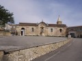
Park in the car park of the cooperative winery on Route de la Commanderie in Tavel.

Follow the yellowPR® signposts along the route.

(S/E) Head north. At the far end of the field, opposite the stadium, turn left.

(1) At the corner by the stadium, go straight on and, at the cross you come to straight away, turn right. Continue straight on for about 500 metres.

(2) Then weave your way to the right between two rows of vines and climb a few steps. After just under a hundred metres, turn left and then immediately right onto a path that runs alongside the vines. After about 150 m, the path turns right and, a hundred metres further on, it turns left. You are now on the Vallongue plateau, home to the pebbly soil that covers the upper terrace of the Rhône – a geological legacy dating back over a million years. You’ll come out onto a small tarmac road; follow it to the right and carry on until you reach the nearby junction.

(3) At the first junction, turn right towards the housing estate. At the T-junction, turn right and head downhill to the stadium. Go round the stadium on the right and return to the junction you took at the start.

(1) Then turn left and then right to reach the car park of the co-operative winery (A/D).

Waypoints

  1. S/E : mi 0 - alt. 279 ft - Cave des Vignerons de Tavel
  2. 1 : mi 0.15 - alt. 292 ft - Crossroads of the circular loop
  3. 2 : mi 0.48 - alt. 322 ft - Junction amongst the vineyards
  4. 3 : mi 0.94 - alt. 384 ft - Junction
  5. S/E : mi 1.43 - alt. 279 ft - Cave des Vignerons de Tavel

Notes

Route created by the winegrowers of Tavel and Lirac, with advice from the FFRandonnée Gard.

Worth a visit

A leaflet for the route is available on site in the shop at the Cave des Vignerons de Tavel&Lirac (Route de la Commanderie, 30126 Tavel)

At the start of the Quaternary period, the River Rhône deposited a vast bed of gravel stretching from Montélimar to La Crau. Of these deluvial deposits, only a few remnants remain, which today provide exceptional wine-growing terroirs. Thus, on this clay soil, a remarkable accumulation of pebbles measuring 10, 20 or even 30 cm in diameter creates an unforgettable landscape. These quartzite pebbles, dislodged from the Alps, were smoothed during their journey and have taken on a russet hue over time.

Always be cautious and plan ahead when you're outdoors. Visorando and the author of this route cannot be held responsible for any accidents occurring on this route.

The GR® and PR® markings are the intellectual property of the Fédération Française de Randonnée Pédestre.

Reviews and comments

5 / 5
Based on 1 review

Reliability of the description
5 / 5
Ease of following the route
5 / 5
Route interest
5 / 5
Laurence.Ody
Laurence.Ody

Overall rating : 5 / 5

Date of your route : Dec 12, 2022
Reliability of the description : ★★★★★ Very good
Ease of following the route : ★★★★★ Very good
Route interest : ★★★★★ Very good
Very busy route : No

The ideal route for returning to activity following an ankle fracture and walking with a splint

Machine-translated

Other walks in the area

For more walks, use our search engine .

The GPS track and description are the property of this route's author. Please do not copy them without permission.