The Gonsans nature trail

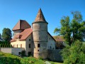
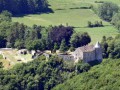
A rural walk through pine forests dotted with clearings where deer leap about, leading you to discover a statue of Our Lady of Lourdes that has found its way into the Comté region, a cave with two-hundred-year-old graffiti, a fortified house and the beautiful church of Gonsans, clad in wooden shingles and featuring fine statuary.

Details

611282
Creation:
Last update:
Last review:
  • Walking
    Activity: Walking
  • ↔
    Distance: 5.48 mi
  • ◔
    Average duration: 2h 55 
  • ▲
    Difficulty: Easy

  • ⚐
    Back to start: Yes
  • ↗
    Ascent: + 479 ft
  • ↘
    Descent: - 463 ft

  • ▲
    Highest point: 1,991 ft
  • ▼
    Lowest point: 1,749 ft

Photos

Description of the walk

Car park at the Maison de la Chasse et de la Nature in Gonsans. Yellow-and-blue signposting is virtually non-existent.

(S/E) Set off along the gravel path heading towards the woods. Take the left-hand path at the first two junctions. At the end of the nature trail, head straight on towards the pastures, which you’ll reach via a small wooden footbridge.

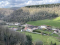
(1) Head towards the large copse in front of you to see the statue of the Virgin of Gonsans and enjoy a view of the plateau. On your right, you’ll see the fortified house of the Jouffroy family. At the statue of the Virgin, head down the left-hand side of the pasture (with your back to the statue), moving towards the fence, which you cross at the cattle gate. The walking trail continues straight ahead, but leave it and turn left onto the departmental road for about forty metres.

(2) Turn right onto the gravel road, which quickly becomes a dirt track. A hundred metres further on, you’ll pass a beautiful, moss-covered sinkhole on your left. Enter it – even though there’s no path – and cross it, staying in the middle. You’ll reach the sharp limestone pavement at a large stone marking the boundary between the upper sharp limestone pavement (on the right) and the lower sharp limestone pavement (on the left). Climb (carefully) up and then back down the sharp limestone pavement at this point, following the upper sharp limestone pavement whilst veering slightly to the right. Caution: crossing the sharp limestone pavement by heading to the left may seem easier but is impossible and dangerous, as it leads you above the cave entrance.

(3) The cave will be on the left, at the bottom of a second sinkhole. It’s a beautiful, large cavity that I could only make out dimly from the threshold, having only my mobile phone’s torch, so I cannot judge whether it is safe to enter. With a proper torch, it is no doubt possible to go down a little further, but do remain vigilant. Turn back to the path and head left.

(4) Caution! You’ll come to a crossroads forming a triangle. Carry on straight ahead at the first fork, walk about ten paces to reach the actual crossroads, and continue straight ahead, keeping a sinkhole on your right.

(5) At the small tarmac road, turn left for about a hundred metres, then right onto a path that is half earth, half stone (signposted ‘Gonsans 34’). When it becomes entirely earth, it forks. Head up the left-hand fork. Cross the main road and take the small tarmac road on the left, at the foot of the ‘Forêt Communale’ sign. The road becomes stony and enters a beautiful fir forest. You then pass through a series of pastures and copses.

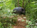
(6) At the edge of another fir forest, turn right onto the dirt track which quickly enters the woods. Head diagonally to the right at the small patch of meadow to rejoin the path through a gap in the trees, then turn right again at the nearby fork. The path may be muddy in wet weather. Cross two small clearings quietly and, like me, you might be surprised to spot two pretty does bounding about. A chorus of birds is guaranteed.

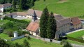
(7) As you emerge from the woods, turn right onto the small gravel road. At the beautiful hunting lodge, head down to the right towards the village. When you reach the first houses, turn right onto the Chemin de la Vie au Château. Opposite the statue of the Virgin Mary, on your right, stands the 16th-century Manoir des Comtes de Jouffroy on its hillock. Continue to the Rue de l’Église, with its wooden shingles, and head up to the right to visit the church (altarpiece and statues).

(8) On leaving the church, walk a short way up the main road to the left, then turn left again immediately at the fork (towards Magny-Châtelard). When the road bends to the right, leave it and enter the pasture via the cattle gate, head up towards the statue of the Virgin Mary, then towards the edge of the woods and the starting point of the trail, which is about a hundred metres to the right of the water tower.

(1) Back at the end of the discovery trail, this time turn left to complete the circular loop. Shortly after the sharp limestone pavement section, at the fork, continue left to return to the car park (S/E).

Waypoints

  1. S/E : mi 0 - alt. 1,867 ft - The House of Hunting and Nature
  2. 1 : mi 0.45 - alt. 1,952 ft - The Virgin of the Mount
  3. 2 : mi 0.89 - alt. 1,877 ft - Behind the Mont
  4. 3 : mi 1.03 - alt. 1,864 ft - Sinkhole and cave
  5. 4 : mi 1.44 - alt. 1,949 ft - A triangular crossroads
  6. 5 : mi 1.81 - alt. 1,896 ft - Les Crettottes
  7. 6 : mi 2.69 - alt. 1,962 ft - Les Prés de Gersier
  8. 7 : mi 3.49 - alt. 1,818 ft - La Combe aux Geais
  9. 8 : mi 4.17 - alt. 1,772 ft - Saint-Maurice Church
  10. S/E : mi 5.48 - alt. 1,867 ft - The House of Hunting and Nature

Worth a visit

  • The discovery trail, comprising 45 markers placed in front of trees, shrubs or animals (represented by life-size silhouettes) and 15 orientation markers hidden in the forest. Investigator’s guide and the website.
  • The Deschamps Cave and its graffiti, some of which dates back to the 18th century. Be sure to bring a torch.
  • The Virgin of the Mount, dating from the interwar period, a time when imitations of the Grotto of Lourdes were common.
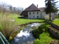
  • The 16th-centuryManor House of the Counts of Jouffroy, built on the site of the former castle.
  • The Church of Saint-Maurice, clad in wooden shingles – wooden tiles used to cover roofs and façades. It houses a 16th-century Flamboyant Gothic altarpiece and polychrome wooden statues, notably Saint Maurice on horseback.

Reviews and comments

3.1 / 5
Based on 7 reviews

Reliability of the description
2.7 / 5
Ease of following the route
3 / 5
Route interest
3.6 / 5
reitop
reitop

Overall rating : 2.3 / 5

Date of your route : Nov 06, 2024
Reliability of the description : ★★☆☆☆ Disappointing
Ease of following the route : ★★☆☆☆ Disappointing
Route interest : ★★★☆☆ Average
Very busy route : No

I’ve never found a cave!

Machine-translated

Cénaf
Cénaf

Overall rating : 2.7 / 5

Date of your route : Nov 18, 2022
Reliability of the description : ★★☆☆☆ Disappointing
Ease of following the route : ★★☆☆☆ Disappointing
Route interest : ★★★★☆ Good
Very busy route : No

I’d read the reviews beforehand and had a feeling it wouldn’t be easy.
That’s putting it mildly! The instructions are confusing and inaccurate. Despite our best efforts and the map, we lost our way at one point.
Shortly afterwards, a friend told me she’d done it with a group, with great difficulty, and had to ask loggers for directions along the way.
It’s a shame – it could have been a lovely walk if it had been explained differently.

Machine-translated

annecornut
annecornut

Overall rating : 2.3 / 5

Date of your route : Mar 03, 2019
Reliability of the description : ★★☆☆☆ Disappointing
Ease of following the route : ★★☆☆☆ Disappointing
Route interest : ★★★☆☆ Average

As we weren’t equipped with GPS devices, we had trouble finding our way right from the start of the walk. In fact, there are a multitude of paths leading off from the House of Hunting and Nature, and I think we went down every single one of them before realising that we should have taken the signposted discovery trail right from the start. Why wasn’t this mentioned in the guidebook, instead of referring to a ‘gravel path’ (they’re all gravel paths and they all lead into woodland!)? As a result, due to a lack of time, we were unable to go any further than La Vierge, where we turned back. It seems it doesn’t get much easier after that either....

Machine-translated

PatMal59
PatMal59

Overall rating : 3.3 / 5

Date of your route : Sep 30, 2018
Reliability of the description : ★★★☆☆ Average
Ease of following the route : ★★★☆☆ Average
Route interest : ★★★★☆ Good

A lovely walk with the children
We couldn’t find point 5 – there were lots of new logging tracks.
Used a map and compass bearing. For point 6
A lovely nature trail – the church was undergoing external renovation with scaffolding
Virgin Mary statue on the hill – very unusual to find this monument in the middle of a field

Machine-translated

meunier.geraldine@wanadoo.fr

Overall rating : 4 / 5

Date of your route : Mar 25, 2018
Reliability of the description : ★★★★☆ Good
Ease of following the route : ★★★★☆ Good
Route interest : ★★★★☆ Good

The start is great, but we got lost too from point 4 onwards. We went downhill when we should have turned right. The map says to go straight on… so we didn’t complete the whole walk. We’ll have to do it again.

Machine-translated

0019024941701
0019024941701

Overall rating : 3.3 / 5

Date of your route : Mar 12, 2018
Reliability of the description : ★★★☆☆ Average
Ease of following the route : ★★★★☆ Good
Route interest : ★★★☆☆ Average

Hello
A lovely walk, but it lacks points of interest
The most interesting viewpoint is at the start of the route, and after that you’re mostly in the woods
It’s nice because there aren’t any leaves on the trees yet
Great in spring

Machine-translated

Elisa25000
Elisa25000

Overall rating : 3.7 / 5

Date of your route : Mar 08, 2018
Reliability of the description : ★★★☆☆ Average
Ease of following the route : ★★★★☆ Good
Route interest : ★★★★☆ Good

Hello
We got lost at point 4 because we veered too far to the left on the descent, but we eventually found point 5 thanks to the map
The instructions to go straight on… aren’t very clear
Perhaps you could provide some guidance? Indicate not to go down
Otherwise, at the cave, turn round to get back onto the road on the left, then follow the signposted path
Kind regards

Machine-translated

Other walks in the area

For more walks, use our search engine .

The GPS track and description are the property of this route's author. Please do not copy them without permission.