The Ravine Blanche Tamarind Grove walking trail

Little known, this route allows you to explore the Ravine Blanche tamarind grove, which features several trails. Accessible to all walkers, this family-friendly trail is very well signposted and well-maintained, winding through the shade of the tamarind trees for almost the entire journey. The restoration of this site and the creation of this route are thanks to the efforts of the Tamar-Haut association.

Details

n°432555
Creation:
Last update:
Last review:
  • Walking
    Activity: Walking
  • ↔
    Distance: 2.90 mi
  • ◔
    Average duration: 1h 50 
  • ▲
    Difficulty: Easy

  • ⚐
    Back to start: Yes
  • ↗
    Ascent: + 535 ft
  • ↘
    Descent: - 525 ft

  • ▲
    Highest point: 4,800 ft
  • ▼
    Lowest point: 4,341 ft

Photos

Description of the walk

Access: From Le Tampon, head towards La Plaine des Palmistes via the N3. Stay on the same road until you reach the village of Le Dix-Neuvième. Pass a petrol station on your left, then take the second turning on the right. At the next two roundabouts, take the first exit. At the end of the road, turn right towards Ravine Blanche. Stay on the same road until you reach the next church, then follow the sign for the ‘fitness trail’ by turning left. Park at the next car park on the left.

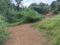
(S/E) An information board is available at the start of the walk, along with toilets. Then follow the footpath which begins to the left of the board. This route is straightforward: simply follow the red markings and the signs for “sentier pédestre”. Looking back, you can see the ocean and part of the southern coastline, whilst to the left you can see the village of La Ravine Blanche and the peak of the same name. It’s a pleasant walk through this forest of highland tamarind trees. A few minutes after setting off, you’ll walk briefly through a eucalyptus forest: this will be the only stretch where you won’t come across any tamarind trees. The path then runs alongside a solar farm before descending gently. As well as tamarind trees, you’ll often come across fanjants here.

(1) After crossing a small ravine, follow the footpath to the right. Then cross a picnic area, passing a few sports facilities.

(2) At the road, turn left, then rejoin the footpath on the right a few metres further on. This marks the start of the second part of the route, which will be even more overgrown. This section will, however, be a little longer.

(3) At the second road, turn right, then rejoin the footpath on the left immediately afterwards. You’ll cross several small ravines, but you’ll never leave the tamarind grove.

(4) At the third road, turn left, then rejoin the path on the right.

(5) Walk up a gentle slope before reaching a fourth track. Take the path that continues straight ahead and crosses a picnic area. You will then return to the junction you encountered on the lane. After crossing the ravine again, follow the footpath by turning left. Within a few minutes, you will reach the majestic tamarind trees at the starting point (S/E)


Waypoints

  1. S/E : mi 0 - alt. 4,583 ft - Car park
  2. 1 : mi 0.98 - alt. 4,646 ft - Junction with the return path, ravine
  3. 2 : mi 1.05 - alt. 4,613 ft - On the left, by the road
  4. 3 : mi 1.25 - alt. 4,508 ft - On the right, at the second road
  5. 4 : mi 1.85 - alt. 4,442 ft - On the left, at the third road
  6. 5 : mi 2.26 - alt. 4,610 ft - Continue straight ahead
  7. S/E : mi 2.9 - alt. 4,583 ft - Car park

Notes

This trail is suitable for all walkers and presents no difficulty.
A kiosk and picnic area are available shortly after (1).
Toilets are available at the starting point (S/E).

Worth a visit

See the Tamarinaie de la Ravine Blanche.

Reviews and comments

4.5 / 5
Based on 2 reviews

Reliability of the description
5 / 5
Ease of following the route
4 / 5
Route interest
4.5 / 5
Bruno 974
Bruno 974

Overall rating : 5 / 5

Date of your route : Oct 30, 2026
Reliability of the description : ★★★★★ Very good
Ease of following the route : ★★★★★ Very good
Route interest : ★★★★★ Very good
Very busy route : No

A truly magnificent route. Ideal for beginners. The forest is brilliant.

Machine-translated

JJLESTRADE
JJLESTRADE

Overall rating : 4 / 5

Date of your route : Dec 19, 2024
Reliability of the description : ★★★★★ Very good
Ease of following the route : ★★★☆☆ Average
Route interest : ★★★★☆ Good
Very busy route : No

Very easy walk
Several routes
We took the footpath
Except for the section on the other side of the road, where we preferred to take the botanical trail
Very pleasant, even if the signposting is a bit worn

Machine-translated

Other walks in the area

For more walks, use our search engine .

The GPS track and description are the property of this route's author. Please do not copy them without permission.