Country:
 City:
City:


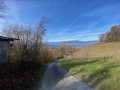

The route starts and finishes at the Place de la Gare in Estavayer-le-Lac.
(S/E) Walk down Avenue de la Gare for 50 metres, then turn immediately right, following the yellow signposts for walking trails. Continue along Route de la Gare until you reach a small detour, passing under an arch marked ‘Sentier des Dominicaines’; it’s worth taking a look at the monastery, which is about a hundred metres away.
(1) Then return to Rue de la Gare, head right for 50 metres, then turn left onto Route du Port until you reach a junction.
(2) Turn left onto Rue des Thiolleyres, walk past the football pitches and carry on straight ahead along Route des Lacustres, with Lake Neuchâtel on your right.
(3) Pass by the Pierre du Mariage (erratic boulder) and continue along the path that runs alongside the reed bed. After a lookout point, the path turns left and passes under the railway line.
(4) You’ll soon reach a fork in the path. Ignore the path on the left that leads up to the church and carry on straight ahead through the woods until you reach a level crossing at the entrance to the village of Cheyres.
(5) Turn onto the road leading uphill to the left, into the hamlet of Le Moulin. At the county road, follow it to the left for about a hundred metres, then cross it carefully to take the Chemin des Crotes, which runs alongside steep vineyards. After a fairly steep climb, take a path branching off to the right, just before the hamlet of Béthanie.
(6) Follow this path as it continues to climb through the forest until you reach the exit.
(7) Walk past a car park and turn left, until you reach a clearing where a welcome bench allows you to catch your breath after the climb.
(8) Turn left onto Chemin de Bonnefontaine until you reach Rue du Four.
(9) Follow it to the left to pass through the pretty village of Châbles.
(10) On leaving the village, turn right at the Fork in the road and follow the Chemin de la Condémine. Ignore the first path leading down to the left and take the second path, which descends through the woods, crosses a stream and climbs back up to the village of Châtillon.
(11) At the crossroads, head right for 70 m and take the Chemin de la Vuardaz, which descends to the left. After a bend to the left, turn onto the first path on the right, which leads back through the fields towards Estavayer-le-Lac.
(12) Pass under the main road and, after 150 m, turn left onto the Chemin des Crêtes and head towards the station on the right (S/E).

 Visorando Member
 Easy
Easy 
 Difficult