


Refine your search for walks in Le Salat
Le Salat walks


 The Aubert Waterfall from Saint-Girons
 Visorando Member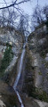
 6.83 mi
 +1,394 ft
 -1,401 ft
 4h 20
4h 20
 Moderate
 Departure from Saint-Girons (Ariège)
A circular from the centre to the Aubert Waterfall via Cap de la Bouiche. Beautiful view of Saint-Girons and the heights above Moulis.
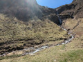
Léziou and Bégé waterfalls
 4.39 mi
+958 ft
-958 ft
2h 50
4.39 mi
+958 ft
-958 ft
2h 50
 Easy
Departure from Couflens (Ariège)
Easy
Departure from Couflens (Ariège)
A pleasant walk with no difficult sections or steep slopes. It follows a track suitable for vehicles (GR® T57) and offers views of two magnificent waterfalls as it runs alongside a stream in the first section.
Le Cos and the banks of the Salat
 5.39 mi
+1,693 ft
-1,683 ft
3h 55
Moderate
Departure from Seix (Ariège)
5.39 mi
+1,693 ft
-1,683 ft
3h 55
Moderate
Departure from Seix (Ariège)
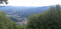
A steady climb to the summit of Cos with two beautiful viewpoints, the Salat valley and the Garbet valley and the Vallier massif on the other side, and a return to the banks of the Salat River with its turbulent, turquoise-blue waters.
On the hillsides of Soueix
 3.37 mi
+577 ft
-597 ft
2h 05
Easy
Departure from Soueix-Rogalle (Ariège)
3.37 mi
+577 ft
-597 ft
2h 05
Easy
Departure from Soueix-Rogalle (Ariège)
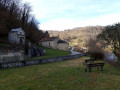
Walk through the hillsides of the village of Soueix with panoramic views of Le Vallier, the Col d'Ayens and Mirabat Castle. Architectural highlights include the churches of Saint-Sernin and Vic d'Oust, and the railway bridge.
Trémau sinkhole, starting from Saint-Girons
 6.96 mi
+1,138 ft
-1,138 ft
4h 10
Moderate
Departure from Saint-Girons (Ariège)
6.96 mi
+1,138 ft
-1,138 ft
4h 10
Moderate
Departure from Saint-Girons (Ariège)
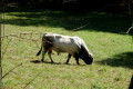
This mostly shaded walk offers varied views of the valleys and hills at the foot of the Sourroque massif, with a wild feel in places, all close to Saint-Girons.
The Cirque d'Anglade and the Saubé Hut
6.48 mi
+3,238 ft
-3,225 ft
5h 50
 Difficult
Departure from Couflens (Ariège)
Difficult
Departure from Couflens (Ariège)
This hike offers a variety of landscapes, with woods giving way to mountain pastures as you climb higher, and the beautiful Cirque d'Anglade site to discover.Visorando app recommended.
Walks near Le Salat
Refuge du Pinet - Montcalm/Estats/Verdaguer Peaks - Refuge Vallferrera
7.84 mi
+3,786 ft
-4,790 ft
6h 55
 Very difficult
Departure from Auzat (Ariège)
Very difficult
Departure from Auzat (Ariège)
The second day is a high-mountain stage passing through the highest point of this itinerary: Pic d'Estats, as well as two other peaks over 3,000 m nearby, Pic du Montcalm and Pic de Verdaguer. The route is largely over scree and rocky terrain, which will greatly appeal to mineral enthusiasts. The trail largely follows the Porta del Cel hike and the GR®T61. Although not particularly technical, this stage should not be taken lightly due to its altitude (three peaks over 3,000 metres), its length, its elevation gain and its trails composed of loose stones that can make progress difficult.
Bassiès-Port de Lers mountain hut via the Étang d’Alate and Mont Ceint
 3.97 mi
+1,883 ft
-2,313 ft
3h 30
Difficult
Departure from Auzat (Ariège)
3.97 mi
+1,883 ft
-2,313 ft
3h 30
Difficult
Departure from Auzat (Ariège)
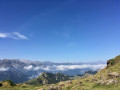
Before heading back, there is the option of a return trip to the Étang de Bassiès from the refuge, leaving some of your luggage at the refuge.A fairly short second stage, with two steep ascents (19% to 38%): one from the Refuge de Bassiès to the Port de Bassiès, and the even more challenging one from the Port de Saleix to the Pic de Girantès or Mont Ceint. In fact, it is a rather gruelling, up-and-down stage, classified as difficult. The ascents and descents are on challenging trails (pebbles, rocks, scree). The whole day is spent in open country with stunning panoramic views. The route passes the beautiful Étang d’Alate.The relative altitude, between 1,520 m and 2,100 m, means this day’s walk is feasible even in the height of summer.