Country:
 City:
City:


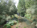
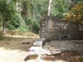
(S/E) Set off from Plaza Castilla. Follow the Paseo de la Audiencia, which runs along the right bank of the River Arlanzón. After 250 metres, you’ll come to the Tribunal Superior de Justicia Fiscal and the Audiencia Provincial. Turn right onto the footbridge crossing the river.
On the other side, follow the quays (Calle de la Merced, Calle de Valladolid, Paseo Sierra de Atapuerca) for just under 2 km. You will then find yourself facing a four-lane road bridge spanning the River Arlanzón.
(1) Head towards the riverbank to pass under the bridge. As you emerge, turn right onto a path that leads away from the river and joins a tarmac road at the end of a roundabout. Turn left to follow the tarmac path alongside this road.
(2) After one kilometre, the track and the road emerge from the trees; the road splits into two branches: a dirt track to the left and a cycle path to the right. Continue to the right along the tarmac track which runs alongside the cycle path. Both lead to a roundabout.
(3) Cross the road (following the line of the track you are leaving) and, immediately afterwards, turn left onto a track which climbs and then loops back after about fifty metres (a sign points towards Fuentes Blancas).
The track runs alongside a road. Follow it for 500 metres: for the last 200 metres, the track runs alongside a wall.
(4) Cross the road opposite a green gate set into the wall. Follow the wall and turn right 60 metres further on to take a tarmac track that climbs. It begins with red and white barriers, and a plaque on the wall indicates that this is the Camino de la Paz. The Miraflores Charterhouse is at the end of this track.
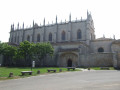
(5) As you leave the Chartreuse, take the other road that leads to it. Between this road and the Chartreuse church, there is a lawn. At the end of this lawn, turn right onto a path between the lawn and a pine forest. The path follows a wall before veering away from it and heading downhill.
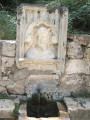
(6) About 500 metres past the Charterhouse, in a hollow, a path branches off to the left and heads downhill. You can see that it joins a fairly wide dirt track. Take this path. When you reach the wide track, which serves as a car park, you will see a fountain on your left. Continue along the wide track, then cross the road.
(7) Ahead of you is the Fuente del Castaño. Take a path to its left; the first few metres are marked by posts, the tops of which are painted white and red. 200 metres further on, you’ll come to a bridge. Cross the River Arlanzón, then, immediately afterwards, take the dirt track on the left that runs alongside the river. Follow this path, ignoring several paths on your right. Continue along the river, even if the path veers away from it from time to time.
(8) When you reach the Bulevar del Ferrocarril, turn left and follow the cycle path that passes under the bridge. Take the grassy bank rather than the pavement on Avenida del Arlanzón.
As you follow the river, you’ll pass under several footbridges and road bridges.
(9) Between the second and third road bridges, cross a tributary, the Rio Vena, which flows into the Rio Arlanzón. The next bridge is adorned with several statues. Pass under this bridge, then turn right onto a path that leads back to street level.
(10) Turn left to follow the Paseo Marceliano Santamaria.
(11) Walk past the Arco de Santa María and follow the Paseo de la Audiencia until you reach Plaza Castilla (S/E).
 Visorando Member

 Difficult