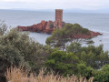
The Rastel d'Agay from Agay beach

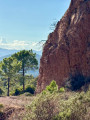
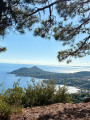
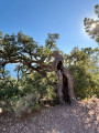
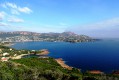
Ascent to the Rastel d'Agay, a superb viewpoint over the Mediterranean and the entire Estérel massif.

Details

70331801
Creation:
Last update:
Last review:
  • Walking
    Activity: Walking
  • ↔
    Distance: 3.36 mi
  • ◔
    Average duration: 2h 20 
  • ▲
    Difficulty: Easy

  • ⚐
    Back to start: Yes
  • ↗
    Ascent: + 932 ft
  • ↘
    Descent: - 932 ft

  • ▲
    Highest point: 942 ft
  • ▼
    Lowest point: 7 ft

Photos

Description of the walk

Park near the Agay water sports centre. It is also possible to come by bus or train.

(S/E) Walk between the two buildings opposite the water sports centre. Turn left onto Avenue des Pléiades and keep right at the junction.

(1) Go up the cul-de-sac on the right, go under the railway line and climb the stairs. Go straight on at the roundabout.

(2) Walk up Impasse des Bruyères and then take the stairs at the end of the cul-de-sac.

(3) Turn left onto Avenue du Bourg and follow it, ignoring the side streets. 

(4) Take the path on the right after the last houses and join a dirt track. 

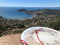
(5) Turn right and follow this track to the orientation table. 

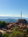
(6) Take the middle path which runs along the ridge and leads you to the highest point marked by a metal flag: superb views from the Rastel d'Agay.

(7) From the summit, head back down the same route to the car park (S/E). 

Waypoints

  1. S/E : mi 0 - alt. 10 ft - Car park on Boulevard de la Plage.
  2. 1 : mi 0.08 - alt. 20 ft - Junction
  3. 2 : mi 0.34 - alt. 171 ft - Crossroads
  4. 3 : mi 0.46 - alt. 302 ft - Avenue du Bourg - Staircase
  5. 4 : mi 0.72 - alt. 371 ft - Crossroads: road and path
  6. 5 : mi 0.86 - alt. 463 ft - Junction. Track - Path
  7. 6 : mi 1.5 - alt. 866 ft - Junction. Return to the summit.
  8. 7 : mi 1.68 - alt. 942 ft - Summit. Rastel d'Agay
  9. S/E : mi 3.36 - alt. 10 ft - Car park on Boulevard de la Plage.

Notes

No water sources or shelters. Make sure you are well-equipped, especially in summer.

Reviews and comments

4.9 / 5
Based on 4 reviews

Reliability of the description
4.8 / 5
Ease of following the route
5 / 5
Route interest
5 / 5
filochard_06
filochard_06

Overall rating : 4.7 / 5

Date of your route : May 12, 2026
Reliability of the description : ★★★★☆ Good
Ease of following the route : ★★★★★ Very good
Route interest : ★★★★★ Very good
Very busy route : No

An easy walk with no difficulty at all. Very pleasant. Stunning views over Agay Bay. Follow it up with a picnic on the beach and a quick dip!

Machine-translated

tebon
tebon

Overall rating : 5 / 5

Date of your route : Feb 09, 2026
Reliability of the description : ★★★★★ Very good
Ease of following the route : ★★★★★ Very good
Route interest : ★★★★★ Very good
Very busy route : No

A lovely walk above Agay. The urban section is not unpleasant. It ends with a ridge path that is easy to follow. There is a somewhat steep staircase to cross a escarpment.

Machine-translated

User 23590065

Overall rating : 5 / 5

Date of your route : Jul 10, 2025
Reliability of the description : ★★★★★ Very good
Ease of following the route : ★★★★★ Very good
Route interest : ★★★★★ Very good
Very busy route : No

A beautiful hike with magnificent views
A nice climb that's well worth the effort
There weren't many people because it was very hot

Machine-translated

pincemaille
pincemaille

Overall rating : 5 / 5

Date of your route : Apr 11, 2025
Reliability of the description : ★★★★★ Very good
Ease of following the route : ★★★★★ Very good
Route interest : ★★★★★ Very good
Very busy route : Yes

An easy, short walk lasting 2–2½ hours. Flowering scrubland, plenty of rockroses, and magnificent views from the ridge. An urban feel at the start, followed by beautiful countryside. Very pleasant.

Machine-translated

Other walks in the area

For more walks, use our search engine .

The GPS track and description are the property of this route's author. Please do not copy them without permission.