The Sarrasins Bridge via the Lachat barns

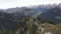
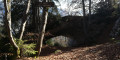
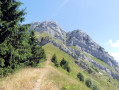
A lovely climb up to the Lachat barns, followed by a ridge walk where, at the end of the path, you’ll discover a beautiful natural arch known as the ‘Pont des Sarrasins’.

Details

n°41760651
Creation:
Last update:
Last review:
  • Walking
    Activity: Walking
  • ↔
    Distance: 6.07 mi
  • ◔
    Average duration: 5h 05 
  • ▲
    Difficulty: Difficult

  • ⚐
    Back to start: Yes
  • ↗
    Ascent: + 2,615 ft
  • ↘
    Descent: - 2,582 ft

  • ▲
    Highest point: 4,810 ft
  • ▼
    Lowest point: 2,851 ft

Photos

Description of the walk

Coming from Thônes, on leaving the village of Les Villards, take the Mont Lachat road. Park at the junction for Praz Cornet (Deux Nants stream car park).

(S/E) At the hiking sign, continue for a few metres along the Praz Cornet road, then cross a meadow on the left, climbing steeply until you reach a track suitable for vehicles. Take the track straight ahead.

(1) Leave the path leading up to Mont Lachat on your right. Turn left and then leave the track, passing under a chalet and following the sign for “Balcon des Fours”. Continue straight on until you reach the Chalet des Millières.

(2) Go round to the right, then over and round this chalet, following the signposts. You’ll come to a junction at Les Fours, marked by a signpost.

(3) Head straight on towards Les Fours Dessus. The path passes beneath the first chalet, then climbs steeply, going to the right of the next chalets before entering the forest. Continue along this path to reach the Frasse junction.

(4) Take the path on the right which leads to Les Granges du Lachat.

(5) At the first chalet, turn left and walk all the way round the building to start the ridge path: if you end up at the toilet block, you’ve gone the wrong way. Follow this track as best you can as it winds along the ridge. See Practical Information.

(6) Ignore the path branching off to the left – you’ll use that on the way back – and continue downhill along the ridge. At the end of the route, the path branches off to the left towards the Pont des Sarrasins (signposted).

(7) Retrace your steps for about 1 km.

(6) Look out for a small rock marked with two green arrows and turn right towards a tree with a signpost. The path descends steeply for 500 m, then more gently, and joins the path leading from La Frasse to La Combe Banon.

(8) Turn left to return to the La Frasse junction, which you passed on the way there.

(4) Turn right and then head for the junction at Les Fours, which you also passed on the way there.

(3) At the signpost, turn left towards La Côte and Le Mont.

(9) Cross a footbridge and take the path on the left. Walk past the Chalets de la Côte; the path continues to climb, then becomes a balcony path leading to the Chalets du Mont.

(10) Turn right to begin the descent.

(11) Ignore the path on the left heading towards Praz Cornet and keep to the right to reach the initial junction of the circular route.

(1) Turn left and, heading in the opposite direction to the way out, make your way back to the Deux Nants car park (S/E).

Waypoints

  1. S/E : mi 0 - alt. 2,851 ft - Les Deux Nants car park
  2. 1 : mi 0.14 - alt. 3,005 ft - Junction of the circular loop
  3. 2 : mi 0.77 - alt. 3,448 ft - “Les Millières” chalet
  4. 3 : mi 1.09 - alt. 3,743 ft - Junction 2 of the circular loop
  5. 4 : mi 1.71 - alt. 4,383 ft - La Frasse. Crossroads, 3rd circular loop
  6. 5 : mi 1.94 - alt. 4,810 ft - Granges du Lachat
  7. 6 : mi 2.33 - alt. 4,721 ft - Junction: Return via the Sarrasins Bridge
  8. 7 : mi 2.93 - alt. 4,557 ft - Pont des Sarasins (Thônes)
  9. 8 : mi 3.71 - alt. 4,423 ft - Crossroads, turn left
  10. 9 : mi 4.51 - alt. 3,740 ft - Chalets de la Côte
  11. 10 : mi 5.32 - alt. 4,150 ft - The Mount
  12. 11 : mi 5.78 - alt. 3,264 ft - Junction for Praz Cornet, on the right
  13. S/E : mi 6.07 - alt. 2,854 ft - Les Deux Nants car park

Notes

This route is clearly marked for the section from the car park to La Frasse and Les Granges du Lachat.
However, the ridge route is very tricky. There are still traces of faded red, yellow and green markings. It is easy to lose your way; if this happens, try to follow the ridge as best you can, as the end is slightly better marked with green markings.
(6) On the return journey, it is important to spot the small rock with an arrow marking the direction of the descent.
This descent path is very steep at the start, so please take care.
If necessary, head back to the barns and retrace your steps.

Worth a visit

(5) For the more adventurous, at Les Granges du Lachat, you can make a round trip up to the viewpoint.

Reviews and comments

4.7 / 5
Based on 1 review

Reliability of the description
5 / 5
Ease of following the route
5 / 5
Route interest
4 / 5
natachacharles
natachacharles

Overall rating : 4.7 / 5

Date of your route : Aug 30, 2026
Reliability of the description : ★★★★★ Very good
Ease of following the route : ★★★★★ Very good
Route interest : ★★★★☆ Good
Very busy route : No

The start of the walk is quite steep, and in full sun. I’d therefore recommend setting off early to avoid the heat. The rest of the walk is mostly through the forest and so pleasant despite the sun. The first stop at the Granges du Lachat offers a lovely view, but it’s just as well to carry on to the end of the path to take in the full panorama at the Chalet du Lachat. The route to the Pont des Sarrasins isn’t always visible, but if you follow the ridge, you’ll find it easily. On the way back, the descent is long and steep, and the final circular route (9–10–11) involves a proper climb back up before descending again to the car park. It’s tough at the end of the walk and doesn’t really add much apart from a lovely view. On that particular day, this section was difficult due to numerous trees blocking the path. In total, our GPS devices recorded 900 metres of elevation gain over 12 km.

Machine-translated

Other walks in the area

For more walks, use our search engine .

The GPS track and description are the property of this route's author. Please do not copy them without permission.