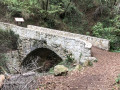
The Moon Bridge at Carros

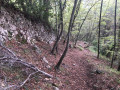
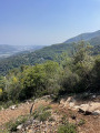
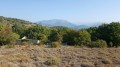
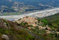
A short walk through a dense forest with a variety of tree species. A descent along a beautiful path, often paved, and from the stone Pont de la Lune, the return climb is dotted with information boards about the local flora and fauna. This short walk is best combined with a free visit to Carros Castle.

Details

42039744
Creation:
Last update:
Last review:
  • Walking
    Activity: Walking
  • ↔
    Distance: 1.89 mi
  • ◔
    Average duration: 1h 30 
  • ▲
    Difficulty: Easy

  • ⚐
    Back to start: Yes
  • ↗
    Ascent: + 758 ft
  • ↘
    Descent: - 758 ft

  • ▲
    Highest point: 1,296 ft
  • ▼
    Lowest point: 581 ft
  • ⚐ Country: France
  • ⚐
    Area: Alps
  • ⚐ City: Carros (06510)
  • ⚑
    Start/End: N 43.792438° / E 7.185679°
  • ❏
    IGN map(s): Ref. 3642ET, 3742OT
  • Hour-by-hour weather

Photos

Description of the walk

Park at the entrance to the village.

(S/E) Take the Chemin de l'Ubac, which is a tarmac road, and head towards the Placo dou Pue (which is a square)
Watch out for vehicles; you will be walking along several tarmac sections

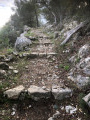
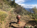
(1) At Marker 42, take a moment to look at the orientation table located behind the stone tower. Then return to Marker 42 and follow the sign for "Pont de la Lune". Follow the beautiful descending forest path that runs alongside the terraces and head to Marker 50.

Yellow markings

(2) Turn right, follow the signs for “Pont de la Lune” and, at the next crossroads, turn right to reach the Pont de la Lune. It’s worth stopping to look at the ruins of a mill. The path climbs back up to marker 45, dotted with information boards.

(3) At the junction of the path and a tarmac road, turn right; marker 44 is located about a hundred metres further on. Continue towards the village of Carros.

Unmarked

(4) Leave the tarmac road and turn right, just before a large ochre-coloured wall. Follow the paved slanting street, then continue along the uphill road leading to the village.

(5) At the junction with Chemin de l’Ubac, turn left and continue for about 50 metres.
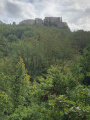
Turn left onto the access ramp to the village, known as the Mountado dou distilado, follow it and turn onto the Escalie dou casteu steps, heading towards the castle (le casteu) of Carros, which is the International Centre for Contemporary Art. Once your visit is over, go round to the back of the castle and take the descending staircase, which leads to the Chemin de l'Ubac, taking you back to the car park (S/E).

Waypoints

  1. S/E : mi 0 - alt. 1,194 ft - Car park or entrance to the village of Carros-le-Vieux
  2. 1 : mi 0.18 - alt. 1,201 ft - Placo dou Pue (marker 42)
  3. 2 : mi 0.87 - alt. 600 ft - Trail junction, marker 50
  4. 3 : mi 1.26 - alt. 856 ft - Trail junction, marker 45
  5. 4 : mi 1.35 - alt. 938 ft - Crossroads: tarmac road – footpath
  6. 5 : mi 1.58 - alt. 1,201 ft - Junction
  7. S/E : mi 1.89 - alt. 1,194 ft - Car park or entrance to the village of Carros-le-Vieux

Notes

Walking sticks are always useful.
Avoid rainy days, as the ground can be slippery.
No water on the course.

Worth a visit

Visit the 12th-century Château de Carros, which is free to enter.
See opening times on the website
The entrance to the 11th-century church is located at the castle entrance.

Reviews and comments

4.5 / 5
Based on 5 reviews

Reliability of the description
4.8 / 5
Ease of following the route
4.6 / 5
Route interest
4.2 / 5
bernard bb
bernard bb

Thank you, RandoPhil56 720, for this review
It really is a nice little educational hike.
Best regards, rando, b

Machine-translated

RandoPhil56 720
RandoPhil56 720

Overall rating : 4 / 5

Date of your route : Nov 03, 2025
Reliability of the description : ★★★★☆ Good
Ease of following the route : ★★★★☆ Good
Route interest : ★★★★☆ Good
Very busy route : No

Short, easy hike. A few climbs, but nothing insurmountable. Interesting educational signs.
Worth doing again.

Machine-translated

bernard bb
bernard bb

Thank you, danielaime06, for this review,
and this important health update
Looking forward to meeting up
Hiking regards, b.

Machine-translated

danielaime06
danielaime06

Overall rating : 4.7 / 5

Date of your route : Apr 29, 2025
Reliability of the description : ★★★★★ Very good
Ease of following the route : ★★★★☆ Good
Route interest : ★★★★★ Very good
Very busy route : No

A short, perfect route for getting back into shape or when you’re short on time, even in summer thanks to the wooded sections.
The information boards along the route are interesting, and the whole trail has recently been cleared of undergrowth.
Note that walking poles are indeed useful for negotiating the descent on a few sections.
Also worth noting is that in the castle museum – apart from some curious works of art – there is drinking water and toilets (closed on Mondays and public holidays).
In short, thank you Bernard for this delightful discovery so close to the built-up areas of the hills of the Nice hinterland!

Machine-translated

bernard bb
bernard bb

Hello Mykkelman
Thank you for your review; it really is a lovely little walk
Best wishes for your walks, b.

Machine-translated

mykkelman
mykkelman

Overall rating : 4.7 / 5

Date of your route : Mar 17, 2025
Reliability of the description : ★★★★★ Very good
Ease of following the route : ★★★★★ Very good
Route interest : ★★★★☆ Good
Very busy route : No

A lovely little walk on a sunny day following rain. Waterfalls and streams all along the path. This means there are a few tricky sections. The Moon Bridge is right at the bottom; it isn’t signposted, even though there are plenty of information boards about flora and fauna all along the route. The final stretch of the return route is a bit hidden from the road. It looks like a rainwater drainage channel. Be sure to follow the directions on Visorando.

Machine-translated

bernard bb
bernard bb

Thanks, Fralai, for this review
It really is a short hike
that requires a bit of effort on the way back
Hiking friend, b.

Machine-translated

Fralai
Fralai

Overall rating : 4.3 / 5

Date of your route : Sep 16, 2024
Reliability of the description : ★★★★★ Very good
Ease of following the route : ★★★★★ Very good
Route interest : ★★★☆☆ Average
Very busy route : No

A short, steep walk.

Machine-translated

bernard bb
bernard bb

:-)

Machine-translated

Noursette1956
Noursette1956

Thanks for your reply. Oh dear, so we did miss the turn-off after all... what a shame... Anyway, yes, the walk was lovely, easy and really enjoyable.

Machine-translated

bernard bb
bernard bb

Hello Noursette,
You did indeed miss a turn-off,
but the most important thing is the enjoyment you had in completing
this lovely little circular loop :-)
Hiking regards, b.

Machine-translated

Noursette1956
Noursette1956

Overall rating : 5 / 5

Date of your route : Apr 12, 2023
Reliability of the description : ★★★★★ Very good
Ease of following the route : ★★★★★ Very good
Route interest : ★★★★★ Very good
Very busy route : No

A lovely walk through the woods to reach the Moon Bridge. A lovely find. An easy walk with clear signposting. However, towards the end of the walk, we couldn’t find the path mentioned – it looked as though the path had been closed off to make way for a private property? Did we miss something? As a result, we had to finish up on the road where there was a lot of traffic, which was less pleasant after such a lovely walk

Machine-translated

Other walks in the area

For more walks, use our search engine .

The GPS track and description are the property of this route's author. Please do not copy them without permission.