Country:
 City:


On the D9, take the Les Pinchinades exit – exit 10 if coming from Aix-en-Provence or exit 11 if coming from Vitrolles. Head towards the Les Collets Rouges equestrian centre. Park in the Magenta car park to the left of the equestrian centre.
(S/E) Set off along the path that runs alongside the road to the right, heading south-east. Continue to thesecond junction of paths.
(1) Turn right, heading west. You’ll reach the edge of the valley, then cross a large area devoid of vegetation.
(2) Turn right and head down into the valley. Keep to the right to cross the valley floor and climb up the other side. You’ll reach a T-junction.
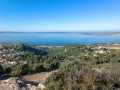
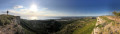
(3) Turn left and keep to the left to follow this path as it climbs up the Vallon de Rouard. Pass two ruins in succession. After a stony climb, you’ll reach the edge of the Vitrolles cliffs and a viewpoint. Take in the view.
(4) Head north along the narrow path that runs closest to the cliffs. Then pass to the left of a large water reservoir and, further on, walk alongside the limestone quarry.
(5) Carry on to the left at the end of the quarry and head towards the car park next to the speed camera.
(6) Cross the road, head towards the speed camera, then turn right, following the wire fence to rejoin a path along the cliffs, heading north-east. Go round an aerial on the right and rejoin the path that runs closest to the cliffs. Pass by the ruins of the Chappe telegraph station. You’ll reach a junction of several paths with a map of the Vitrolles Plateau.
(7) Turn left, heading north, then take thefirst path on the left which leads to the edge of the cliffs. After a right-hand bend, you’ll reach the large car park at the Rognac Communal Forest. Continue straight on. You’ll arrive near the Jas d’Arbaud.
(8) Cut left and, a little further on, rejoin the track heading due north. Walk for about 500 m until you reach the start of a path on the right.
(9) Turn right onto the path, which climbs slightly. After a left-hand bend, the path levels out and then becomes a narrow track that climbs steeply to the right towards a watchtower. Behind the watchtower, continue northwards along the track that runs alongside the cliffs. Keep to the left.
(10) Cut across to the right into the open area, which leads to a junction of tracks. Turn right onto the track that runs alongside the gas pipes (yellow posts). You’ll arrive at car park no. 12 for the Aix hunters.
(11) Turn right at the barrier and follow the track across the Grand Arbois Plateau. Ignore the paths branching off to the left and right.
(12) When you reach the wider track, turn left and head for a four-way junction.
(13) Turn right towards the large water reservoir. Pass it on the left and join a track; take this track to the left, heading south. You’ll come to a sign for the Aix-en-Provence Municipal Forest – Grand Arbois and a map of the Plateau de Vitrolles.
(14) Turn left towards the signposts. Keep to the right at a Y-junction, then right again at another Y-junction. The path then narrows, leading down a steep, slippery slope which joins a track further down. Continue left along the track, pass underground cistern no. 78 and carry on straight ahead, heading south-east then south. The ground turns ochre. Walk past some beehives.
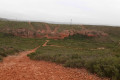
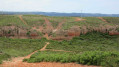
(15) Turn left and follow the track, with the red ochre hills on your left and a large cultivated field on your right.
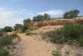
(16) Leave the track to the left to get closer to the hills and admire this magnificent colour at closer quarters.
(17) Return to the track and continue to the left. Along the way, you’ll see the remains of trees burnt in a massive fire in 2016.
(18) Turn left again to join, halfway up the hillside, a path used by the horses from the riding centre. You’ll come across handmade jumping obstacles.
(19) Join the main track, which, after a right-hand bend, leads to the riding centre. Walk past the centre on the right-hand side and head for the car park (S/E).

 Visorando Member

 Easy