From Les Collets Rouges to Le Pouchon

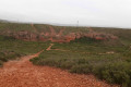
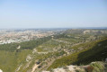
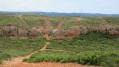
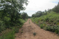
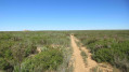
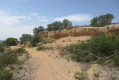
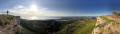
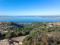
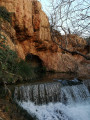
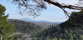
A lovely walk on the Vitrolles Plateau, starting from the Collets Rouges equestrian centre towards the cliffs of Vitrolles and Rognac, before crossing the red ochre hills of Le Pouchon. A varied landscape and magnificent views throughout the walk.
GPX track required.

Details

40267731
Creation:
Last update:
Last review:
  • Walking
    Activity: Walking
  • ↔
    Distance: 7.82 mi
  • ◔
    Average duration: 4h 05 
  • ▲
    Difficulty: Moderate

  • ⚐
    Back to start: Yes
  • ↗
    Ascent: + 541 ft
  • ↘
    Descent: - 548 ft

  • ▲
    Highest point: 764 ft
  • ▼
    Lowest point: 390 ft

Photos

Description of the walk

On the D9, take the Les Pinchinades exit – exit 10 if coming from Aix-en-Provence or exit 11 if coming from Vitrolles. Follow signs for the Collets Rouges equestrian centre. Park in the Magenta car park to the left of the equestrian centre.

(S/E) Follow the signs for the DFCI track along the tarmac road heading down towards the north. After a sharp bend to the left, go through the barrier and head west. You’ll come to a Y-junction.

(1) Keep to the left and follow the wide track, which forms part of theGR® de Pays 2013 Marseille Provence Métronome trail, heading west. You’ll reach an X-junction.

(2) Head north on track AR110. Pass to the left of a large water reservoir, then walk alongside the pink marble sand quarry. You’ll reach the tarmac road leading to the Vitrolles speed camera.

(3) Cross it and head towards the cliffs. Turn right and follow the path that runs alongside these cliffs. Take in the scenery.

(4) Turn right onto the path which joins a junction of tracks and a signpost at elevation 206. Head towards the Plateau du Grand Arbois, heading north-east. You’ll reach a junction of several tracks at elevation 192.

(5) Turn right onto the track running alongside the fence of the Domaine des Pradeaux. Further on, keep to the left to follow the track as it climbs. Pass elevation 196 and underground fire tank no. 78, then arrive at a Y-junction with some old wooden signposts.

(6) Head left towards the hunting car park sign no. 18. Reach the top of the track at elevation 232, where there is a gate and a large information board about the area. Follow the track heading eastwards until you reach a Y-junction.

(7) Turn right onto the stony, then sandy path which descends steadily. You’ll reach a triangular junction with a small patch of vegetation in the centre.

(8) Turn left, then you’ll come across thefirst rocks sculpted by erosion. Further on, on the left, you’ll notice a ruin. Just after that, you’ll reach a Y-junction.

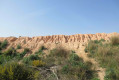
(9) Turn left onto the narrow, overgrown path. Climb a rocky mound on the left, then follow the path as it branches off towards the south-west and then south. Further on, you’ll reach a large, bare hillock with sand and ochre-coloured rocks. Cross it on the left. Below the hill, head right and follow the path that runs at the base of the rocks. Admire the shape of these rocks. Further down, you’ll come to a junction of several tracks (alt. 195 m).

(10) Below the hillock, turn right and follow the path which runs to the left of the rocks. Admire the shape of these rocks. Further down on the right, join a wide track and turn left to follow the path which runs alongside a power line. You’ll spot a large water reservoir. You’ll reach a Y-junction at elevation 163.

(11) Turn left. You’ll reach a Y-junction

(12) Turn left and head down to the foot of the red ochre hills. Turn right at the bottom of the Bayle valley and follow the track which, further down, joins the tarmac road leading to the Collets Rouges equestrian centre. Turn right onto this road and walk for about a hundred metres.

(13) Cross the road and follow the path that runs alongside it and leads back to the starting point (S/E).


Waypoints

  1. S/E : mi 0 - alt. 430 ft - Magenta car park
  2. 1 : mi 0.37 - alt. 482 ft - Y-junction – GR 2013
  3. 2 : mi 1.33 - alt. 577 ft - Trail AR110
  4. 3 : mi 2.1 - alt. 686 ft - Tarmac road
  5. 4 : mi 3 - alt. 682 ft - Towards the 206-metre mark
  6. 5 : mi 3.53 - alt. 633 ft - Elevation 192
  7. 6 : mi 4.31 - alt. 640 ft - Y-junction – Old signposts
  8. 7 : mi 4.85 - alt. 758 ft - Y-junction – Descent
  9. 8 : mi 5.1 - alt. 636 ft - Triangular loop
  10. 9 : mi 5.4 - alt. 623 ft - Triangular route
  11. 10 : mi 5.96 - alt. 633 ft - Butte
  12. 11 : mi 6.64 - alt. 561 ft - Elevation 163
  13. 12 : mi 6.82 - alt. 518 ft - Bayle Valley
  14. 13 : mi 7.34 - alt. 390 ft - Tarmac road
  15. S/E : mi 7.82 - alt. 430 ft - Magenta car park

Notes

For reference: the author’s time for this route was 2 hours 50 minutes, excluding a lunch break.

Always be cautious and plan ahead when you're outdoors. Visorando and the author of this route cannot be held responsible for any accidents occurring on this route.

The GR® and PR® markings are the intellectual property of the Fédération Française de Randonnée Pédestre.

Reviews and comments

4 / 5
Based on 3 reviews

Reliability of the description
4.3 / 5
Ease of following the route
3.7 / 5
Route interest
4 / 5
Corinne.13
Corinne.13

Overall rating : 4.7 / 5

Date of your route : Apr 29, 2026
Reliability of the description : ★★★★★ Very good
Ease of following the route : ★★★★★ Very good
Route interest : ★★★★☆ Good
Very busy route : No

A lovely route with beautiful views. There is very little shade, and the descent is difficult in several places as the path is rutted. But it’s not dangerous.

Machine-translated

Vusky
Vusky

A correction has been made to the diagram and description to avoid any confusion between points 8 and 10.

Machine-translated

Vakoran
Vakoran

Overall rating : 3.7 / 5

Date of your route : Oct 18, 2024
Reliability of the description : ★★★★☆ Good
Ease of following the route : ★★★☆☆ Average
Route interest : ★★★★☆ Good
Very busy route : No

A fairly easy walk offering some lovely views and other points of interest, such as these rounded rocks and ochre-coloured formations.
I followed the GPX track for the whole walk, but despite this, between points 8 and 10, two sections were unclear, and I found myself having to struggle up a steep, tricky rocky slope (as the rock was crumbling) and then jump over a fairly steep ledge.
Nevertheless, I’d recommend it in any season, because despite the rain the night before, the fact that it was dawn, and even though it was autumn, none of the paths were waterlogged, and it was easy to avoid the few slightly muddy patches.

Machine-translated

Vusky
Vusky

Good evening,
In accordance with the Visorando charter, none of my routes cross private property on the day the walk is published.

Machine-translated

AUDO13
AUDO13

Hello, doesn’t the unmarked section cross private property? Thank you.

Machine-translated

phildaix
phildaix

Overall rating : 3.7 / 5

Date of your route : Oct 02, 2023
Reliability of the description : ★★★★☆ Good
Ease of following the route : ★★★☆☆ Average
Route interest : ★★★★☆ Good
Very busy route : No

The walk is absolutely lovely thanks to the varied terrain, the landscape and the distant views, even if it’s a bit built-up in places; and the colours are magnificent (today there’s a mistral blowing with lovely light).
It’s a bit tricky to follow the path because of the numerous junctions where you have to make a choice, and which aren’t mentioned in the guidebook. At point 9, it was impossible to find the path; you have to use your GPS to make your way through the vegetation before getting back on track. But then again, you always manage to find your bearings in the end.
Otherwise, it’s an easy walk with little elevation gain; there are a few stony sections that are a bit slippery.
A route that isn’t very busy, though there were a few mountain bikers about.

Machine-translated

Other walks in the area

For more walks, use our search engine .

The GPS track and description are the property of this route's author. Please do not copy them without permission.