


 Country:
 City:
City:


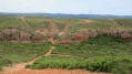
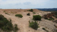
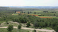
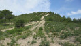
On the D9, take the Les Pinchinades exit – exit 10 if coming from Aix-en-Provence or exit 11 if coming from Vitrolles. Head towards the Collets Rouges equestrian centre. Park in the Magenta car park to the left of the equestrian centre.
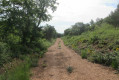
(S/E) Take the path signposted ‘Les Collets Rouges’ which runs alongside the equestrian centre. At the end of the fence and at the start of a right-hand bend, follow the track on the left which heads due north then north-east. Ignore a path branching off to the right and you’ll come to a Y-junction.
(1) Leave the track to the right and follow the path which passes by some beehives, then narrows as it runs alongside a stream bed. Ignore the paths to the left and right, cross a small hill and arrive at a T-junction.
(2) Turn left, then, about 25 metres further on, pass to the right of an electricity pylon. You’ll rejoin a track at a Y-junction.
(3) Turn left onto this sandy track. On the right, admire the red ochre cliffs. Pass a large rock painted blue (???) and, after a short descent to the left, you’ll reach a Y-junction.
(4) Turn sharply left onto a overgrown path that runs alongside a stream bed. You’ll spot some beehives down below on the right; then, just after passing under the high-voltage power line, you’ll reach a Y-junction.
(5) Head left, following the high-voltage line, then about 100 m further on, turn right at a Y-junction. Keep heading west; this avoids entering the private property at Le Pouchon, even though there is no ‘No Entry’ sign on this side. After passing some tall pine trees and then an open area, you’ll reach an X-junction and a ‘Private Property’ sign on the right.
(6) Head straight north, then about 50 m further on, turn right (shortcut). Join the track again and keep right at the two successive Forks in the road. You’ll reach a Y-junction with a concrete marker.
(7) Turn right and follow the overgrown path that runs alongside the property’s fence. The path then becomes uneven towards the end. You’ll reach an inverted Y-junction.
(8) Stay on the left-hand track and keep left at the inverted Y-junction. Pass the P18 hunters’ car park and continue straight on, heading west (old signposts), until you reach a star-shaped junction.
(9) Keep to the right, pass the P19 hunters’ car park and underground cistern no. 78. Look out for a path on the right that climbs steeply up a hillock.
(10) Turn right onto this path. Take care: the climb is steep and slippery. Keep to the right through the vegetation. At the top, you’ll reach a Y-junction.
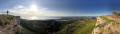
(11) Turn right and follow the path as it winds along the edge of the cliffs. Take in the panoramic view and you’ll reach an electricity pylon.
(12) Continue straight on to the right, cross an open area and arrive at an X-junction with a track and a large information sign.
(13) Behind the sign, carry on along the path that runs alongside the cliffs and joins the track further on. Turn right onto the track, then, about 50 metres further on, turn right again and you’ll reach a Fork in the road.
(14) Head right along the stony then sandy path, which descends steadily. You’ll reach a triangular junction with a small patch of vegetation in the centre.
(15) Head off to the left, then spot the first rocks sculpted by erosion and, further on to the left, a ruin. You’ll reach a large triangular junction.
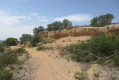
(16) Turn left through the vegetation. Climb a rocky mound on the left, then follow the path which branches off towards the south-west and then south. Further on, you’ll reach a large, bare mound with sand and ochre-coloured rocks; cross it on the left.
(17) Below the hillock, head right and follow the path running along the base of the rocks. Admire the shapes of these rocks. Further down, you’ll come to the start of several tracks (elevation 185).
(18) Turn left and follow the track down towards the south. Take a slight detour to get closer to the edge of the cliffs. Note a large water reservoir and reach the next junction (elevation 176).
(19) Carry on to the right and reach a star-shaped junction (elevation 163).
(20) Head left and descend into the Bayle valley, keeping as close to the cliffs as possible. Continue to the right at the bottom of the valley and follow the track which, further on, joins the tarmac road leading to the Collets Rouges equestrian centre.
Cross the road at a car park, walk for about 100 m westwards and reach a junction of paths.
(21) Follow the path heading north-west, keeping a good distance to the right of the road. You’ll arrive at the car park, the starting point of the walk (S/E).

 Visorando Member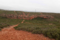

 Easy
Easy 
 Association / Club / Walk leader
 Difficult
