


 Country:
 City:
City:


On the D9, take the Les Pinchinades exit – exit 10 if coming from Aix-en-Provence or exit 11 if coming from Vitrolles. Head towards the Les Collets Rouges equestrian centre. Park in the Magenta car park, to the left of the equestrian centre.
(S/E) Follow the signs for the DFCI track along the tarmac road heading down towards the north. After a sharp bend to the left, go through the barrier and head west. Keep to the left until you reach an area with concrete tables and benches and a V-shaped junction at elevation 137.
(1) Turn right onto the path that follows a stream bed. The path is sometimes uneven. Pass by a well, then reach a T-junction. Turn right at the junction, pass an olive grove, then keep to the right at elevation 164, heading north-east. Pass by a terraced plot planted with olive trees and arrive at an X-junction.
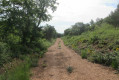
(2) Turn left onto the wide track. Pass by Lena’s olive grove, then reach an X-junction. Turn right onto the long track which passes by the Grenadier’s hut and then descends to the right into a small valley.
(3) Cross the Bondon stream and reach a T-junction at elevation 184.
(4) Turn left, then arrive at a large wooded area and a T-junction. Opposite a gate and a fence, turn right onto the track, then look out for the corner of the fence.
(5) Turn left and follow the fence to the end. Join a wide track and follow it due north. You’ll reach the Domaine du Grand Arbois and, further on, the Watchtower at an elevation of 270.
(6) Turn right at the tower, then, about 200 m further on, turn right at the Y-junction. Pass by a water retention basin. Follow the wide track southwards.
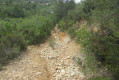
(7) Leave the track and turn left between two cairns onto a stony path that descends. Keep to the left at the junction with a track, then arrive in the Mion valley. Note the numerous water retention walls.
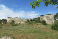
(8) Turn left to head deep into the wide meadows of the valley. You’ll reach the ruins of Mion Farm. Explore the site, then continue south-east. You’ll come to an X-shaped junction.
(9) Turn right onto thefirst path, which climbs steeply before levelling out 100 metres higher up, where it branches off southwards and then heads straight south-west. Pass by an electricity pylon, cross a track, then a double track. You’ll reach a Y-junction and turn left.
(10) Turn right at the Fork in the road. The path descends steadily. You’ll reach a Y-junction.
(11) Turn right at the junction and you’ll reach a T-junction and a wildlife drinking trough.
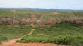
(12) Pass to the left of the watering hole along the uneven path, which descends before levelling out. The passage is narrow between the bushes but poses no difficulty. Pass by a house and reach the boundary of this property. Turn right onto the track and continue due south. To the left lie the red ochre hills and the remains of trees burnt in a massive fire in 2016. You’ll come to a Y-junction
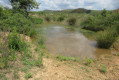
(13) Turn right, then, about 20 metres further on, take a detour to the right to admire a marsh. Continue on your way until you reach the Les Collets Rouges equestrian centre.
Go round the riding centre on the right and return to the car park (S/E).



 Visorando Member

 Easy
Easy 
 Association / Club / Walk leader
 Difficult
