The Gourvest region

A walk along the circular route in the commune of Plougourvest (part of the Pays Léonard region) with a few insights into the local heritage.

Details

31595000
Creation:
Last update:
Last review:
  • Walking
    Activity: Walking
  • ↔
    Distance: 6.25 mi
  • ◔
    Average duration: 3h 05 
  • ▲
    Difficulty: Moderate

  • ⚐
    Back to start: Yes
  • ↗
    Ascent: + 200 ft
  • ↘
    Descent: - 180 ft

  • ▲
    Highest point: 400 ft
  • ▼
    Lowest point: 256 ft

Photos

Description of the walk

Park in the car park next to the former presbytery (Route de Plouzévédé).

(S/E) Heading north from the car park, take the small lane on the right, then turn left at the corner by the cemetery. Continue for 150 metres and turn right towards Kerduff.

(1) Turn right and continue along the sunken lane to Mescam. Once you reach the hamlet, turn right until you reach the tarmac road.

(2) Turn left and follow the road for about 450 m (caution: busy road), then turn left onto the farm track. Turn left at the junction, join a road and turn left to cross Coativellec (misspelt on the IGN map).

(3) At the Stop sign, cross the D35 (caution: busy road) and take the track opposite, to the right of the shed. Continue along this track until you reach the pretty Stang mill.

(4) Turn right onto the road, then left after the pond. Pass through Le Stang and Veuleury (marked as ‘Ar Véleuri’ on the IGN map) until you reach a four-way junction.

(5) Take the left-hand track. At this point, you can join the Plougar route by turning off to the right. Head down to the river, then back up and turn left at the end of the track to reach the Guerruas crossroads.

(6) Turn left onto the road to cross the hamlet, continue for about 200 m, then turn right towards Coat Bian (Coat Bihan). Pass the farm, then turn left. Continue along the track for about 200 m, turn onto the track on the right, then carry on until you reach the D35.

(7) Turn right onto the main road and carry on to the four-way junction. Turn left onto the road. At the right-hand bend, take the left-hand dirt track and head into the woods. Keep left at the three-way junction and carry on to the Kervellec cross (Croaz Kervélec).

(8) Turn left onto the road, continue to the hamlet known as La Gare and pass through it.

(9) Turn onto the small road on the right (Rue de Croas Nevez) and walk past the wayside cross. Navigate the left-hand bend, rejoin the road you left earlier and follow it to the right as far as the church.

(10) Turn right at the roundabout (church) to return to the starting point (S/E).

Waypoints

  1. S/E : mi 0 - alt. 341 ft - Car park next to the former vicarage
  2. 1 : mi 0.3 - alt. 351 ft - T-junction
  3. 2 : mi 0.63 - alt. 331 ft - Road junction
  4. 3 : mi 1.59 - alt. 318 ft - Stop – D35 road
  5. 4 : mi 1.91 - alt. 259 ft - Stang Mill
  6. 5 : mi 2.36 - alt. 331 ft - Crossroads
  7. 6 : mi 3.07 - alt. 308 ft - Guerruas
  8. 7 : mi 3.98 - alt. 377 ft - D35 road
  9. 8 : mi 4.9 - alt. 400 ft - Cross
  10. 9 : mi 5.94 - alt. 367 ft - The railway station
  11. 10 : mi 6.18 - alt. 348 ft - Roundabout - Église Saint-Pierre (Plougouverst)
  12. S/E : mi 6.25 - alt. 341 ft - Car park next to the former vicarage

Notes

Please note: there are sections on some busy roads!

Worth a visit

Several examples of local heritage:
(3) The 16th-century Calvary at Coativéllec.
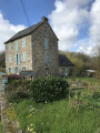
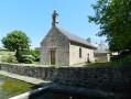
(4) Stang Mill, which once belonged to Stang Manor. Built in 1775 and raised in 1919, it remained in operation until 1970.
(4) Stang Calvary, 16th century
(8) Kervellec Calvary, 15th century
(9) Croaz-Nevez Calvary, 15th century: a cross with tapered arms, a crucifix and the Virgin and Child crowned by an angel.
(9) A place known as ‘La Gare’, the former station on the railway line known as the ‘potato train’.
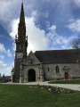
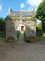
The Church of Saint-Pierre, dating from the 16th and 17th centuries. It has an irregular layout, like many churches that have been extended at different times. The Léonard-style bell tower bears the date 1588. The south side porch dates from 1616. At the top of the façade it features a keystone decorated with a sun, and on the pediment a kersantite statue of the crowned Virgin Mary. Inside the church, one can see the 17th-century high altar and the altarpiece.
In front of the church stand the fertility stones, dating from around the 5th or 6th century BC.

Reviews and comments

3.9 / 5
Based on 3 reviews

Reliability of the description
4.3 / 5
Ease of following the route
4 / 5
Route interest
3.3 / 5
erictual
erictual

Overall rating : 4.7 / 5

Date of your route : Aug 01, 2023
Reliability of the description : ★★★★★ Very good
Ease of following the route : ★★★★★ Very good
Route interest : ★★★★☆ Good
Very busy route : No

A very pleasant route, well described and a fine example of the Leontine countryside, with wayside crosses dotted here and there. The route winds its way through fields and valleys, following a few stretches of road. There are few difficulties apart from some relatively muddy sections. Having completed this route in the midst of a gloomy, rainy summer, one can only imagine the state of certain sections in the depths of winter!
We didn’t come across a single soul apart from three magnificent hares.
A visit to the church at Plougourvest rounds off the walk nicely.

Machine-translated

Les pommiers
Les pommiers

Overall rating : 4 / 5

Date of your route : Mar 26, 2023
Reliability of the description : ★★★★☆ Good
Ease of following the route : ★★★★☆ Good
Route interest : ★★★★☆ Good
Very busy route : No

Between points 8 and 9, you can take a small path on the left to leave the busy road and head for the station.

Machine-translated

Fañch Lanhou
Fañch Lanhou

Overall rating : 3 / 5

Date of your route : Mar 20, 2023
Reliability of the description : ★★★★☆ Good
Ease of following the route : ★★★☆☆ Average
Route interest : ★★☆☆☆ Disappointing
Very busy route : No

A very muddy route… perhaps best tackled in the summer. As if it weren’t muddy enough, the tracks left by quad bikes and other vehicles make the paths almost impassable. It’s a shame for the volunteers who maintain the paths; it’s quite disheartening.

Machine-translated

Other walks in the area

For more walks, use our search engine .

The GPS track and description are the property of this route's author. Please do not copy them without permission.