Country:
 City:
City:


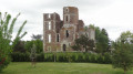
Parking is available at the Château de l’Étang car park.
(S/E) From the car park, head towards the château on the right.
(1) When you reach the château, turn left towards the woods (pond on the left). Take the path heading north-west.
(2) At the junction, take the second path on the right (north-east). At the next junction, turn right (route marked in yellow). Cross another path then turn right. At the next junction, veer left then immediately right.
(3) At the T-junction, turn right. Go round a riding centre on the right and head towards the castle.
(1) Carry on straight ahead, passing the starting car park on your left (follow the yellow markings).
(4) Go round the town hall and the village hall on the right. Turn left and walk past the school on your right. Turn right onto Rue du Docteur Payen.
(5) At the end, first turn right then left and follow Rue de l’Orme du Coin.
(6) Near the A701, take a sharp left into Rue de la Médicinerie. In the hamlet, turn left onto Rue du Lac. Walk alongside the lake on your right.
(7) Turn right (playground). At the southern tip of the lake, turn left then right (be careful, there is no marked path here). At the main road, turn right onto a small path running alongside it.
(6) Go under the bridge and take the path immediately on the left. Follow the dual carriageway again, this time on your left. Veer to the right and follow the yellow markings southwards, ignoring the side paths. The path finally turns right and leads onto Rue des Chimoutons.
(8) Follow this street to the left. At the end of the road, turn left into Rue Passe Debout. Then take the first right, Rue de Villamblain, then the first right again (dead end). At the end, turn left onto a path and come out onto Allée des Bordes; follow it to the right.
(9) Turn left onto Rue des Bordes, then turn left again. Turn right onto a footpath (Sentier des Aydes aux Toits) which runs alongside the dual carriageway. Cross Rue des Vallées. At the end of the footpath, first turn right then left and continue along the Sentier des Aydes aux Toits.
(10) At the end, turn left onto Rue de Pimelin. Take the first right, Chemin des Bourdins. At the end of this, turn right (Chemin du Moulin). Cross Rue Anatole Faucheux and continue north.
(11) At the junction, carry straight on along Rue du Ran d’Abbas.
(12) At the junction with Rue du Grand Clos on your right, turn left (west) onto a forest track. At the end, turn right onto Rue de la Fassière. At the end of the road, turn left.
(13) Turn right onto the path running alongside the motorway. Turn right at the edge of the forest. Take the second path on the right, staying at the edge of the forest and then through the fields. At the next junction, carry on straight ahead. At the next junction, turn left and, at the forest gate, turn left. At the Fork in the road, take the Chemin des Petits Souliers on the right. Turn into the first path on the left and, at the T-junction, turn left again.
(14) At the end of the path, turn right, then immediately right onto Rue de la Pelleterie. Just before the end of the street, take a small path on the left (stone bench) to join Rue de l’Orme du Coin. Then turn left onto this street.
(6) Carry on straight ahead to the end of the street. Turn right onto Rue du Bourg. Head slightly left towards the church and the War Memorial (Place des Anciens Combattants). Go round the church on the right and head left towards the information boards (history of the commune of Saran).
(16) Turn right again and go round the town hall on the right.
(4) Turn right, then immediately right again to reach the starting car park (S/E).





 Visorando Member
 Easy
Easy 
 Difficult