Circular in the Forest of Orléans from Chanteau

A walk under the canopy of majestic trees, following the greenway through the grounds of the remarkable Château de Charbonnière and the national forest.

Details

2086749
Creation:
Last update:
Last review:
  • Walking
    Activity: Walking
  • ↔
    Distance: 7.10 mi
  • ◔
    Average duration: 3h 20 
  • ▲
    Difficulty: Easy

  • ⚐
    Back to start: Yes
  • ↗
    Ascent: + 69 ft
  • ↘
    Descent: - 66 ft

  • ▲
    Highest point: 436 ft
  • ▼
    Lowest point: 341 ft
  • ⚐ Country: France
  • ⚐ City: Chanteau (45400)
  • ⚑
    Start/End: N 47.946099° / E 1.949882°
  • ❏
    IGN map(s): Ref. 2219ET
  • Hour-by-hour weather

Photos

Description of the walk

Start from the car park on the right-hand side of the D101 (Route d’Orléans) on the outskirts of Semoy (towards Chanteau, Marigny-les-Usages)

(S/E) Take the wide, straight forest track (GR®® 3B) after passing the barrier blocking access to it.

(1) Turn right at the first junction onto the track known as Route de Semoy. Cross the old railway line.

(2) When you reach a tarmacised crossroads, turn left onto the track, leaving the Route de Semoy to continue to the right. Turn right when you come to a cross-track to follow the old railway line. Go through the gate, then follow the twists and turns of the main track. This runs alongside the main course of the Ruet stream until you reach the Étang de Ruet on your left, which you’ll follow until you come to a footbridge at the edge of the pond.

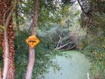
(3) Turn left onto the footbridge to cross the Ruet, then follow the pond on your left – an ideal spot for wildlife spotting. At the end of the path, cross the Ruet again to the right to reach a wide cross-path (with steps), along which you should head to the right. Ignore the side paths and continue along the straight Allée Pouet to the Château de Charbonnière. Go round the château to the left, following the small tarmac road.

(4) The narrow lane cuts across a cross-path. The tarmac quickly gives way to a forest track after the junction with a small cross-road (Rue de Charbonnière).

(5) At the next junction, leave the busiest lane, Rue de la Borde, and take a grassy path on the right. Cross Rue de Charbonnière. Access to the lane is restricted by two barriers on either side of the road.

(6) At the next junction, turn slightly right, leaving Rue de Compoint on your left and Rue de la Grenouillère on your right.

(7) At the next junction, take the left-hand path marked ‘Voie Verte’ and follow it all the way to the stud farm.

(8) At the crossroads on the edge of the stud farm, continue straight ahead along the busiest path, which you should follow until it meets a cross-path, after running alongside the old railway line.

(9) Turn right onto the cross-path and follow its winding course until you return to the starting point of the walk at the car park beside the D101 (Route d’Orléans) (S/E).


Waypoints

  1. S/E : mi 0 - alt. 407 ft - Car park near the D101 (Semoy exit)
  2. 1 : mi 0.63 - alt. 404 ft - Turn right at the first junction
  3. 2 : mi 1.39 - alt. 413 ft - Turn left onto the lane
  4. 3 : mi 2.97 - alt. 351 ft - Turn left onto the footbridge
  5. 4 : mi 4.18 - alt. 404 ft - Opposite: cross-path
  6. 5 : mi 4.56 - alt. 390 ft - Grassy path on the right
  7. 6 : mi 4.97 - alt. 427 ft - On the right, opposite
  8. 7 : mi 5.22 - alt. 420 ft - The path furthest to the left (greenway)
  9. 8 : mi 5.79 - alt. 430 ft - Opposite, on a busy avenue
  10. 9 : mi 6.37 - alt. 387 ft - Turn right onto the cross-path
  11. S/E : mi 7.1 - alt. 410 ft - Car park near the D101

Notes

The walk can also start at Charbonnière Castle, which has a large car park at (4)

Some paths may be muddy in late winter and early spring.

Worth a visit

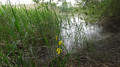
Spot wildlife (deer) in the morning or evening, numerous species of birds in Charbonnière Park and on the Étang de Ruet, as well as a rich variety of flora along the path (wood hyacinths, wild strawberries, etc.)

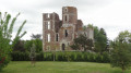
The imposing Château de Charbonnière, set in exceptional surroundings, boasts rich architectural detail.

About a hundred metres past point (9), you can head towards Étang de Beulie by taking a path on the left – a peaceful spot where you can sit on a bench and enjoy the tranquillity before continuing along the rest of the path.

Always be cautious and plan ahead when you're outdoors. Visorando and the author of this route cannot be held responsible for any accidents occurring on this route.

The GR® and PR® markings are the intellectual property of the Fédération Française de Randonnée Pédestre.

Reviews and comments

4.5 / 5
Based on 14 reviews

Reliability of the description
4.6 / 5
Ease of following the route
4.8 / 5
Route interest
3.9 / 5
FlorianCM
FlorianCM
• Edited:

Overall rating : 4.3 / 5

Date of your route : Aug 21, 2026
Reliability of the description : ★★★★☆ Good
Ease of following the route : ★★★★★ Very good
Route interest : ★★★★☆ Good
Very busy route : No

A lovely, well-signposted walk. It would be useful to suggest some side paths that could be taken, to allow for a walk through the forest rather than just on hard surfaces. A lovely experience all the same. We completed the walk in 2 hours and 45 minutes, without rushing. Thank you for the description.

Machine-translated

User 18999636

Overall rating : 4.7 / 5

Date of your route : Jan 19, 2026
Reliability of the description : ★★★★★ Very good
Ease of following the route : ★★★★★ Very good
Route interest : ★★★★☆ Good
Very busy route : Yes

Very nice, we did it in 2½ hours.

Machine-translated

Brigitte45
Brigitte45

Overall rating : 4.7 / 5

Date of your route : Jul 08, 2024
Reliability of the description : ★★★★★ Very good
Ease of following the route : ★★★★★ Very good
Route interest : ★★★★☆ Good
Very busy route : No

Very pleasant walk in the Orléans forest on wide paths. No difficulty.

Machine-translated

Chambrin Muriel
Chambrin Muriel

Overall rating : 5 / 5

Date of your route : Mar 04, 2024
Reliability of the description : ★★★★★ Very good
Ease of following the route : ★★★★★ Very good
Route interest : ★★★★★ Very good
Very busy route : Yes

A wonderful walk in the heart of the forest.

Machine-translated

foufou45
foufou45

Overall rating : 4 / 5

Date of your route : Sep 25, 2023
Reliability of the description : ★★★★☆ Good
Ease of following the route : ★★★★☆ Good
Route interest : ★★★★☆ Good
Very busy route : Yes

Very good hike.
Thank you.

Machine-translated

Jean-Louis Pinault
Jean-Louis Pinault

Thank you for your kind comments.
Jean-Louis

Machine-translated

coyoye
coyoye

Overall rating : 5 / 5

Date of your route : Aug 14, 2023
Reliability of the description : ★★★★★ Very good
Ease of following the route : ★★★★★ Very good
Route interest : ★★★★★ Very good
Very busy route : Yes

Hello,
An easy hike that I do very regularly throughout the year.
It's a bucolic and colourful walk at this time of year with wild flowers lining the path.
And the beautiful Forest of Orleans is a natural source of serenity.
To be done and redone without moderation.
Looking forward to seeing you there...

Machine-translated

dolot
dolot

Overall rating : 5 / 5

Date of your route : Aug 03, 2023
Reliability of the description : ★★★★★ Very good
Ease of following the route : ★★★★★ Very good
Route interest : ★★★★★ Very good
Very busy route : No

Perfect, very well marked route with colours indicating the distance
no need to search, beautiful, very beautiful hike in the very green Forest of Orléans
heather in bloom, majestic ferns, beautiful butterflies on wild orchids
Pure pleasure, pure happiness
Thank you, best regards
Françoise

Machine-translated

A girodet
A girodet

Overall rating : 4.7 / 5

Date of your route : May 23, 2023
Reliability of the description : ★★★★★ Very good
Ease of following the route : ★★★★★ Very good
Route interest : ★★★★☆ Good
Very busy route : No

A beautiful hike through the woods of CHARBONNIÈRE. Admittedly, we travel more on paved roads than on dirt or grassy paths, but at least we never lose track of the route.
One question: why, at the end of the route, did the blue route on my iPhone go in a straight line without following the red route on the VISORANDO app?

Machine-translated

AnneBihan
AnneBihan

Overall rating : 4.7 / 5

Date of your route : Feb 28, 2022
Reliability of the description : ★★★★★ Very good
Ease of following the route : ★★★★★ Very good
Route interest : ★★★★☆ Good
Very busy route : Yes

Lovely walk around Charbonnière Park. Thank you, Jean-Louis!

Machine-translated

Viviane03
Viviane03

Overall rating : 3.7 / 5

Date of your route : Apr 20, 2021
Reliability of the description : ★★★★☆ Good
Ease of following the route : ★★★★★ Very good
Route interest : ★★☆☆☆ Disappointing
Very busy route : Yes

We did this route during the Easter holidays, which was a mistake. Too many people. Too many cyclists, too (in my opinion).
We ended up zigzagging our way through the route, no longer following the trail, taking wooded paths and dirt tracks while keeping the app open to find our way.
The route is almost entirely on hard-packed paths. It's tiring walking on such hard ground.
That said, I will go for another walk in the forest, taking only the dirt paths in this beautiful forest, and opening the app to find my way back to my starting point once I've had a good walk.
This is because I haven't found any walks that are exclusively on paths on the website for this area of the Forest of Orléans. But perhaps there are some?
Thank you for the route map anyway.

Machine-translated

Jean-Louis Pinault
Jean-Louis Pinault

Thank you for your comments.
Have a good evening,
Jean-Louis

Machine-translated

ibouillot
ibouillot

Overall rating : 4 / 5

Date of your route : Aug 05, 2019
Reliability of the description : ★★★★★ Very good
Ease of following the route : ★★★★★ Very good
Route interest : ★★☆☆☆ Disappointing

not a very beautiful part of the forest and an unnatural path

Machine-translated

Jean-Louis Pinault
Jean-Louis Pinault

Many thanks for this valuable information, which I have gladly incorporated into the description.
Have a nice day,
Jean-Louis

Machine-translated

kikidistrict3
kikidistrict3

Overall rating : 4 / 5

Date of your route : Jul 15, 2019
Reliability of the description : ★★★★☆ Good
Ease of following the route : ★★★★☆ Good
Route interest : ★★★★☆ Good

Hello,
It was a pleasant hike where the heat was well absorbed by the undergrowth.
Two small comments:
- At point 3, you can go down the footbridge (bridge) to walk along the Ruet pond, which allows you to observe the wildlife, and continue until you come to some steps on the right that lead to the Pouet alley on the right, thus resuming the route at point 3.
- Of course, a stop at the Château de Charbonnière is a must to discover its beautiful architecture.
- A few metres after point 9, on the left (250 m), you will find the Bedine pond, a peaceful spot with a bench where you can enjoy the calm before continuing on to the end of the trail.

Machine-translated

Other walks in the area

For more walks, use our search engine .

The GPS track and description are the property of this route's author. Please do not copy them without permission.