Country:

 City:
City:


The village of Saint-Maurice-l’Exil is situated in northern Isère, about 20 km south of Vienne. Head north from the village along the D4. Opposite the industrial and commercial estate, take Rue de Jappeloup. At the end of this road, which is a cul-de-sac, there is a car park. Park in this car park. The walk starts from this point.
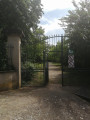
(S/E) Head towards the entrance to the Parc des Varilles and go through the gate. Walk straight through the park along the main path, ignoring a path branching off to the left. Walk past the children’s playground.
At the end of the main path, turn left onto the zigzagging uphill path.
When you reach a fork in the road, take the right-hand path uphill. Continue straight on until you reach the flat area at the top of the park.
(1) Turn off the straight path and head right. Continue straight on until you reach the downhill section of the path.
Winding your way downhill, in places via wooden steps and log footbridges. You’ll reach the park exit and Rue Guy de Maupassant.
(2) Turn left onto this street. At the fountain, turn left up the slight incline along Rue de Mata and stay on this street until you reach a junction with Rue Auguste Rodin. Turn left onto this street.
Before the road begins a slight incline, and after passing a small, distinctive white cottage with a steep black roof on your right, you’ll come to a wide path behind a hedge.
(3) Turn right onto this path, which gradually veers away from the road.
Follow this path until you reach a junction where you must turn right uphill. Be careful not to miss this junction, as it is easy to carry on straight ahead without noticing it. The path will become a narrow track winding through the woods.
Follow this path until you reach another wide path – not very clearly marked on the ground as it is overgrown with grass – running between the fruit tree plantations. Take this path on the left.
Carry on straight ahead, staying on the main path.
Pass a path branching off to the right by keeping to the left, and you’ll soon reach a fork in the road where there’s a ‘dead end’ road sign and a ‘no dumping’ sign.
(4) At this fork in the road, just after the sign, turn left, almost going in the opposite direction.
At the first junction, keep to the right and at the second, continue straight ahead.
The dirt track joins another tarmac road, where you should turn left. Further on, you’ll reach another junction with a hiking signpost (Les Varilles).
(5) Carry on straight ahead. Ignore a path branching off to the right.
Pass under the high-voltage power line and, immediately afterwards, you’ll come to a crossroads.
(6) Turn right onto this track. Ignore thefirst track on the left; turn left at the next track. Pass under the power line again. Then first turn right then left. Continue along this track until you reach a road.
Cross the road by first turning left then right, then 20 metres further on at the junction, take the road on the left. On your left you’ll see a sort of old wine press.
(7) Leave this road quickly and take the dirt track on the right which runs alongside a fence made of logs.
At this crossroads, keep to the left to take the path furthest to the left. Then follow this dirt track, ignoring the turnings to the right and left. You’ll come to another crossroads at the edge of a wood.
(8) Turn left. Enter the woodland and continue along this track, ignoring the turnings on the right, until you reach a road.
(9) Turn right onto it towards the medium-voltage pylon and pass under the power line.
Carry on along this road (Rue du 16 mars 1962) until you reach the first houses in Clonas-sur-Varèze (a hamlet known as La Rainy). Continue straight on through the village, passing two streets on the right and then a third on the left, until you reach a crossroads.
At this junction, turn right, then 50 metres further on, turn left
Pass by the foot of the water tower and continue straight on, slightly downhill, towards a small roundabout.
(10) Take the street on the right, then 30 metres further on, turn onto the dirt track on the left.
After about 50 m, turn left onto the small tarmac road – this is Rue Les Hauts de Clonas – and continue uphill.
You’ll come to a fork in the road where you should take the path on the right; leave the road here. Keep going straight on along this path, ignoring the paths branching off to the right and left.
You’ll pass a pumping station on your right before reaching a tarmac section.
Then, 20 metres further on, you’ll reach a crossroads where you should turn right. Shortly afterwards, a gate will appear across the path; this is one of the entrances to the Parc des Varilles. This gate is closed to vehicles. Pedestrians can go round it by turning right.
(1) Return to the initial crossroads you passed on the way out.
Then continue downhill along the path you took at the start.
Reach the fork in the road; this time, turn right, continuing downhill, rather than going straight on.
Ignore a path branching off to the left and continue along the path that winds its way downhill to rejoin the path where the walk began; here, take the right-hand path.
Head for the park exit and the Parc de Varilles car park (S/E).


 Visorando Member


 Easy
Easy 
 Difficult