Country:

 City:
City:


The route starts from the Orizkiko Pass (390m), on the heights of Etxalar, where there is a car park at the foot of a telecoms mast (see Google Maps link).
(S/E) We set off east-north-east along a track that descends gently towards the Aitxate stream.
(1) At the thalweg, we turn right and head up the other side. The track reaches a small ridge.
(2) We head back down, initially heading east then south-east. We then climb up to the Baztanen Borda farm.
(3) We continue for a further 200 m or so and reach a Fork in the road.
(4) We take the path on the right and head down, ignoring the tracks to the right.
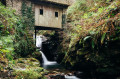
(5) At another fork in the road, we turn right and descend more steeply to the mill (327 m). It stands above the stream between two waterfalls. This recently restored building (by the owners, who also run the restaurant) was built during the Carlist Wars in the early 19th century and was used to supply the troops. Later, under Franco’s dictatorship, it also operated at full capacity at night.
(6) We retrace our steps back to the original Fork in the road, near the farm.
(4) We turn sharply to the right.
(7) We turn left and head uphill.
(8) At the Fork in the road, we head off to the right.
(9) We turn sharply to the right and continue uphill.
(10) At a junction, we carry on straight ahead.
(11) At the junction, we turn right.
(12) We join the GR®11 and follow it to the left (red and white markings). This takes us to a pass called Urtzumeatza.
(13) We take the second path on the left, still following the GR®11.
(14) At the junction, we head diagonally left and leave the GR®11. We continue heading south-west.
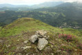
(15) At the junction, we head straight ahead, slightly to the left, and, at the Fork in the road that appears immediately, we turn right. We climb westwards to ascend Gaineko Harrieta (a small dolmen).
(16) We head back down towards the north-west.
(17) At the T-junction, we turn left. We soon reach a track and follow it to the left.
(18) We turn sharply to the right.
(19) At the next junction, we turn left. We cross a track and very quickly return to the starting point (S/E).
 Visorando Member
 Easy
Easy