Country:

 City:
City:


The starting point for the walk is at the car park at the entrance to Etxalar. To get to this starting point by car, see the “Practical information” section below.
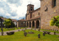
(S/E) Leave the car park heading towards the town centre; you’ll be on the NA-4400 or Carrer de Lizarrieta. Turn right at the church.
(1) Immediately after the church, look out for a very beautiful house with pillars and the letter “i” (for information) on the front. This is Etxalar’s cultural centre (Kultur Etxea at No. 4 Jauregieta Street). It is here, towards the back, that you’ll find the first sign giving a general overview of the Karmen route.
After reading the sign, do not follow the street, but cross over towards No. 5 and follow this street to the end, which bears the same name.
(2) Follow the signs for Zugarramurdi to the left. Do the same a little further on by turning left and you’ll reach a multi-way junction.
(3) Turn left towards Olagaraia, continue along a tarmac road and reach a bridge over the River Tximista.
(4) Cross this bridge and, at the next Y-junction, leave the tarmac road and turn right towards Anorbe. Then follow the concrete track that runs alongside the river until you reach the Echalar hydroelectric power station.
(5) Continue along the right bank of the river to reach the hamlet of Arbia, marked by sign no. 2. Head down towards the river and cross the bridge to see the stone marked ‘1804’, the date on which the bridge was rebuilt after the old one was swept away by severe flooding.
(6) On your way back up, cross the road to get a closer look at the Arbia Waterfall, the top of which may be hidden by vegetation. Then return to the path and head towards a crossroads of footpaths.
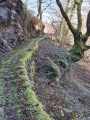
(7) Leave the tarmac road here and take a path on the left. This change of direction is clearly marked by the red trail logo depicting a Sevillian woman with her fan. Follow this lovely little path right through the heart of the forest until you reach signpost no. 3, marking the Sarriku borda (barn).
(8) Continue along the path and, at the bottom of the descent, you’ll reach signpost no. 4, which features the Sarriku Bridge, dating from 1760, which enabled all trade in the Baztan Valley to take place.
(9) Cross the bridge, continue along the path and you will then come across Carmen – or rather, its logo.
(10) Follow the small path on the right which runs alongside the River Tximista and reach a section of the path elevated above the river.
(11) Cross this; to avoid any problems, it is fitted with ropes which you hold with your left hand. A little further on, the path joins the wide concrete track you left earlier, at a bridge.
(12) Turn left onto this track and, a little further on, you’ll come to signpost no. 5, which provides a general overview of life in Etxalar at that time. It discusses the linen-based clothing and work in the iron ore and coal forges. Also note the memorial stone against the wall.
(13) Continue uphill along this track until you reach signpost no. 6, the furthest point of this walk. This is Karmen’s house, known as the ‘borda de Errotxe’ – or, more precisely, what remains of it.
(14) Then turn round and retrace your steps to the junction by the bridge you crossed on the way out.
(12) Keep left on the tarmac track, then return to the junction with the path you also passed on the way out.
(7) Then retrace your steps along the route you took on the way there until you reach the junction by the bridge over the River Tximista.
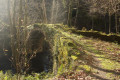
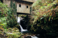
(4) Turn right onto the path marked with a ‘no traffic’ sign (there is also a wooden sign pointing towards Etxalar). This path is often muddy as it runs through meadows. Further on, cross a superb stone bridge. Further on, you’ll come across a Way of the Cross, an old wash house and, finally, a beautiful waterfall before reaching the NA-4400.
(15) Turn left onto this road, head towards the church and turn right to return to the car park at the entrance to Etxalar (S/E).


 Visorando Member

 Easy
Easy