Country:

 City:
City:


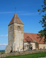
Start behind the church at Anthien (GPS - 47°18'46.5"N 3°44'22.9"E)
Markings: Blue, then Blue + Yellow.
Car parking is available at the start.
(S/E) From the rear of the church, take Rue Moreau, then continue along the stony path that extends from it and climbs up to the plateau (panoramic view).
(1) Cross the D217 and carry on straight ahead. Pass a path on your left and take the road on your right. At the junction, follow the D42 to the left for about 500 metres.
(2) Take the track on your left.
(3) At the junction, turn right onto the road, pass a road on your left and then take the path on your left. At the end of the path, head left up Mont Sabot (panoramic view) and walk around the summit.
(4) Descend from Mont Sabot via a steep path between the hedges, opposite the chapel doors. Once at the bottom, follow the path to the left for 350 metres, then turn off onto the path to the right. It runs past the foot of Mont Bion, on your right.
(5) At the junction, take the path on the left to descend to the hamlet of Chitry. Walk through the hamlet on the left.
(6) Then continue along the road leading up to Fletz on the right.
(7) Once you reach the hamlet (panoramic view), continue along the path on the left. It leads to the Croix de Mont-Vieille.
(8) Take the road on the right, which goes downhill. At the junction, keep left. After the fork, walk past the town hall, leaving Vignes-le-Haut on your right. Follow the road to Vigne-le-Bas.
(9) Then cross the hamlet to the right via the D217.
(10) At the bottom of the hamlet, turn left past the houses and continue along the path which climbs to the left, due south, towards the hamlet of Le Chemin. Keep straight on at the junction, then turn left at the next one.
(11) Head towards the wayside cross, then go down the path opposite. Follow the D6 straight ahead to return to the church (S/E).
 Visorando Member

 Easy
Easy 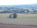
 Tourist office