Mont Nivigne and the Crêtes du Lomont

A long hike, offering stunning views thanks to the cliff known as the Crête du Mont Nivigne, as well as the Col des Justices, not to mention the Crête de la Cabatane, where, with a bit of luck, you might spot Mont Blanc on a clear, cloudless day – and yes, a snow-capped mountain in the middle of summer is clearly visible!

Thanks to all these ridges (cliffs), you’ll be able to admire the beautiful landscape and the surrounding villages, as well as the lakes and so on…

See the ‘Practical Information’ section regarding the (9).

Details

n°2520894
Creation:
Last update:
Last review:
  • Walking
    Activity: Walking
  • ↔
    Distance: 10.96 mi
  • ◔
    Average duration: 6h 45 
  • ▲
    Difficulty: Difficult

  • ⚐
    Back to start: Yes
  • ↗
    Ascent: + 1,929 ft
  • ↘
    Descent: - 1,906 ft

  • ▲
    Highest point: 2,497 ft
  • ▼
    Lowest point: 1,027 ft

Photos

Description of the walk

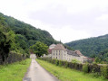
The walk starts from the car park at the municipal campsite in the village of Chavannes-sur-Suran.

(S/E) Cross the bridge over the Suran and take the road on your left, following it to Rue des Déserts in the hamlet of Chavuissiat le Petit.

(1) Turn right onto Rue des Déserts. In the hamlet of Chavuissiat le Petit, follow the road on your left and, at the end, continue to the right as far as the last house. Carry on along the grassy path leading uphill to the left.

(2) At the junction, take the path on the left which leads downhill.

(3) At the bottom of the path, at the junction, do not follow the signposting, but carry on to the left.

(4) Follow Rue de Nivigne, cross the bridge over the Suran and reach the D42. Cross with care, and continue along the path in front of you – this is where the real challenge begins.

(5) At the junction, take the path on your left.

(6) At the fork, take the stony path on the right and follow it. From time to time, you’ll see yellow markings.

(7) Stay on the main path on the right and follow it.

(8) Continue along the path, taking time to admire the panoramic view.

(9) At the fork (signpost), take the path on the left which leads downhill.
Caution: this is a very steep and slippery section with a handrail along part of the descent.

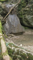
(10) At the landmark rock, head straight on towards the fence, then turn left to follow it.

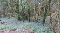
(11) At the gap in the fence, make sure you close it properly and continue to the right through the woodland. Continue southwards, following the ridge for about 3.5 km.

(12) At the junction, take the path on your left.

(13) At the double junction, with two signposts some distance apart, choose the one pointing towards the Col des Justices (at the top of the signpost) and take the small grassy path just behind it which climbs uphill.

(14) Leave the small path and turn left (be careful, it’s a steep descent). Enjoy the view of Mont Blanc if the weather is fine.

(15) At the bottom of this descent, turn right.

(16) At the fork, turn left onto the stony path, then further on, turn left again to rejoin the road. Look for the start of a path on the right at the edge of the woods.

(17) Take it to the right through the undergrowth and follow the yellow signposts.

(18) As you emerge from the woods, turn right onto the grassy path which continues as the Chemin du Bois. At the D42, continue left and then right onto the Route des Orchidées to reach the car park (S/E).

Waypoints

  1. S/E : mi 0 - alt. 1,037 ft - Municipal campsite car park - Suran (rivière)
  2. 1 : mi 1.05 - alt. 1,083 ft - On the right, Rue des Déserts
  3. 2 : mi 1.52 - alt. 1,316 ft - Path on the left
  4. 3 : mi 2.03 - alt. 1,099 ft - Junction: turn left
  5. 4 : mi 2.08 - alt. 1,083 ft - Rue de Nivigne
  6. 5 : mi 2.81 - alt. 1,181 ft - Junction: turn left
  7. 6 : mi 3.35 - alt. 1,558 ft - Stony path on the right
  8. 7 : mi 4.64 - alt. 2,431 ft - Main path to the right
  9. 8 : mi 4.74 - alt. 2,467 ft - Magnificent panoramic view.
  10. 9 : mi 5.01 - alt. 2,497 ft - Junction: turn left
  11. 10 : mi 5.25 - alt. 2,110 ft - At the landmark rock, head straight on until you reach the fence
  12. 11 : mi 5.52 - alt. 1,982 ft - Pass through the fence.
  13. 12 : mi 7.6 - alt. 1,969 ft - Junction: turn left
  14. 13 : mi 7.78 - alt. 1,847 ft - Path behind the post - Col des Justices
  15. 14 : mi 8.07 - alt. 1,808 ft - Junction: turn left
  16. 15 : mi 8.62 - alt. 1,257 ft - At the bottom of the descent, turn right.
  17. 16 : mi 9.3 - alt. 1,148 ft - Junction: turn left
  18. 17 : mi 9.95 - alt. 1,083 ft - Path on the right through the woodland.
  19. 18 : mi 10.48 - alt. 1,099 ft - On the right, a grassy path
  20. S/E : mi 10.96 - alt. 1,037 ft - Municipal campsite car park

Notes

At point (9), there is a steep and slippery section: use the handrail when going up and down.

Telescopic walking poles and good walking boots.
A pair of binoculars would be a bonus.
Make sure you bring water.

Worth a visit

(8) Panoramic view.

Panoramic view and the chance to see Mont Blanc in the distance, in clear, cloudless weather.

Reviews and comments

3.8 / 5
Based on 2 reviews

Reliability of the description
4 / 5
Ease of following the route
4 / 5
Route interest
3.5 / 5
tenebre6683
tenebre6683

Hello Bobby Socks,

As for the tree lying across the path, unfortunately these things do happen.

In principle, the route is mapped out during the hike, but when the route is re-mapped, there may be an oversight.

I try to draw up the map and provide the information as accurately as possible, though it’s not always straightforward.

Point No. 14 has me puzzled; I’ll need to walk the route again to check it out.

Thank you for the information; I hope you enjoy your walk.

Regards

tenebre6683

Machine-translated

Bobby Socks
Bobby Socks

Overall rating : 3.7 / 5

Date of your route : Jun 21, 2020
Reliability of the description : ★★★★☆ Good
Ease of following the route : ★★★★☆ Good
Route interest : ★★★☆☆ Average
Very busy route : No

A route offering stunning panoramic views of Cuissiat and the surrounding villages. You might want to extend the route as far as the Nivigne signpost at waypoint 9 (approximately 1 km extra there and back)
Plenty of undergrowth – a bit too much for our liking, even though the paths are very pleasant.

The descriptions for waypoints 10 and 14 need reviewing; they’re difficult to follow in the field.
On the GPX track, point 14 does not exist; the path you need to take is on the left, about 50–80 metres before the GPX track (a narrow path with a fallen tree across it, opposite a small yellow sign marked with the number 7).

Machine-translated

tenebre6683
tenebre6683

Hello, I’m sorry to hear that this walk wasn’t enjoyable at all; I’ll see if I can do it again soon. On my last walk, everything was fine – there were signposts and no dogs about.
I hope you’ll enjoy my other routes.
And once again, my apologies.
As for the signposts, some people are having a bit of fun taking them down.

Machine-translated

apollo
apollo

Overall rating : 4 / 5

Date of your route : Mar 15, 2020
Reliability of the description : ★★★★☆ Good
Ease of following the route : Not used / Not applicable
Route interest : ★★★★☆ Good

We did the route this morning; it’s quite a climb. It’s a nice route, but we never managed to find the track marked at point 14.
So we carried on to the end of the single track, which took us to the top of the Treffort hairpin bends, then we reached Duyhs via a small path before coming across a dog that left quite a mark on my thigh!!!
So we had to head back via the road...

Machine-translated

Other walks in the area

For more walks, use our search engine .

The GPS track and description are the property of this route's author. Please do not copy them without permission.